The instrument's own words
page 1 · read by Gemma vision
474
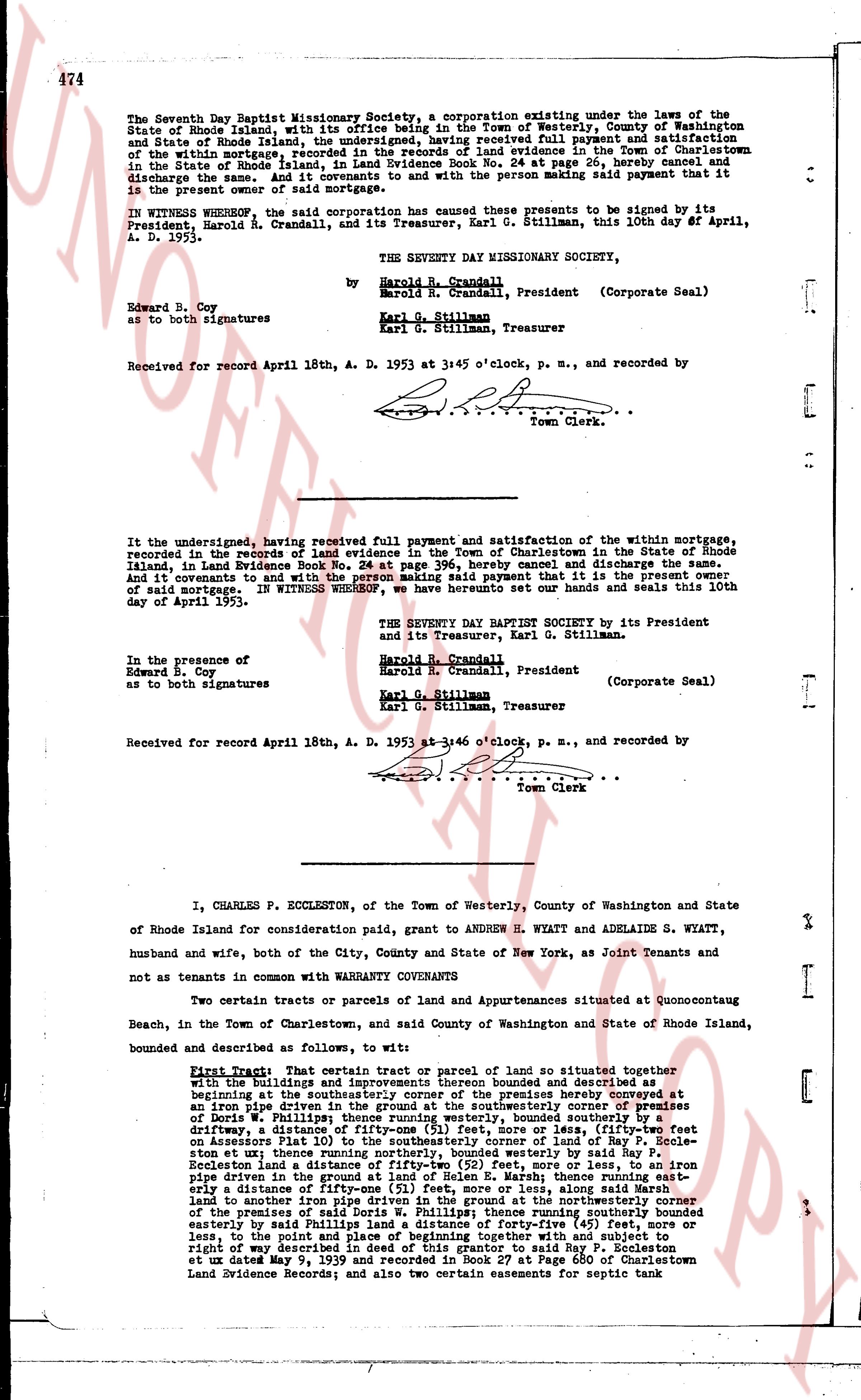
The Seventh Day Baptist Missionary Society, a corporation existing under the laws of the State of Rhode Island, with its office being in the Town of Westerly, County of Washington and State of Rhode Island shares, the undersigned, having received full payment and satisfaction of the within mortgage, recorded in the records of land evidence in the Town of Charlestown in the State of Rhode Island, in Land Evidence Book No. 24 at page 26, hereby cancel and discharge the same. As of this 10th day of April, A. D. 1953 with the person making said payment that it is in the present owner of said mortgage.
IN WITNESS WHEREOF, the said corporation has caused these presents to be signed by its President, Harold R. Crandall, and its Treasurer, Karl G. Stillman, this 10th day of April, A. D. 1953.
THE SEVENTH DAY MISSIONARY SOCIETY,
by Harold R. Crandall
Harold R. Crandall, President (Corporate Seal)
Karl G. Stillman
Karl G. Stillman, Treasurer
Edward B. Coy
as to both signatures
Received for record April 18th, A. D. 1953 at 3:45 o'clock, p. m., and recorded by
[Signature]
Town Clerk.
----
It the undersigned, having received full payment and satisfaction of the within mortgage, recorded in the records of land evidence in the Town of Charlestown in the State of Rhode Island, in Land Evidence Book No. 24 at page 396, hereby cancel and discharge the same. And do hereby witness that it is the present owner of said mortgage. IN WITNESS WHEREOF, we hereunto seal our contracts and seals this 10th day of April 1953.
THE SEVENTY DAY MISSIONARY SOCIETY by its President and it its Treasurer, Karl G. Stillman.
Harold R. Crandall
Harold R. Crandall, President (Corporate Seal)
Karl G. Stillman
Karl G. Stillman, Treasurer
In the presence of
Edward B. Coy
as to both signatures
Received for record April 18th, A. D. 1953 at 3:45 o'clock, p. m., and recorded by
[Signature]
Town Clerk
----
I, CHARLES P. ECCLESTON, of the Town of Westerly, County of Washington and State of Rhode Island for consideration paid, grant to ANDREW H. WYATT and ADELAIDE S. WYATT, husband and wife, both of the City, County and State of New York, as Joint Tenants and not as tenants in common with WARRANTY COVENANTS
Two certain tracts or parcels of Land and Apartments situated at Quonocutaug Beach, in the Town of Charlestown, and said County and State of Washington and State of Rhode Island, bounded and described as follows, to wit:
FIRST PIECE: Then a certain tract or parcel of land so situated together with the buildings and improvements thereon bounded and described as beginning at the southwesterly corner of the premises hereby conveyed as corner of an iron pipe driven in the ground at the southwesterly corner of premises of Doris W. Phillips; thence running westerly, bounded southerly by a [?] driftways, a distance of [?] feet, more or less, (Fifty-four feet on Assessors Plat 10) to the southwesterly corner of land of Ray P. Recle-ston et ux therefrom running northerly, bounded easterly by the buildings and improvements on the land of a distance of fifty-two (52) feet, more or less, to an iron pipe driven in the ground at the northwesterly corner of said Ray P. Recle-ston et ux therefrom running westerly to the Marsh, thence running northerly a distance of fifty-one (51) feet, more or less, along said Marsh to another iron pipe driven in the ground at the northwesterly corner of the premises of said Doris W. Phillips; thence running southerly bounded easterly by said Phillips, a distance of fifty-five (55) feet, more or less, to the point and place of beginning together with and subject to a right of way described in deed of this grant to said Ray P. Eccleston et ux dated May 9, 1939 and recorded in Land Evidence Book at Page 480 of Charlestown Land Evidence Records; and also two certain easements for septic tank
The page as recorded