The instrument's own words
page 1 · read by Gemma vision
471
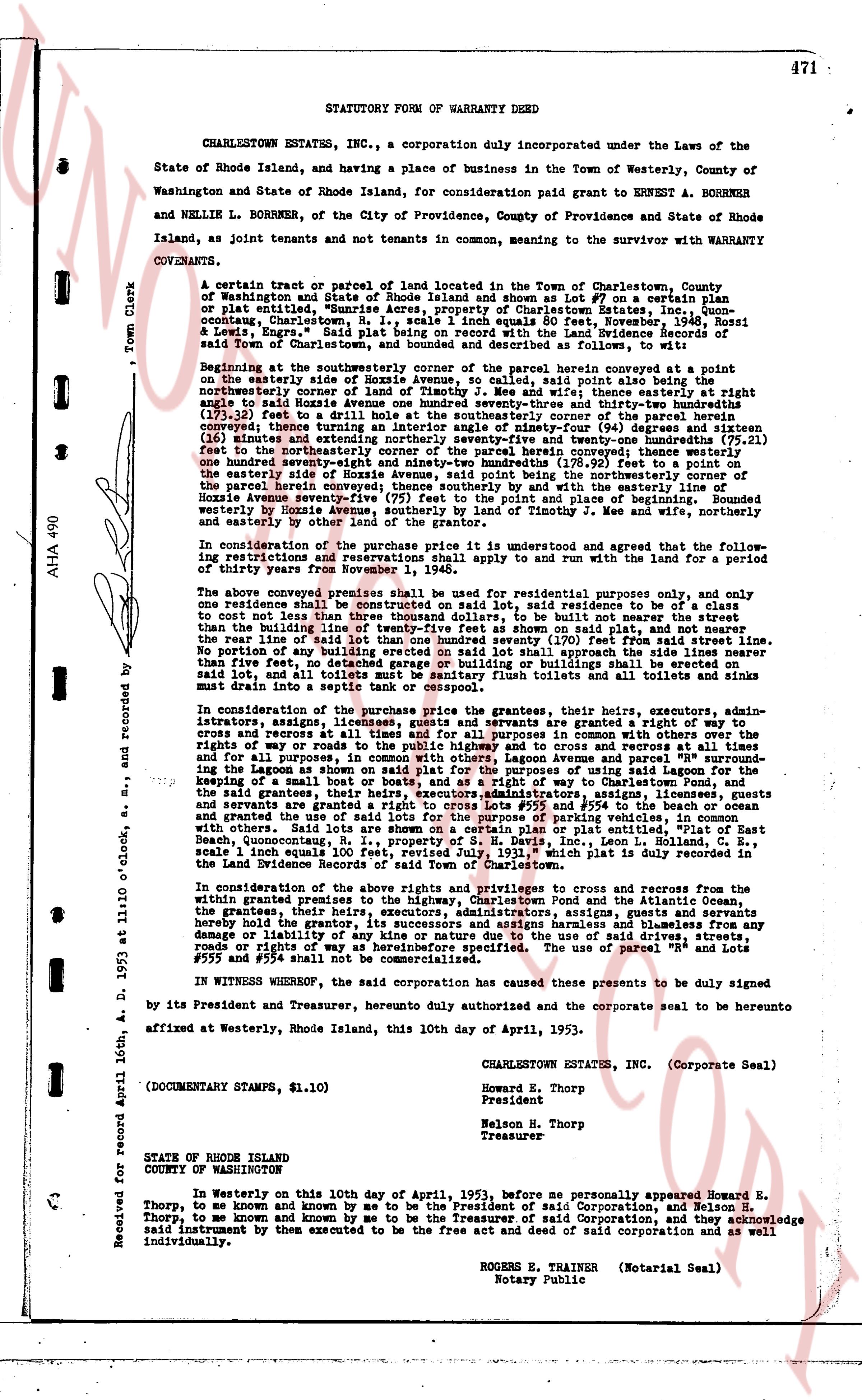
STATUTORY FORM OF WARRANTY DEED
CHARLESTOWN ESTATES, INC., a corporation duly incorporated under the Laws of the State of Rhode Island, and having a place of business in the Town of Westerly, County of Washington and State of Rhode Island, for consideration paid grant to ERNEST A. BORRNER and NELLIE L. BORRNER, of the City of Providence, County of Providence and State of Rhode Island, as joint tenants and not tenants in common, meaning to the survivor with WARRANTY COVENANTS,
A certain tract or parcel of land located in the Town of Charlestown, County of Washington in the State of Rhode Island known as and shown as 97 on a certain plan of plat entitled, "Sunrise Acres apartment Charlestown Estates Inc., Book 23, page one-hundred-one, Charlestown, R.I., scale 1 inch equals 80 feet, November, 1948, Rossi & Lewis, Engrs," being a part of the land of the Land Evidence book 33, page 471 of said Town of Charlestown, and bounded and described as follows, to wit:
Beginning at the southwesterly corner of the parcel herein conveyed being a point on the easterly line of old Hoxie Avenue, said point also being a point on the line of the northeasterly corner of land of Timothy J. Mee and wife, thence easterly at right ninety feet to said Hoxie Avenue one hundred seventy-seven and thirty-three hundredths (177.33) feet to the line of the land of the Land Evidence book 23, page 101, thence curving thence turning an interior angle of ninety-four (94) degrees and sixteen (16) minutes and seconds easterly, and then northerly one hundred twenty-three (123) feet to the northeasterly corner of the parcel herein conveyed; thence turning a one hundred eighty (180) degree curve with a radius of 100 feet, the center of the curve being on the easterly side of Hoxie Avenue, said point being the northeasterly corner of the parcel herein conveyed; thence turning a one hundred eighty (180) degree curve with the easterly Hoxie avenue seventy-five (75) feet to the point of beginning and bounded westerly by said Hoxie Avenue, northerly by land of Timothy J. Mee and wife, northerly and easterly by other land of the grantor of the land.
In consideration of the purchase price it is understood and agreed that the following restrictions and reservations shall apply to and run with the land for a period of thirty years from November 1, 1948.
The above conveyed premises shall be used for residential purposes only, and one residence shall be constructed on said lot, said residence to be of a class to cost not less than $5,000.00 (five thousand dollars) but not more than 20 feet from than the building line of twenty-five feet shown on said plat, no slab and pier, nor the rear line of said lot shall be less than 20 feet from the building line of said residence. No portion of any building erected on said lot shall approach the side lines nearer than twenty feet from the building line of said residence. No accessory buildings on said lot, and all toilets shall be sanitary flush toilets and all toilets and sinks must be tied into a septic tank.
In consideration of the purchase price the grantors, their heirs, executors, administrators, assigns, licensees, grantees, and servants are granted a right of way of building, and for all purposes, in common with the other owners of lots on said plat, the rights of way or roads to the public highway and to cross and recross at all times and for all purposes, the roads, lagoons and avenues per se and the right of way crossing the Lagoon as shown on said plat for the purpose of using said Lagoon for the keeping of a small boat on rafts, and as a gate of way to Charlestown Pond, and the said rights of way, roads, lagoons and avenues per se and the right of way crossing the Lagoon are granted to the grantees, their heirs, executors, administrators, assigns, licensees and servants are granted a right to cross lot #552 and #554 to the beach or ocean and other waters, in common with the other owners of lots on said plat and the other lots with others. Said Lots are shown on a certain plan or plat entitled, "Plan of East Beach, Quonochontaug, Charlestown, R.I., Lot #97, Rossi & Lewis, Engrs," scale 1 inch equals 100 feet, revised July, 1931," which plat is duly recorded in the land evidence of Charlestown, R.I.
In consideration of the above rights and privileges to cross and recross from the within granted premises to the highway, Charlestown Pond and the Atlantic Ocean, the grantors, their heirs, executors, administrators, assigns and substitutions, hereby hold the grantor, its successors and assigns harmless and blameless from any damage, loss or expense of any kind whatever due to the use of said drive, streets, roads or rights of way as hereinbefore described. The use of parcel "#552" and Lots #955 and #954 shall not be commercialized.
IN WITNESS WHEREOF, the corporation has caused these presents to be duly signed by its President and Treasurer, herewith, duly authorized and the corporate seal to be heretofore affixed at Westerly, Rhode Island, this 10th day of April, 1953.
CHARLESTOWN ESTATES, INC. (Corporate Seal)
Howard E. Thorp
President
Nelson H. Thorp
Treasurer
STATE OF RHODE ISLAND
COUNTY OF WASHINGTON
In Witness to this 10th day of April, 1953, before me personally appeared Howard E. Thorp, to me known and known by me to be the President of said Corporation, and Nelson H. Thorp to me known and known by me to be the Treasurer of said Corporation, and they acknowledge said instrument by them executed to be the free act and deed of said corporation and all individually.
ROGERS E. TRAINER (Notarial Seal)
Notary Public
Received for record April 16th, A. D. 1953 at 11 o'clock O'clock, and recorded by
Town Clerk
AHA 490
page 2 · read by Gemma vision
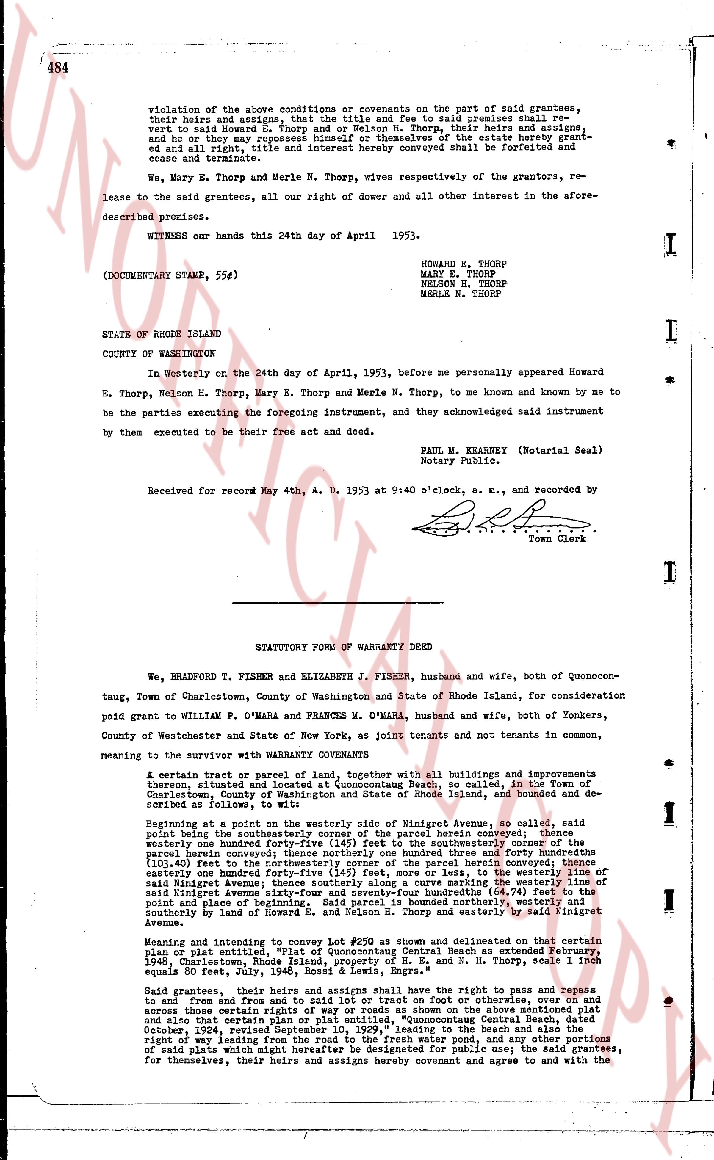
violation of the above conditions or covenants on the part of said grantees,
their heir and assigns, and assign that the title and fee to said premises shall re-
vert to said Howard E. Thorp and Nelson N. Thorp, their heirs and assigns, and
he or they may repossess himself or themselves of the estate hereby grant-ed
and all right, title and interest hereby conveyed shall be forfeited and
cease and terminate.
We, Mary E. Thorp and Merle N. Thorp, wives respectively of the grantors, re-
lease to the said grantees, all our right of dower and all other interest in the afore-
described premises.
WITNESS our hands this 24th day of April 1953.
(DOCUMENTARY STAMP, 55¢)
HOWARD E. THORP
MARY E. THORP
NELSON N. THORP
MERLE N. THORP
STATE OF RHODE ISLAND
COUNTY OF WASHINGTON
In Westerly on the 24th day of April, 1953, before me personally appeared Howard
E. Thorp, Nelson N. Thorp, Mary E. Thorp and Merle N. Thorp, to me known and known by me to
be the parties executing the foregoing instrument, and they acknowledged said instrument
by them executed to be their free act and deed.
PAUL W. KEARNEY (Notarial Seal)
Notary Public.
Received for record May 4th, A. D. 1953 at 9:40 o'clock, a. m., and recorded by
[Signature]
Town Clerk
----
STATUTORY FORM OF WARRANTY DEED
We, BRADFORD T. FISHER and ELIZABETH J. FISHER, husband and wife, both of Quonocon-
taug, Town of Charlestown, County of Washington and State of Rhode Island, for consideration
paid grant to WILLIAM P. O'MARA and FRANCES M. O'MARA, husband and wife, both of Yonkers,
County of Westchester and State of New York, as joint tenants and not tenants in common,
meaning to the survivor with WARRANTY COVENANTS
A certain tract or parcel of land, together with all buildings and improvements
thereon, situated and located at Quonocutaug Beach, so called, in the Town of
Charlestown, County of Washington and State of Rhode Island, as bounded and describ-
ed as follows, to wit:
Beginning at a point on the westerly side of Wingnet Avenue, so called, said
point being the southwesternly corner of the parcel herein conveyed; thence
southeasterly one hundred forty-five (145) feet to the southwesternly corner of
the parcel herein conveyed; thence northerly one hundred three and forty hundredths
(103.40) feet to the northwesternly corner of the parcel herein conveyed; thence
easterly one hundred forty-five (145) feet, more or less, to the westerly line of
said Wingnet Avenue; thence northerly one hundred three and forty hundredths of
said Wingnet Avenue sixty-four and seventy-four hundredths (64.74) feet to the
north point of lot number 250 as described and marked westerly, whereas the north-
westernly boundary of said lot number 250 is bounded northerly by Howard E. and
Nelson N. Thorp and easterly by said Wingnet Avenue.
Meaning and intent to convey lot #250 as shown and delineated on that certain
plan or plat entitled, "Plot of Quonocutaug Central Beach as extended February,
1948, Charlestown, Rhode Island, property of H. E. and N. Thorp, Scale 1 inch
equals 50 feet, 1948, volume 1, page 1, S. R. Engrs."
Said grantees, their heirs and assigns shall have the right to pass and repass
to and from and from to said lot or tract on any lot or tract or otherwise, over and on
across those certain rights of way and easements shown on the above mentioned plat
and also that certain plan or plat entitled, "Quonocutaug Central Beach, dated October,
1924, revising and correcting the plan prior to the Beach and extending the
right of way leading from the road to the fresh water pond, and any other portions
of said plats which might hereafter be designated for public use; the said grantees,
for themselves, their heirs and assigns hereby covenant and agree to and with the
The page as recorded