The instrument's own words
page 1 · read by Gemma vision
429
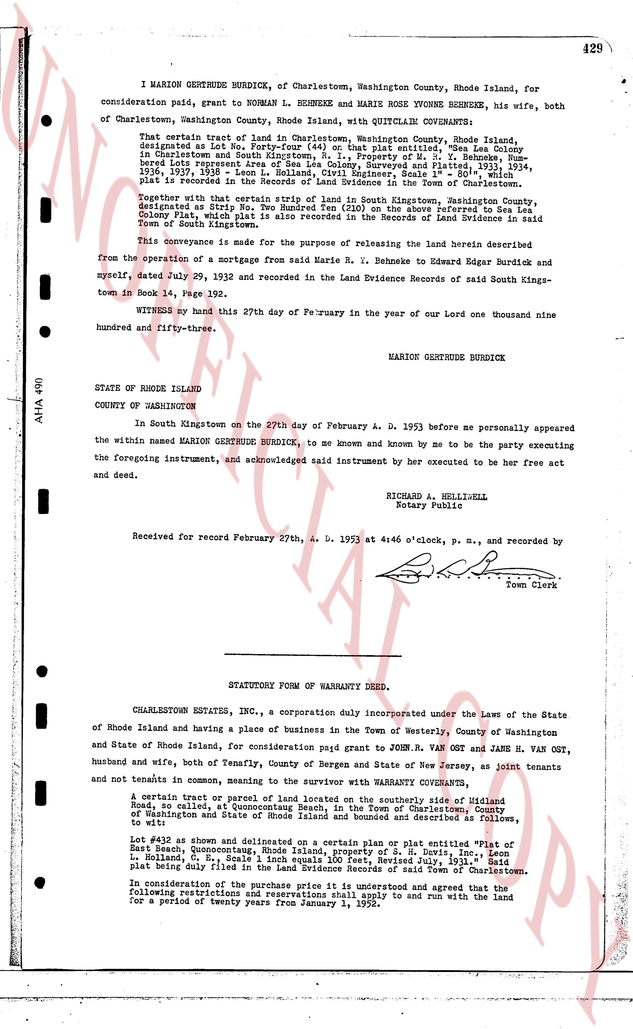
I MARION GERTRUDE BURDICK, of Charlestown, Washington County, Rhode Island, for
consideration paid, grant to NORMAN L. BEHNEKE and MARIE ROSE YVONNE BEHNEKE, his wife, both
of Charlestown, Washington County, Rhode Island, with QUITCLAIM COVENANTS:
That certain tract of land in Charlestown, Washington County, Rhode Island,
designated as Lot No. Forty-seven (47) on the plat entitled, "Sea Lea Colony
in Charlestown and South Kingstown, R. I., Property of M. S. Y. Behneke, Num-
bered lots Representing the land of the surveyed and Platted in 1934,
1936, 1937, 1938" - Leon L. Holland, Civil Engineer, Scale 1" = 80', which
plat is recorded in the Records of Land Evidence in the Town of Charlestown.
Together with that certain strip of land in South Kingstown, Washington County,
designated as Strip "B" on the plat entitled as the above referred to "Sea
Colony Plat", which plat is also recorded in the Records of Land Evidence in said
Town of South Kingstown.
This conveyance is made for the purpose of releasing the land herein described
from the operation of a mortgage from said Marie R. Y. Behneke to Edward Edgar Burdick and
myself, dated July 29, 1932 and recorded in the Land Evidence Records of said South Kings-
town in Book 14, Page 192.
WITNESS my hand this 27th day of February in the year of our Lord one thousand nine
hundred and fifty-three.
MARION GERTRUDE BURDICK
STATE OF RHODE ISLAND
COUNTY OF WASHINGTON
In South Kingstown on the 27th day of February A. D. 1953 before me personally appeared
the within named MARION GERTRUDE BURDICK, to me known and known by me to be the party executing
the foregoing instrument, and acknowledged said instrument by her executed to be her free act
and deed.
RICHARD A. HELLISBELL
Notary Public
Received for record February 27th, A. D. 1953 at 4:46 o'clock, P. M., and recorded by
[Signature]
Town Clerk
----
STATUTORY FORM OF WARRANTY DEED.
CHARLESTOWN ESTATES, INC., a corporation duly incorporated under the Laws of the State
of Rhode Island and having a place of business in the Town of Westerly, County of Washington
and State of Rhode Island, for consideration paid grant to JOHN R. VAN OST and JANE H. VAN OST,
husband and wife, both of Tenafly, County of Bergen and State of New Jersey, as joint tenants
and not tenants in common, meaning to the survivor with WARRANTY COVENANTS.
A certain tract or parcel of land located on the southerly side of Mulford
Road, so called, at Quonocutaug Beach, in the Town of Charlestown, County
of Washington and State of Rhode Island launched and bounded as describes as follows,
to wit:
Lot #32 as shown and delineated on a certain plat or plan entitled "Plat of
East Beach, Quonocutaug, Rhode Island, Property of S. H. Davis, Inc.", Leon
L. Holland, C. E., Scale 1 inch equals 100', Revised July, 1952. Plat and
plat being duly filed in the Land Evidence Records of said Town of Charlestown.
In consideration of the purchase price it is understood and agreed that the
following restrictions and declarations shall apply to and run with the land
for a period of twenty years from January 1, 1952.
The page as recorded