The instrument's own words
page 1 · read by Gemma vision
419
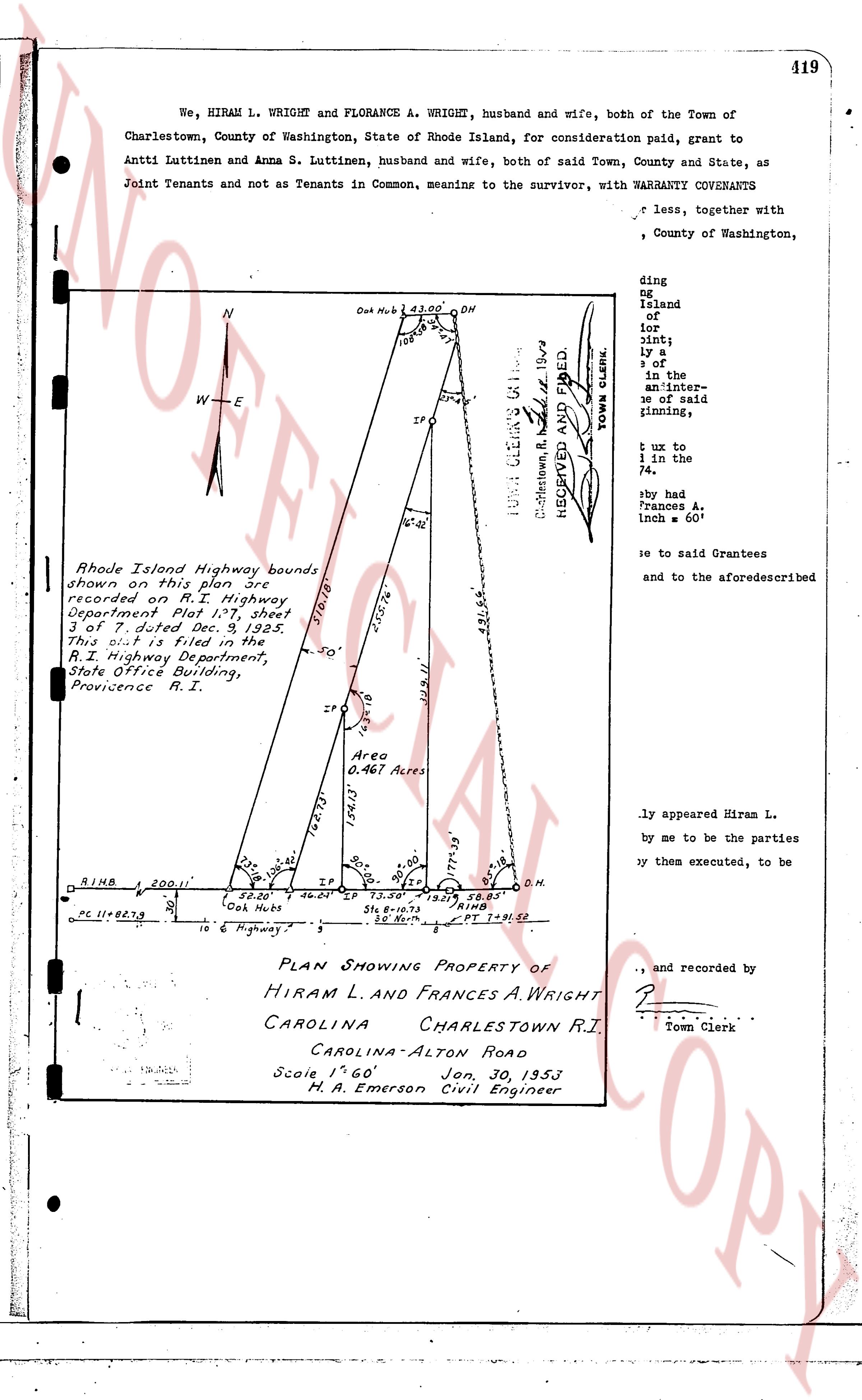
We, HIRAM L. WRIGHT and FLORANCE A. WRIGHT, husband and wife, both of the Town of Charlestown, County of Washington, State of Rhode Island, for consideration paid, grant to Antti Luttinen and Anna S. Luttinen, husband and wife, both of said Town, County and State, as Joint Tenants and not as Tenants in Common, meaning to the survivor, with WARRANTY COVENANTS
x less, together with
ding
ng
Island
of
or
int;
ly a
of a
the in-
an inter-
d
gining,
u zo to
in the
74,
by had
Frances A.
inch = 60'
to se said Grantees
and to the aforesaidcribed
N
W—E
O.H. N. 61° 23.00' O.H.
108
IP
16.21'
49.65'
TOWN CLERK'S COPY
C. Mattoon, R.I. 1953
RECEIVED AND FILED.
TOWN CLERK.
Rhode Island Highway bounds
shown on this plan are
recorded on R.I. Highway
Department Plat 1.27, sheet
3 of 7, dated Dec. 3, 1925.
This plan was filed with the
R.I. Highway Department,
State Office Building,
Province R.I.
31.18'
55.76'
30'
19.91'
IP
Area
0.467 Acres
154.3'
162.13'
23.32'
20.00'
20.00'
20.00'
75.39'
75.39'
58.85'
R.I.H.B. 200.11'
IP 46.04' IP 73.56' IP 58.85'
PC 11+82.73
10.50' 10.50'
O.H.
O.H. N. 83°
S. 10° North
PT = 1+93.51'
10 6 Highway 5
PLAN SHOWING PROPERTY OF
HIRAM L. AND FRANCES A. WRIGHT
CAROLINA CHARLESTOWN R.I.
CAROLINA-ALTON ROAD
Scale 1" = 60" Jan. 30, 1953
H. A. Emerson Civil Engineer
ly appeared Hiram L.
by me to be the parties
by them executed, to be
, and recorded by
Town Clerk
page 2 · read by Gemma vision
419
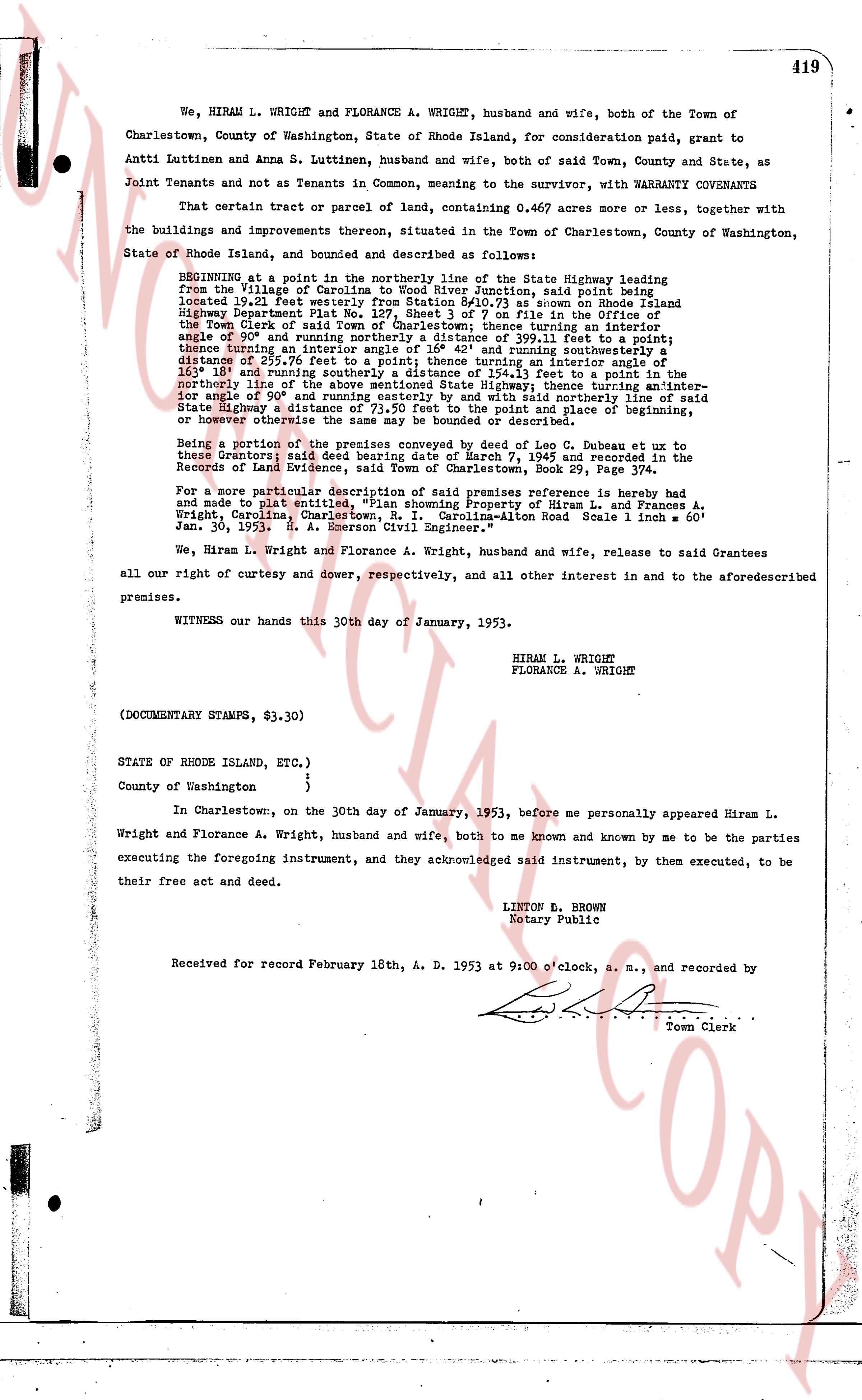
We, HIRAM L. WRIGHT and FLORANCE A. WRIGHT, husband and wife, both of the Town of Charlestown, County of Washington, State of Rhode Island, for consideration paid, grant to Antti Luttinen and Anna S. Luttinen, husband and wife, both of said Town, County and State, as Joint Tenants and not as Tenants in Common, meaning to the survivor, with WARRANTY COVENANTS
That certain tract or parcel of land, containing 0.4697 acres more or less, together with the buildings and improvements thereon, situated in the Town of Charlestown, County of Washington, State of Rhode Island, and bounded and described as follows:
BEGINNING at a point in the northerly line of the State Highway leading from the Village of Charlestown to the Village of Ninigret, said point being located 19.21 feet westerly from Station 94+73.59 on Rhode Island Highway Department Plat 4-11, page 4, on file in the office of the Recorder of the Town Clerk of said Town of Charlestown, thence turning an interior angle of 90° and running northerly a distance of 399.11 feet to a point, thence turning an interior angle of 108° and running southeasterly a distance of 255.76 feet to a point, thence turning an interior angle of 129° 18' and running southeasterly a distance of 131.13 feet to a point in the northerly line of the above mentioned State Highway, thence turning an interior angle of 90° and running westerly along said northerly line of the above mentioned State Highway a distance of 71.20 feet to the point and place of beginning, or however otherwise the same may be bounded or described.
Being a portion of the premises conveyed by deed or lease by C. Dubose et ux to these Grantors; said deed bearing date of March 7, 1945 and recorded in the Records of Land Evidence, said Town of Charlestown, Book 29, Page 374.
For a more particular description of said premises reference is hereby had and made to plat entitled "Plan of Lot 4-B" by Hiram L. Wright and Florance A. Wright, Charlestown, R. I. Carolina-Alton Road Scale 1 inch = 60' R. Scale 1: 60' Jan. 30, 1953, R. A. Moore, Registered Surveyor.
We, Hiram L. Wright and Florance A. Wright, husband and wife, release to said Grantees all our right of curtesy and dower, respectively, and all other interest in and to the aforementioned premises.
WITNESS our hands this 30th day of January, 1953.
HIRAM L. WRIGHT
FLORANCE A. WRIGHT
(DOCUMENTARY STAMPS, $3.30)
STATE OF RHODE ISLAND, ETC.)
)
)
County of Washington {
In Charlestown, on the thirtieth day of January, 1953, before me personally appeared Hiram L. Wright and Florance A. Wright, husband and wife, both to me known and known by me to be the parties executing the foregoing instrument, and they acknowledged said instrument, by them executed, to be their free act and deed.
LINTON G. BROWN
Notary Public
Received for record February 18th, A. D. 1953 at 9:00 o'clock, a. m., and recorded by
[Signature]
Town Clerk
The page as recorded