The instrument's own words
page 1 · read by Gemma vision
350
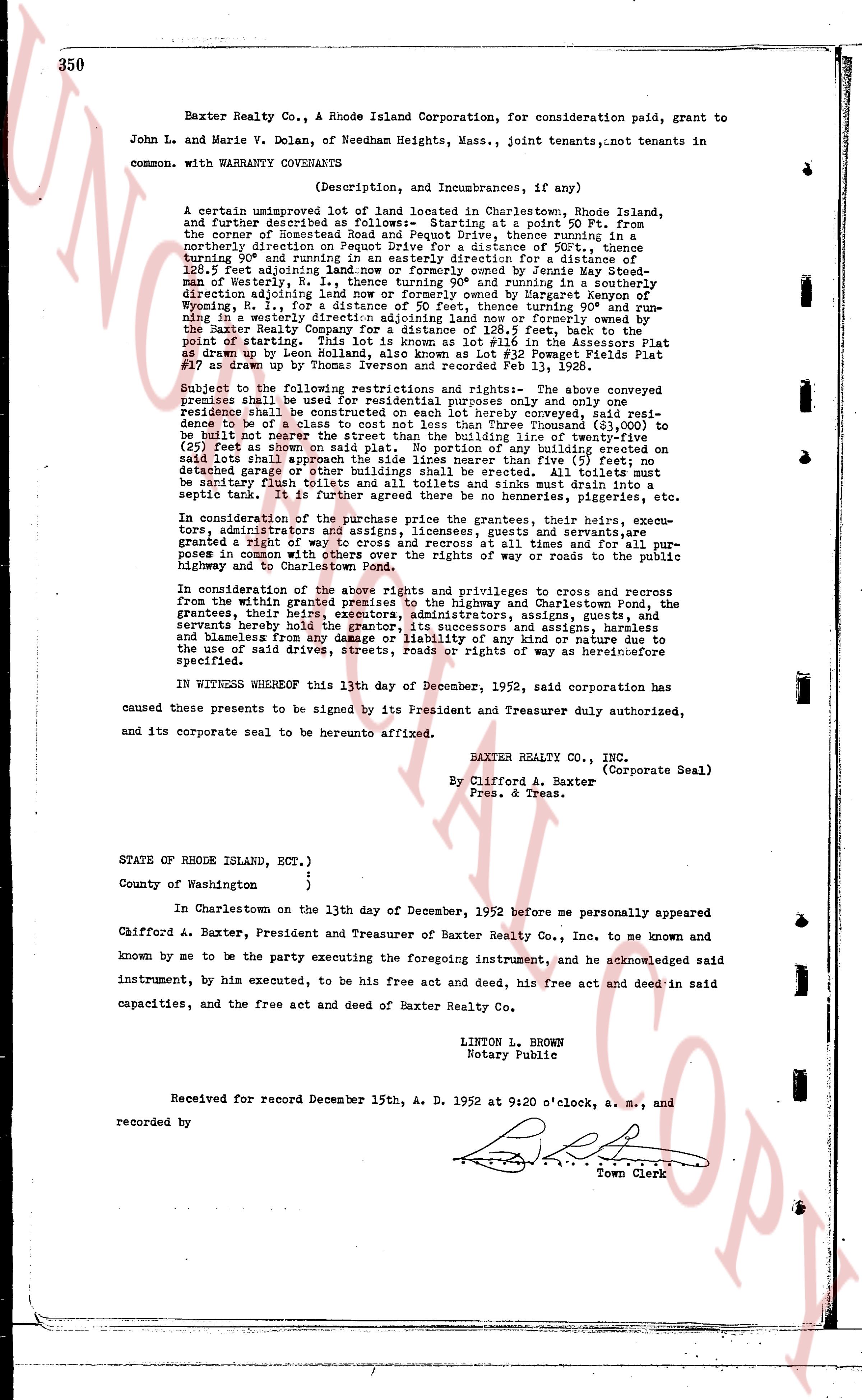
Baxter Realty Co., a Rhode Island Corporation, for consideration paid, grant to
John L. and Marie V. Dolan, of Needham Heights, Mass., joint tenants,not tenants in
common. with WARRANTY COVENANTS
(Description, and Incumbrances, if any)
A certain unimproved lot of land located in Charlestown, Rhode Island,
and further described as follows: Starting at a point 90 Ft. from
the corner of Roastmeat Road and Pequot Drive, thence running in a
northerly direction on Pequot Drive, a distance of 600 ft., thence turning
90° turning and in easterly in a westerly direction for a distance of
128.5 feet Adjoining land now or formerly owned by Jenney Meade sta-
ment of westerly lt. a distance of 128.5 feet and running in a northerly
direction adjoining land now or formerly owned by Margaret Kaynen on
Westerly lt., a distance of 600 feet, thence turning 90° and run-
ning in a westerly direction adjoining land now or formerly owned by the
Baxter Realty Company, a distance of 128.5 feet, back to the
point of starting. This lot is known as lot #16 in the Assessors Plat
drawn up by neon Houseman dated 1935 and as Lot Page 2 Fields Plat
#17 as drawn up by Thomas Iverson and recorded Feb 13, 1928.
Subject to the following restrictions and rights: The above conveyed
premise shall be used for residential purposes only and no more than one
residence shall be constructed on each lot hereby conveyed, said resi-
dence shall be of a value not less than Five Thousand ($5,000) to
be built not nearer the street than the building line of twenty feet
as set off shown on said plat. No portion of any building erected on
said lot shall be nearer the property line than five feet; any garage,
detached garage or other buildings shall be erected. All toilets must
be sanitary right with septic tank and soak stone must drain into a
septic tank. It is further agreed there be no henneries, piggeries, etc.
In consideration of the purchase price the grantees, their heirs, execu-
tors, administrators and assigns, guests, invitees and employees,
granted a right of way to cross and recross at all times and for all pur-
poses in common with other persons in the rights of way or roads to the public
highway and to Charlestown Pond.
In consideration of the above rights and privileges to cross and recross
from the grantor, said grantor grants to the highway and Charlestown Pond, the
grantees, their heirs, executors, administrators, assigns guests,
and licensees herein hereby the grantor, its successors and assigns, harmless
and blameless from any and all liability of any kind or nature due to
the use of said drives, streets, roads or rights of way as hereinbefore
specified.
IN WITNESS WHEREOF this 13th day of December, 1952, said corporation has
caused these presents to be signed by its President and Treasurer duly authorized,
and its corporate seal to be hereunto affixed.
BAXTER REALTY CO., INC.
(Corporate Seal)
By Clifford A. Baxter
Pres. & Treas.
STATE OF RHODE ISLAND, ECT.),
)
County of Washington )
)
In Charlestown on the 13th day of December, 1952 before me personally appeared
Clifford A. Baxter, President and Treasurer of Baxter Realty Co., Inc. to me known and
known by me to be the party executing the foregoing instrument, and he acknowledged said
instrument, by him executed, to be his free act and deed, and his free act and deed in said
capacities, and the free act and deed of Baxter Realty Co.
LINTON L. BROWN
Notary Public
Received for record December 15th, A. D. 1952 at 9:20 o'clock, a. m., and
recorded by [?]
Town Clerk
The page as recorded