The instrument's own words
page 1 · read by Gemma vision
293
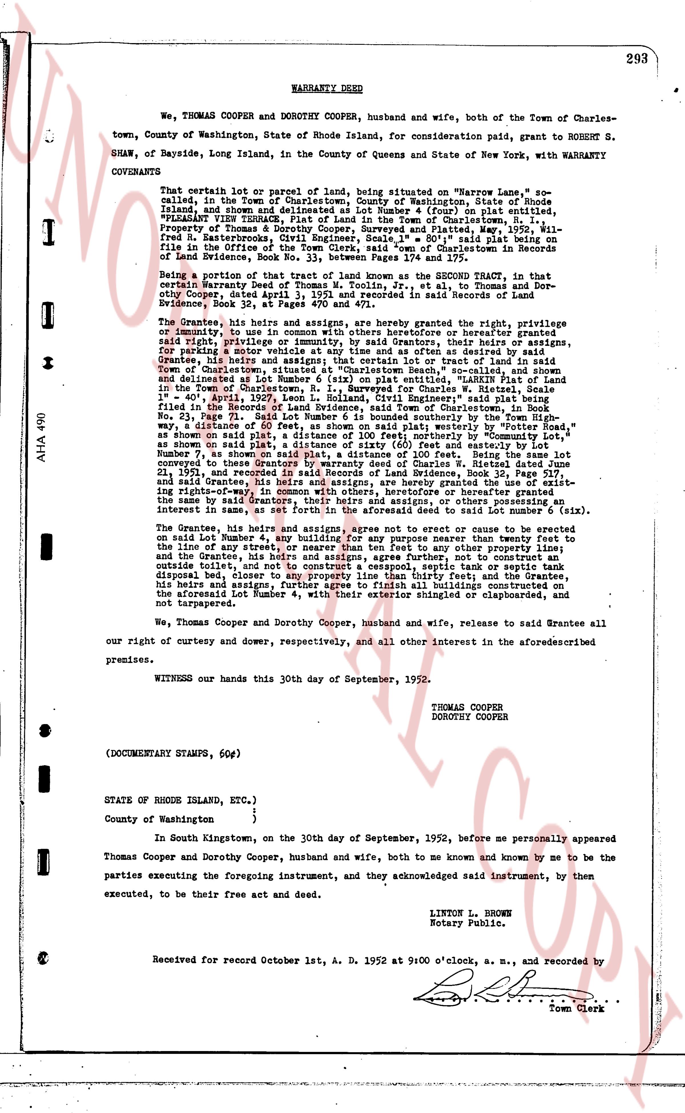
WARRANTY DEED
We, THOMAS COOPER and DOROTHY COOPER, husband and wife, both of the Town of Charlestown, County of Washington, State of Rhode Island, for consideration paid, grant to ROBERT S. SHAW, of Bayside, Long Island, in the County of Queens and State of New York, with WARRANTY CONVEYED
That certain lot or parcel of land, being situated on "Narrow Lane", so called, now called the Town of Charlestown, County of Washington, State of Rhode Island, and shown delineated on a plan made by A. French (or) plat entitled, "PLEASANT VIEW TRACTS, Plot of Land in the Town of Charlestown, R. I." prepared by Thomas H. Moore, Civil Engineer, and plotted May, 1941, and recorded in the Registry of Deeds for the Town of Charlestown in Records of Land Evidence, Book No. 33, between Pages 174 and 175,
Being a portion of that tract of land known as the SECOND TRACT, in that certain Warranty Deed of Thomas M. Toulmin, Jr., et al., to Thomas and Dorothy Cooper, dated April 4, 1941, and recorded in said Records of Land Evidence, Book 32, between Pages 40 and 471;
The Grantees, his heirs and assigns, and hereby agree granting the right, privilege or immunity, to use in the said premises any sewers heretofore or hereafter constructed said right, privilege or immunity, by said Grantors their heirs or assigns, for spraying a motor vehicle with a high pressure spray as desired and the said Grantors, his heirs and assigns, that certain lot or tract of land in said Town of Charlestown, being shown delineated on a plan made by A. French (or) plat entitled, and delineated as Lot Number 6 (six) on plat entitled, "MARK'S PLAT of Land in the Town of Charlestown, R. I." made for Charles W. Hirston, dated December 1st " 40", April 1st, 1942, Lot search L. Holland, Civil Engineer" said plat being filed in the Registry of Deeds for the Town of Charlestown in Records of Land Evidence, Book No. 23, Page 51; said Lot Number 6 is bounded southerly by the Town High way; on the East by Lot Number 5 as shown on said plat; westerly by "Potter's Meadow" as shown on said plat, a distance of 100 Feet on said plat; westerly by "Potter's Meadow" as shown on said plat, a distance of sixty (60) feet and easterly by Lot Number 5 as shown on said plat, a distance of 100 Feet; said Lot Number 6 was conveyed to these Grantors by Warranty deed of Charles W. Hirston dated June 21, 1947 and recorded in said Records of Land Evidence, Book 30, page 111; and said Grantees, his heirs and assigns, are hereby granted the use of existing right-of-way, as shown on said plat, for ingress or egress to or from the premises the same by said Grantors, their heirs and assigns, or others possessing an interest in same as well as the right to construct a road leading to said lot Number 6 (six).
The Grantee, his heirs and assigns, agree not to erect or cause to be erected on said Lot Number 4, any building for any purpose manner than twenty feet to the line of any street, way or road, and further agree that no other purpose, building and the Grantee, his heirs and assigns, agree further, not to construct an outside fire pit, not construct any fence, wall, septic tank or any other tank disposal bed, closer to any property line than thirty feet; and the Grantee, his heirs and assigns, further agree to finish all buildings constructed on the aforesaid Lot Number 4, with their exterior shingles clapboarded or shapiroated, and not tarpapered.
We, Thomas Cooper and Dorothy Cooper, husband and wife, release to said Grantee all our right of curtesy and dower, respectively, and all other interest in the aforementioned premises.
WITNESS our hands this 30th day of September, 1952.
THOMAS COOPER
DOROTHY COOPER
(DOCUMENTARY STAMPS, 60¢)
STATE OF RHODE ISLAND, ETC.)
)
County of Washington )
In South Kingstown, on the 30th day of September, 1952, before me personally appeared Thomas Cooper and Dorothy Cooper, husband and wife, both of me known and known by me to be the parties executing the foregoing instrument, and they acknowledged said instrument, by them executed, to be their free act and deed.
LINTON L. BROWN
Notary Public.
Received for record October 1st, A. D. 1952 at 9:00 o'clock, a. m., and recorded by [?]
Town Clerk
The page as recorded