The instrument's own words
page 1 · read by Gemma vision
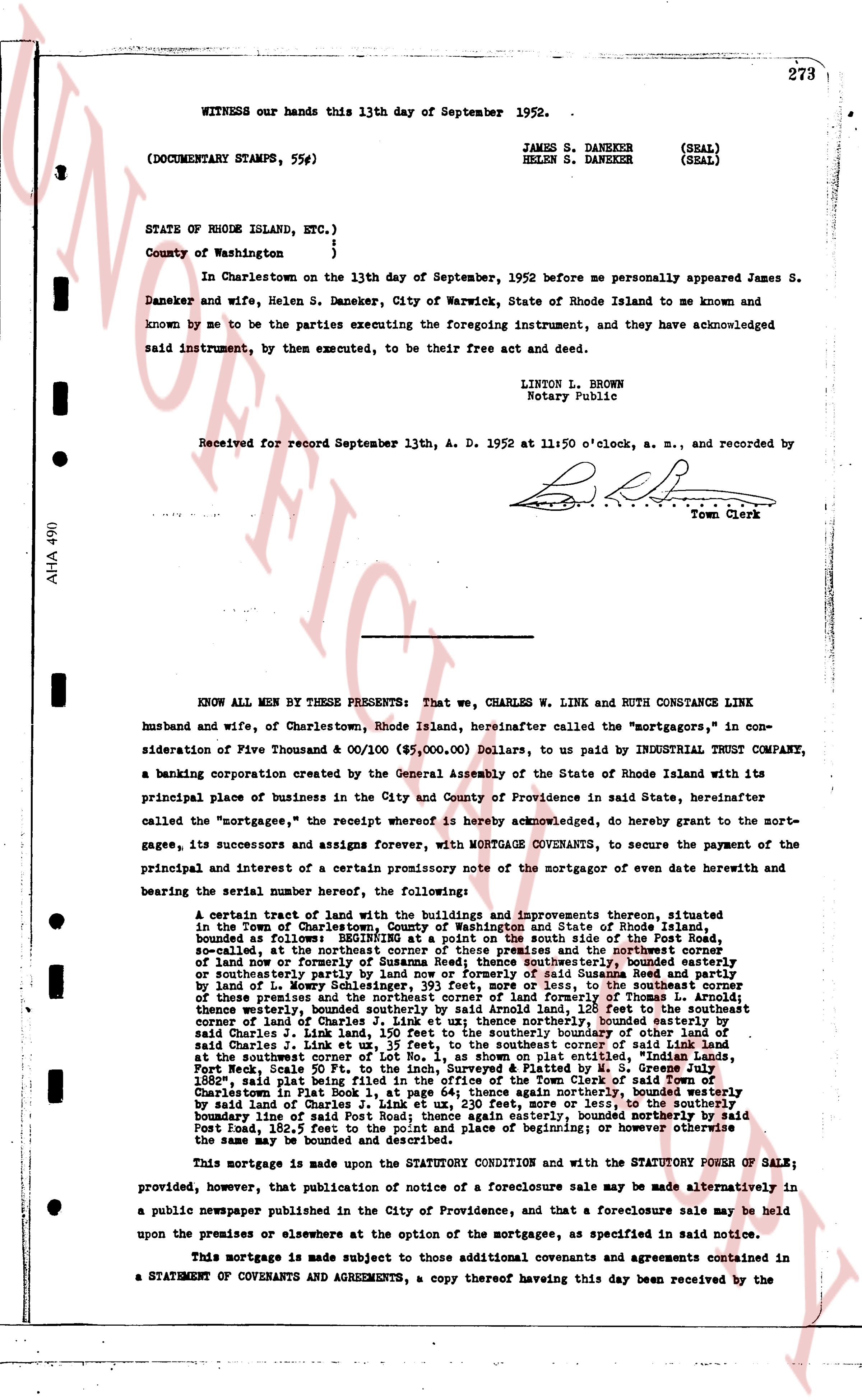
WITNESS our hands this 13th day of September 1952.
(DOCUMENTARY STAMPS, 55¢)
JAMES S. DANEKER (SEAL)
HELEN S. DANEKER (SEAL)
STATE of RHODE ISLAND, ETC., }
County of Washington }
In Charlestown on the 13th day of September, 1952 before me personally appeared James S. Daneker and wife, Helen S. Daneker, City of Warwick, State of Rhode Island to me known and known by me to be the parties executing the foregoing instrument, and they have acknowledged said instrument, by them executed, to be their free act and deed.
LINTON L. BROWN
Notary Public
Received for record September 13th, A. D. 1952 at 11:50 o'clock, a. m., and recorded by
[Signature]
Town Clerk
----
KNOW ALL MEN BY THESE PRESENTS: That we, CHARLES W. LINK AND RUTH CONSTANCE LINK husband and wife, of Charlestown, Rhode Island, hereinafter called the "mortgagors," in consideration of Five Thousand & 00/100 ($5,000.00) Dollars, to us paid by INDUSTRIAL TRUST COMPANY, a banking corporation created by the General Assembly of the State of Rhode Island with its principal place of business in the City and County of Providence in said State, hereinafter called the "mortgagee," the receipt whereof is hereby acknowledged, do hereby grant to the mortgagee, its successors and assigns forever, with MORTGAGE COVENANTS, to secure the payment of the principal and interest of a certain promissory note of the mortgagor of even date herewith and bearing the serial number hereof, the following:
A certain tract of land with the buildings and improvements thereon, situated in the Town of Charlestown, County of Washington and State of Rhode Island, bounded as follows: BEGINNING at a point on the road now called Road to the South Beach, situated at the northern end of said road, at the intersection thereof and the northwest corner of land now or formerly of Susannah Rees; thence southeasterly, bounded easterly on southeasterly part by land of Susannah Rees and heirs, and said Susannah Rees's heirs by land of L. Mowry Schlesinger, 193 feet, more or less, to the southeast corner of these premises and thence southerly, bounded westerly by land of Turner and heirs, 150 feet, to the southeast corner of land of Charles W. Link, as set off on a plat recorded by the Recorder of Turris [?] of Charlestown, said Charles W. Link, land being Lot No. 1, 150 feet to the southerly boundary of land of said Charles W. Link; thence easterly, bounded northerly by land of the mortgagee, 150 feet, to the southeast corner of Lot No. 1, as shown on plat entitled "Indian Lands, Post Road, Near South Beach," recorded in Plat Book 1, at page 64, in the office of the Town Clerk of Town of Charlestown in 1882, said plat being filed in the Office of the Town Clerk of Town said Town of Charlestown in Plat Book 1, at page 64; thence again northerly, bounded westerly by said land of Charles W. Link, 150 feet, more or less, to the intersection of the road now called Post Road; thence again easterly, bounded northerly by said Post Road; thence again northerly to the place of beginning; or however otherwise the same may be bounded and described.
This mortgage is made upon the STATUTORY CONDITION and with the STATUTORY POWER OF SALE; provided, however, that publication of notice of a foreclosure sale may be made alternatively in a public newspaper published in the City of Providence, and that a foreclosure sale may be held upon the premises or elsewhere at the option of the mortgagee, as specified in said notice.
This mortgage is made subject to those additional covenants and agreements contained in a STATEMENT OF COVENANTS AND AGREEMENTS, a copy thereof having this day been received by the
page 2 · read by Gemma vision
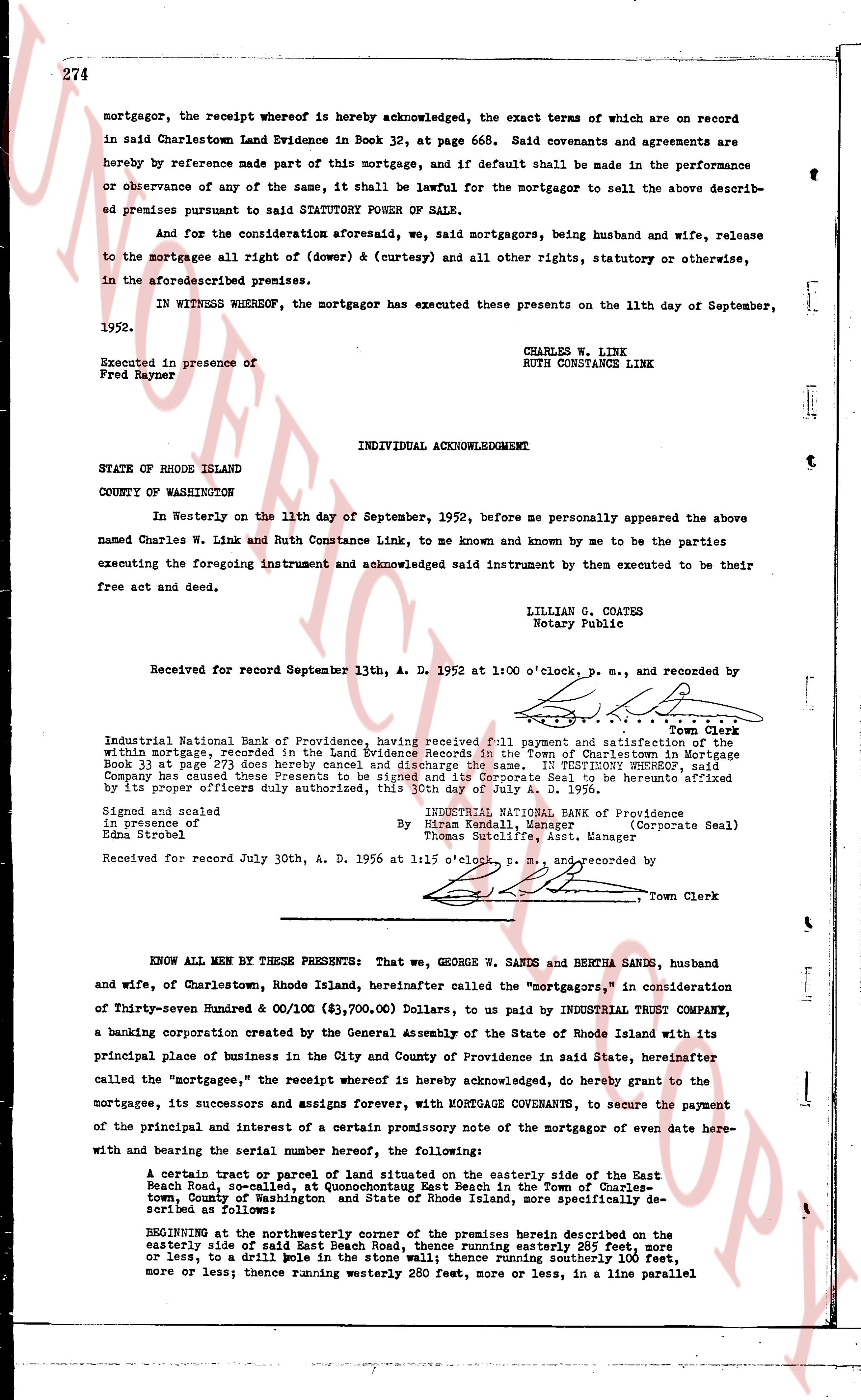
274
mortgagor, the receipt whereof is hereby acknowledged, the exact terms of which are on record
in said Charlestown Land Evidence in Book 32, at page 668. Said covenants and agreements are
hereby by reference made part of this mortgage, and if default shall be made in the performance
or observance of any of the same, it shall be lawful for the mortgagor to sell the above descri-
bed premises pursuant to said STATUTORY POWER OF SALE.
And for the consideration aforesaid, we, said mortgagors, being husband and wife, release
to the mortgagee all right of (dower) & (curtesy) and all other rights, statutory or otherwise,
in the aforesaid described premises.
IN WITNESS WHEREOF, the mortgagor has executed these presents on the 11th day of September,
1952.
CHARLES W. LINK
RUTH CONSTANCE LINK
Executed in presence of
Fred Rayner
INDIVIDUAL ACKNOWLEDGMENT
STATE OF RHODE ISLAND
COUNTY OF WASHINGTON
In Westerly on the 11th day of September, 1952, before me personally appeared the above
named Charles W. Link and Ruth Constance Link, to me known and known by me to be the parties
executing the foregoing instrument and acknowledged said instrument by them executed to be their
free act and deed.
LILLIAN G. COATES
Notary Public
Received for record September 13th, A. D. 1952 at 1:00 o'clock, p. m., and recorded by
[signature]
Town Clerk
Industrial National Bank of Providence, having received full payment and satisfaction of the
within mortgage, recorded in the Land Evidence Records in the Town of Charlestown, said
Book 33 at page 273 does hereby cancel and discharge the same. IN TESTIMONY WHEREOF, said
Corporation has caused these presents to be signed and its corporate seal to be hereunto affixed
by its proper officers duly authorized, this 30th day of July A. D. 1956.
INDUSTRIAL NATIONAL BANK OF Providence
By Norman Kendall, Manager (Corporate Seal)
and [signature] [?] Scilfire, Asst. Manager
Signed and sealed
in presence of
Edna Strower
Received for record July 30th, A. D. 1956 at 1:15 o'clock, p. m., and recorded by
[signature]
Town Clerk
----
KNOW ALL MEN BY THESE PRESENTS: That we, GEORGE W. SANDO and BERTHA SANDO, husband
and wife, of Charlestown, Rhode Island, hereinafter called the "mortgagors," in consideration
of Thirty-seven Hundred & 00/100 ($3,700.00) Dollars, to be paid by INDUSTRIAL TRUST COMPANY,
a banking corporation created by the General Assembly of the State of Rhode Island with its
principal place of business in the City and County of Providence in said State, hereinafter
called the "mortgagee," the receipt whereof is hereby acknowledged, do hereby grant to the
mortgagee, its successors and assigns forever, with MORTGAGE COVENANTS, to secure the payment
of the principal and interest of a certain promissory note of the mortgagor of even date here-
with and bearing the serial number hereof, the following:
A certain tract or parcel of land situated on the easterly side of the East
Beach Road, so-called, at Quonochonticut East Beach in the Town of Charles-
town, County of Washington and State of Rhode Island, more specifically de-
scribed as follows:
BEGINNING at the northeasterly corner of the premises herein described on the
easterly side of said East Beach Road, thence running easterly 285 feet, more
or less to a drill rail (now a stone wall); thence running southerly 100 feet,
more or less; thence running westerly 280 feet, more or less, in a line parallel
The page as recorded