The instrument's own words
page 1 · read by Gemma vision
208
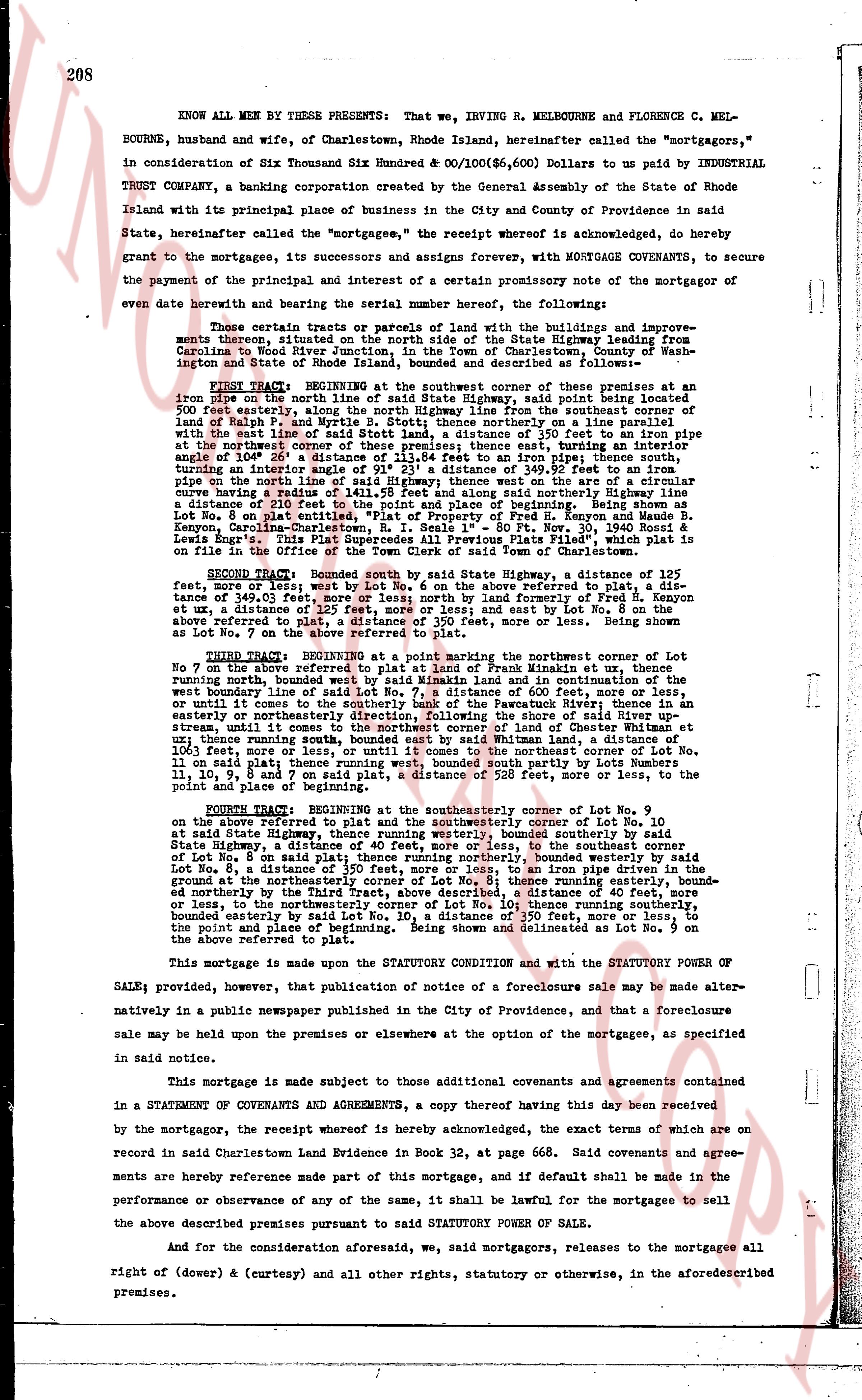
KNOW ALL MEN BY THESE PRESENTS: That we, IRVING R. MELBOURNE and FLORENCE C. MELBOURNE, husband and wife, of Charlestown, Rhode Island, hereinafter called the "mortgagors," in consideration of Six Thousand Six Hundred & 00/100($6,600) Dollars to us paid by INDUSTRIAL TRUST COMPANY, a banking corporation created by the General Assembly of the State of Rhode Island with its principal place of business in the City and County of Providence in said State, hereinafter called the "mortgagee," the receipt whereof is acknowledged, do hereby grant to the mortgagee, its successors and assigns forever, with MORTGAGE COVENANTS, to secure the payment of the principal and interest of a certain promissory note of the mortgagor of even date herewith bearing and the serial number hereof, the following:
Those certain tracts or parcels of land with the buildings and improvements thereon situated on the north side of the State Highway leading from Carolina to North River stream at North River, Charlestown, Rhode Island, bounded by Washington and State of Rhode Island, bounded and described as follows:—
FIRST TRACT: BEGINNING at the southwest corner of these premises at an iron pipe on the north side of the State Highway, said point being located five hundred feet easterly, along the north Highway line from the southeast corner of Lot No. 8 of Plat 1, and running thence north 50° east, northerly, or line approximately with the east line of said Stott land, a distance of 550 feet more or less to an iron pipe at the north boundary line of these premises, thence running south 40° west, running angle of 106° 20 a distance of 113.84 feet to an iron pipe; thence south turning, running south 40° west, a distance of 105.37 feet, more or less, to an iron pipe on the north line of said Highway; thence west on the arc of a circular curve having a radius of 1411.58 feet and along said northerly Highway line a distance of 200 feet more or less to the point of beginning; said tract being identified as Lot No. 8 on Plat entitled "Plat of Property of Fred H. Kenyon and Maurice B. Senge," recorded in Charlestown Land Evidence Book 28, page 384, granted to us by Lewis Engls. This Spot Supercedes All Previous Flats "Plod," which is plat in the office of the Town Clerk of the Town of Charlestown.
SECOND TRACT: Bounded south by said State Highway, a distance of 125 feet, more or less; west on the arc of 60 feet, on the arc of 60 feet referred to, a distance of 140 feet, more or less; north 40° west, a distance of 500 feet, more or less to Fred H. Kenyon et ux, a distance of 125 feet, more or less; and east by Lot No. 8 on the above referred to plat 500 feet, more or less; north 40° west, more or less. Being shown as Lot No. 7 on the above referred to plat.
THIRD TRACT: BEGINNING at a point marking the southwest corner of Lot No. 7 on the above referred to plat, being a distance of 200 feet from Frank Williams at say, running north, bounded west by said Whitman line and in continuation of the west boundary line of said Lot No. 7, a distance of 600 feet, more or less, and in continuation, until it comes to the boundary line of the property of Rawland H. Moore, running in easterly or northeasterly direction, following the shore of said River up stream, until it comes to the north boundary line of 100 feet of land where Whitman et ux, running thence south, bounded east by said Whitman land, a distance of 600 feet, more or less; thence west 100 feet, more or less, to the northeast corner of Lot No. 11 on said plat; thence running west, bounded south partly by Lots numbers 11, 10, 9, 8 and 7 more or less; and north 40° west, more or less to the point and place of beginning.
FOURTH TRACT: BEGINNING at the southeasterly corner of Lot No. 9 on the above referred to plat, and running to the southeasterly corner of Lot No. 10 at said State Highway, thence running westerly, bounded southerly by said State Highway, a distance of 125 feet, more or less, to the southeasterly corner of Lot No. 8 on said plat; thence running northerly, bounded westerly by said Lot No. 8, a distance of 500 feet, more or less, to an iron pipe located at the ground at the northeasterly corner of Lot No. 8; thence running easterly, bounded northerly by the Third Tract, above described, a distance of 40 feet, more or less to the north boundary line of these premises; thence running south, bounded easterly by said Lot No. 10, a distance of 350 feet, more or less, to the point and place of beginning. Being shown and delineated as Lot No. 9 on the above referred to plat.
This mortgage is made upon the STATUTORY CONDITION and with the STATUTORY POWER OF SALE; provided, however, that publication notice of a foreclosure sale may be made alternatively in a public newspaper published in the City of Providence, and that a foreclosure sale may be held upon the premises or elsewhere at the option of the mortgagee, as specified in said notice.
This mortgage is made subject to those additional covenants and agreements contained in a STATEMENT OF COVENANTS AND AGREEMENTS, a copy thereof having this day been received by the mortgagor, the receipt whereof is hereby acknowledged, the exact terms of which are on record in said Charlestown Land Evidence in Book 33, at page 668. Said covenants and agreements are hereby reference made part of this mortgage, and if default shall be made in the performance or observance of any of the same, it shall be lawful for the mortgagee to sell the above described premises pursuant to said STATUTORY POWER OF SALE.
And for the consideration aforesaid, we said mortgagors, release to the mortgagees all right of (dower &) (curtesy) and all other rights, statutory or otherwise, in the aforesaid described premises.
The page as recorded