The instrument's own words
page 1
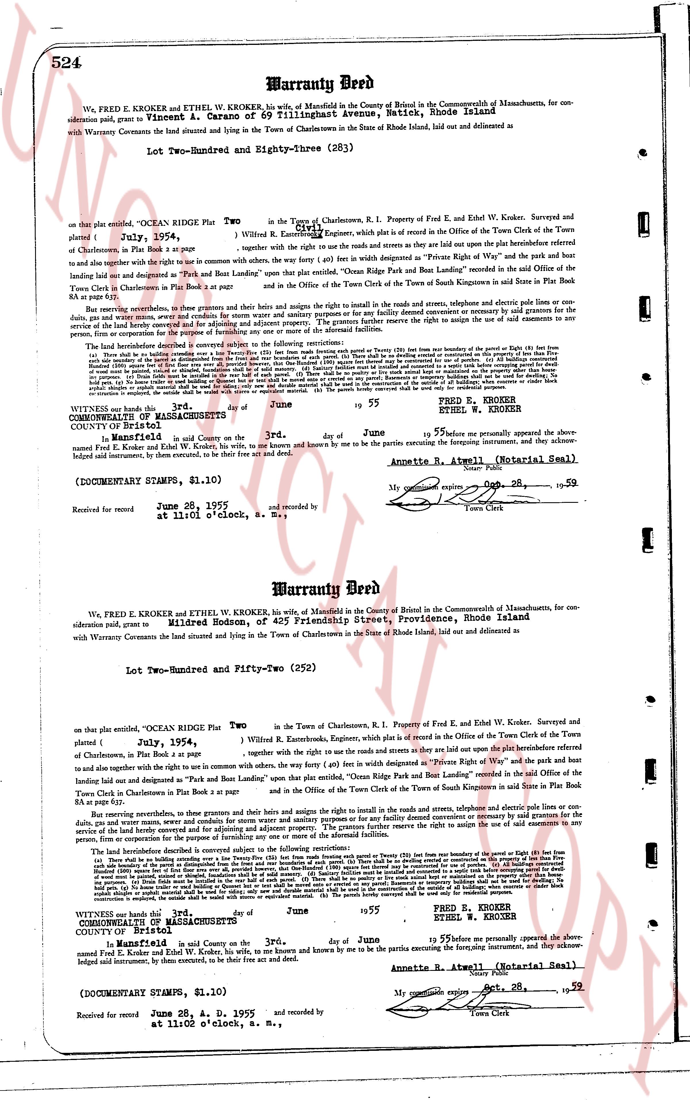
524 Warranty Deed
We, FRED E. KROKER and ETHEL W. KROKER, his wife, of Mansfield in the County of Bristol in the Commonwealth of Massachusetts, for con-
sideration paid, grant to Vincent A. Garano of 69 Tillinghast Avenue, Warwick, Rhode Island phrase
with Warranty Covenants the land situated and lying in the Town of Charlestown in the State of Rhode Island, laid out and delineated as
Lot Two-Hundred and Eighty-three (283)
on that plat entitled, "OCEAN RIDGE PLAT Two in the Town of Charlestown, R. I. Property of Fred E. and Ethel W. Kroker, Surveyed and
platted { July, 1954 } by W. E. Rutter, Engineer, which is plat is recorded in the Office of the Town Clerk of the Town of
of Charlestown, in Plat Book 1 page 54,
together with the right to use the roads and streets as they are laid out upon the plat hereinbefore referred
to and also together with the right to use in common with others, the way (Forty ft) in width seen designated as "Private Right of Way" and the park boat
landing laid out and designated as "Park and Boat Landing" upon that plat entitled, "Ocean Ridge Plat and Park Boat Landing" recorded in the said Office of the
Town Clerk in Charlestown in Plat Book 1 page 82 and
in the Office of the Town Clerk of the Town of South Kingstown in said State in Plat Book
84 or partly.
But reserving nevertheless, to the grantors, their grantees and heirs both the rights and agrees the right to install in the roads and streets, telephone and electric pole lines or con-
duits, gas and water pipes and sewers. The grantors further reserve the right to condemn any portion of the said easements for widening or expansion as may be necessary
for the service of the land hereby conveyed for and adjusting and adjoining party. The grantors further reserve the right to assign the use of said easements to any
person, firm or corporation for the purpose of installing the same.
The following restrictions are hereby subject and conveyed to the following restrictions:
(a) There shall be no building or structure erected on any portion of the said lot (Two-Hundred and Eighty-three) from the westerly 20 feet from the boundary of the Parcel or 15 feet
from the southerly boundary at any disposition from the front and the easterly and rear boundaries of such plot. (b) There shall be no building or structure erected on any portion
of the said lot (Two-Hundred and Eighty-three) except for residential purposes. (c) All buildings constructed for residential purposes shall be single family dwellings. (d)
No building or structure shall be erected on any portion of the said lot (Two-Hundred and Eighty-three) except for residential purposes. (e) Basements or inventory buildings shall be used for dwelling,
the same shall be located in the most easterly part of the said parcel. (f) There shall be no poultry or pig pens or livestock of any kind kept on the said parcel. (g) No
commercial building or structure shall be erected on any portion of the said lot (Two-Hundred and Eighty-three) and no commercial building or structure shall be used for dwelling,
or private Dwellings must be located in the most easterly part of the said parcel. (h) Statements or inventory buildings shall not be used for dwelling, the
same shall be located in the most easterly part of the said parcel. (i) No commercial building or structure shall be erected on any portion of the said lot (Two-Hundred and Eighty-three) and no commercial building or structure shall be used for dwelling,
no evacuation is required, the entire outside shall be walled with stone or equivalent materials. (j) The parcels hereby conveyed shall be used only for residential purposes.
The page as recorded