The instrument's own words
page 1 · read by Gemma vision
47
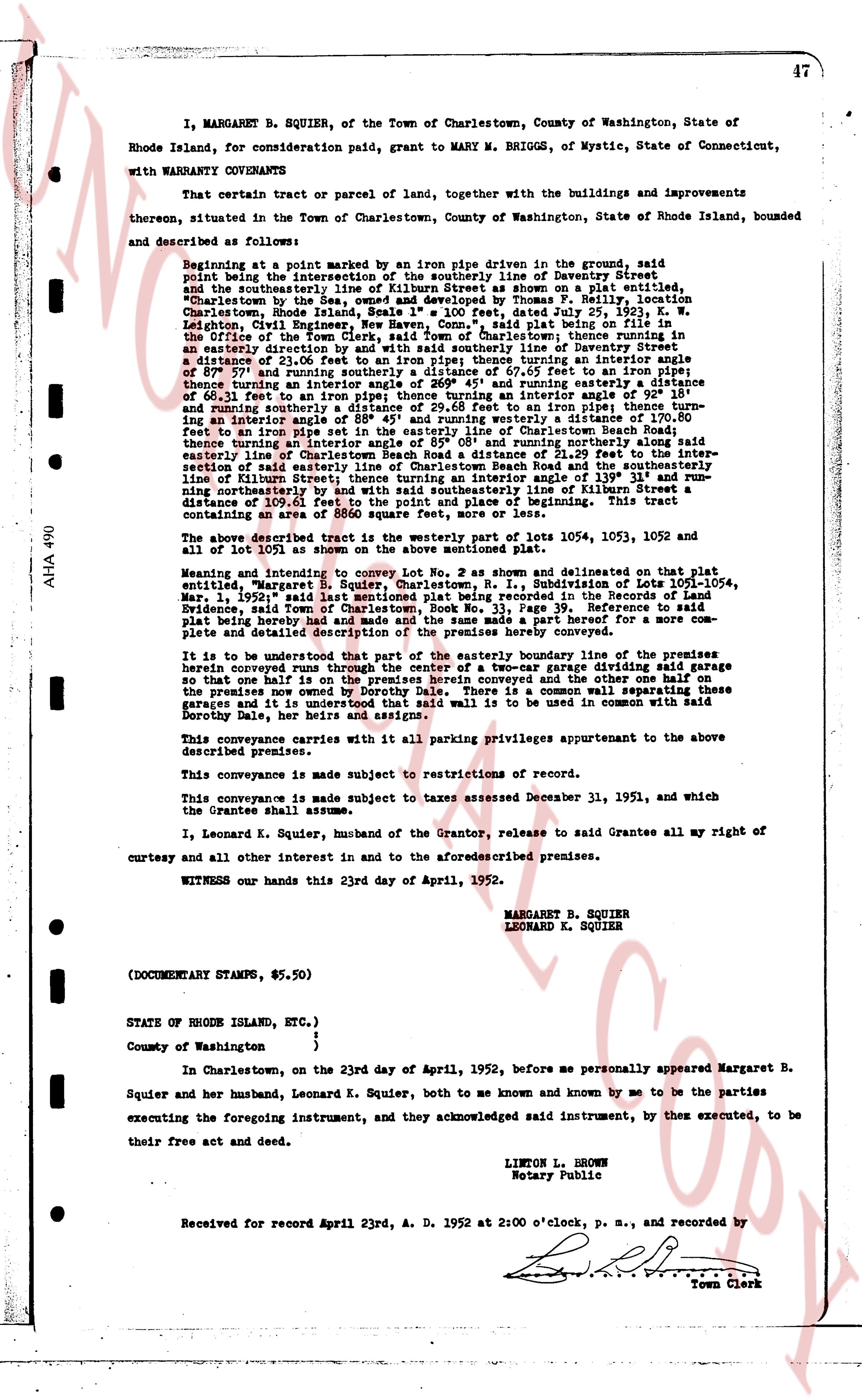
I, MARGARET B. SQUIER, of the Town of Charlestown, County of Washington, State of Rhode Island, for consideration paid, grant to MARY M. BRIGGS, of Mystic, State of Connecticut,
with WARRANTY CONVEYANCE
That certain tract or parcel of land, together with the buildings and improvements thereon, situated in the Town of Charlestown, County of Washington, State of Rhode Island, bounded and described as follows:
Beginning at a point marked by an iron pipe driven in ground, said point being the intersection of the southerly line of Daventry Street and the southeasterly line of the tract of land as shown on a plat, entitled, "Charlestown by the Sea, owned and developed by Thomas F. Reilly, location Charlestown Road, Rhode Island, 1935", dated July 23, 1935, and recorded in the Leighton, Civil Engineer, New Haven Conn., "said plat being on file in the Office of the Town Clerk, Charlestown, R.I."; thence turning an easterly direction along the intersection with said southerly line of Daventry Street a distance of 21.06 ft to an iron pipe; thence turning an interior angle of 87° 07' and running southeasterly a distance of 107.57 ft to an iron pipe; thence turning an interior angle of 269° 45' and running southeasterly a distance of 60.61 ft to an iron pipe; thence turning an interior angle of 111° 30' and running southeasterly a distance of 29.58 ft to an iron pipe; thence turning an interior angle of 111° 30' and running southeasterly a distance of 107.57 ft to an iron pipe set in the easterly line of Charlestown Beach Road; thence turning an interior angle of 139° 31' and running northerly a distance of 21.29 ft to the easterly line of Charlestown Beach Road a distance of 21.29 ft to the intersection with said southerly line of Daventry Street; thence turning an interior angle of 139° 31' and running northerly a distance of 116 ft to the intersection with the southerly line of Daventry Street; thence turning an interior angle of 139° 31' and running northerly a distance of 109.61 ft to the point and place of beginning. This tract containing an area of 8800 square feet, more or less.
The above described tract is the westerly part of lots 1054, 1053, 1052 and 1051 of all of Lot 1 as shown on the plat aforementioned.
Meaning and intent to convey Lot No. 2 as shown and delineated on that plat entitled, "Margaret B. Squier, Charlestown, R. I.", Subdivision of Lots 1051-1054, May 1, 1937 (said last instrument being recorded in the Record of Land Evidence, said Town of Charlestown, Book No. 33, Page 39. Reference to said plat being hereby made and the same is incorporated as a part hereof) for more complete and detailed description of the premises hereby conveyed.
It is to be understood that part of the easterly boundary line of the premises hereby conveyed runs through a wooded area and that a dividing fence dividing said garage so that one half the premises on herein conveyed then granting and the other one half on the premises now owned by Dorothy Dale. There is a common wall separating these garage units and it is understood that wall is to be used in common with said Dorothy Dale, her heirs and assigns.
This conveyance carries with it all parking privileges appurtenant to the above described premises.
This conveyance is made subject to restrictions of record.
This conveyance is made subject to taxes assessed December 31, 1951, and which the Grantee shall assume.
I, Leonard K. Squier, husband of the Grantor, release to said Grantee all my right of curtesy and all other this interest in and to the aforementioned premises.
WITNESS our hands this 23rd day of April, 1952.
MARGARET B. SQUIER
LEONARD K. SQUIER
(DOCUMENTARY STAMPS, $5.50)
STATE OF RHODE ISLAND, ETC.)
County of Washington }
In Charlestown, on the 23rd day of April, 1952, before me personally appeared Margaret B. Squier and her husband, Leonard K. Squier, both to me known and known by me to be the parties Squier and her husband, Leonard K. Squier, both to me known and known by me to be the parties executing the foregoing instrument, and they acknowledged said instrument, by their executed, to be their free act and deed.
LIMTON L. BROWN
Notary Public
Received for record April 23rd, A. D. 1952 at 2:00 o'clock, p. m., and recorded by
[Signature]
Town Clerk
The page as recorded