The instrument's own words
page 1
323
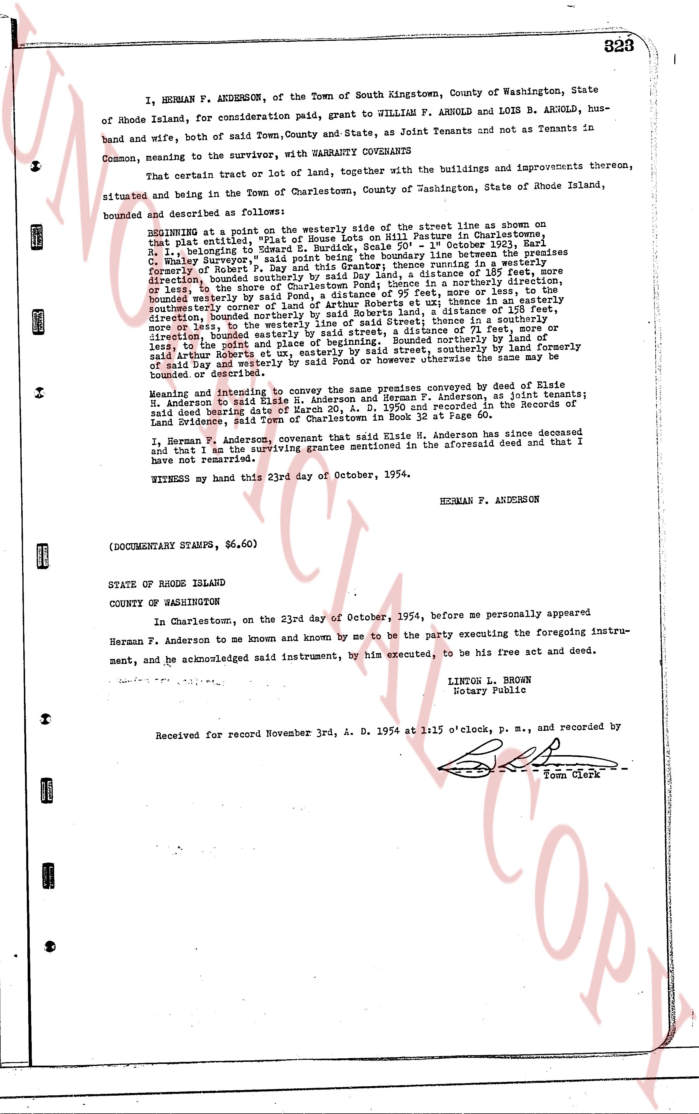
I, HERMAN F. ANDERSON, of the Town of South Kingstown, County of Washington, State
of Rhode Island, for consideration paid, grant to WILLIAM F. ARNOLD and LOIS B. ARNOLD, hus-
band and wife, both of said Town, County and State, as Joint Tenants and not as Tenants in
Common, meaning to the survivor, with WARRANTY COVENANTS
That certain tract or lot of land, together with the buildings and improvements thereon,
situated and being in the Town of Charlestown, County of Washington, State of Rhode Island,
bounded and described as follows:
BEGINNING at a point on the westerly side of, the street line as shown on
that plat entitled, "Plot of House of William F. Arnold Parcel in Charlestown",
Plat 1, belonging to E. S. S. Engineering, Scale 50' = 1" October 1923, Earl
C. Whitehead, Surveyor," said point being the boundary line between the premises
formerly of Robert P. Day and the premises running in a westerly
direction, bounded easterly by said Day land, a distance of 185 feet, more
or less, bounded southerly by said Charlestown Pond, in a northerly direction,
bounded westerly by said Robert P. Day land, a distance of 95 feet, more or less, to
the shore of the Charlestown Pond, bounded northerly, in a northerly direction,
southeasterly corner of land of Arthur Robert A. S. S. land, a distance of 125 feet,
serviceable bounded northerly by said Arthur Robert A. S. S. land, a distance of 111 feet,
more or less, to the westerly line of said Street; thence in a southeasterly
direction, bounded easterly by said Street, a distance of 71 feet, more or
less, to the point and place of beginning." Bounded northerly by land formerly
of said Day and westerly by said Pond or however otherwise the same may be
bounded or described.
Meaning and intending to convey the same premises conveyed by deed of Elsie
B. Anderson to said Elsie H. Anderson and Herman F. Anderson, as joint tenants;
said deed bearing date 1933 and recorded in the Records of
Land Evidence, said Town of Charlestown in Book 32 at Page 60.
I, Herman F. Anderson, covenant that said Elsie H. Anderson has since deceased
and that I am the surviving grantee mentioned in the aforesaid deed and that I
have not remarried.
WITNESS my hand this 23rd day of October, 1954.
HERMAN F. ANDERSON
(DOCUMENTARY STAMPS, $6.60)
STATE OF RHODE ISLAND
COUNTY OF WASHINGTON
In Charlestown, on the 23rd day of October, 1954, before me personally appeared
Herman F. Anderson to me known and known by me to be the party executing the foregoing instru-
ment, and he acknowledged said instrument, by his executed, to be his free act and deed.
LINTON L. BROWN
Notary Public
Received for record November 3rd, A. D. 1954 at 1:15 o'clock, P. M., and recorded by
Town Clerk
The page as recorded