The instrument's own words
page 1 · read by Gemma vision
43
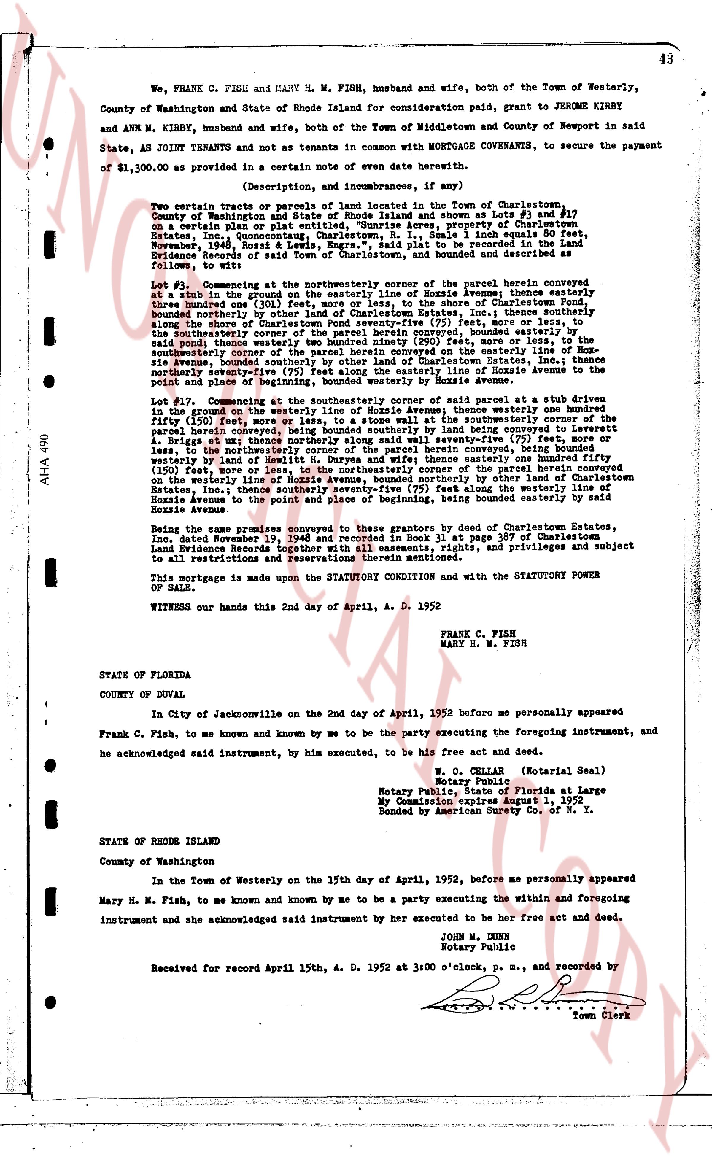
We, FRANK C. FISH and MARY H. M. FISH, husband and wife, both of the Town of Westerly, County of Washington and State of Rhode Island consideration paid, grant to JEROME KIRBY and ANN M. KIRBY, husband and wife, both of the Town of Middletown and County of Newport in said State, AS JOINT TENANTS and not as tenants in common with MORTGAGE COVENANTS, to secure the payment of $1,300.00 as provided in a certain note of date herewith.
(Description, and imbrances, if any)
Two certain tracts or parcels of land owned in the Town of Charlestown, Rhode Island and shown as Lots #3 and #17 on a certain plan or plat entitled, "Sunrise Acres, property of Charlestown Estates, Inc. Communal Areas", dated October 11, 1936, scale 1 inch equals 100 feet, November, 1948, Rossi & Lewis, Engrs., said plat to be recorded in the land Evidence records of said Town of Charlestown and bounded as follows:
Lot #3. Commencing at the southeasterly corner of the parcel herein conveyed at a stub in the ground on the easterly line of Hosie Avenue, thence easterly three hundred one (301) feet, more or less, to the shore of Charlestown Pond, thence southerly boundary by the shore of Charlestown Pond, then westerly one hundred seventy-five (175) feet, more or less, along the shore of Charlestown Pond seventy-five (75) feet, more or less, to the southeasterly corner of the parcel herein conveyed, thence southeasterly one hundred eighty-five (185) feet, more or less, to the southeasterly corner of the parcel herein conveyed namely two hundred ninety (290) feet, more or less, to the southeasterly corner of the parcel herein conveyed on the easterly line of Charlestown Estates, Inc. thence northwesterly seventy-five (75) feet along the easterly line of Hosie Avenue to the point and place of beginning, then northerly seventy-five (75) feet along the easterly line of Hosie Avenue.
Lot #17. Commencing at the southeasterly corner of said parcel at a stub driven in the ground on the westerly line of Hosie Avenue a then westerly one hundred fifty (150) feet more or less to a stub driven in the ground at the southeasterly corner of the parcel herein conveyed, being bounded southerly by land being conveyed to Leverett A. Bridge therefore westerly one hundred seventy-five (175) feet, more or less, to the northwesterly corner of the parcel herein conveyed, being bounded westerly by land being conveyed to Leverett A. Bridge then easterly one hundred fifty (150) feet, more or less, to the northeasterly corner of the parcel herein conveyed, being bounded northerly by land being conveyed to Leverett A. Bridge, then southerly one hundred seventy-five (175) feet along the westerly line of Hosie Avenue, being bounded easterly, by other land of Charlestown Estates, Inc. thence southeasterly seventy-five (75) feet along the westerly line of Hosie Avenue to the point and place of beginning, being bounded easterly by said Hosie Avenue.
Being the same premises conveyed to these grantors by deed of Charlestown Estates, Inc. dated November 15, 1936 and recorded in Book 11 at page 367 of Charlestown Land Evidence Records together with all the rights, easements, points, and privileges and subject to all restrictions and reservations therein mentioned.
This mortgage is made upon the STATUTORY CONDITION and with the STATUTORY POWER OF SALE.
WITNESS our hands this 2nd day of April, A. D. 1952
FRANK C. FISH
MARY H. M. FISH
STATE OF FLORIDA
COUNTY OF DUVAL
In City of Jacksonville on the 2nd day of April, 1952 before me personally appeared Frank C. Fish, to me known and by me to be the party executing the foregoing instrument, and he acknowledged said instrument, by him executed, to be his free act and deed.
W. C. CELLAR (Notarial Seal)
Notary Public
Notary Public State of Florida at Large
My Commission Expires August 1, 1953
Bonded by American Surety Co. of N. Y.
STATE OF RHODE ISLAND
County of Washington
In the Town of Westerly on the 15th day of April, 1952, before me personally appeared Mary H. M. Fish, to me known and by me to be a party executing the within and foregoing instrument and she acknowledged said instrument by her executed to be her free act and deed.
JOHN M. DUNN
Notary Public
Received for record April 15th, A. D. 1952 at 3:00 o'clock, p. m., and recorded by
[Signature]
Town Clerk
The page as recorded