The instrument's own words
page 1 · read by Gemma vision
260
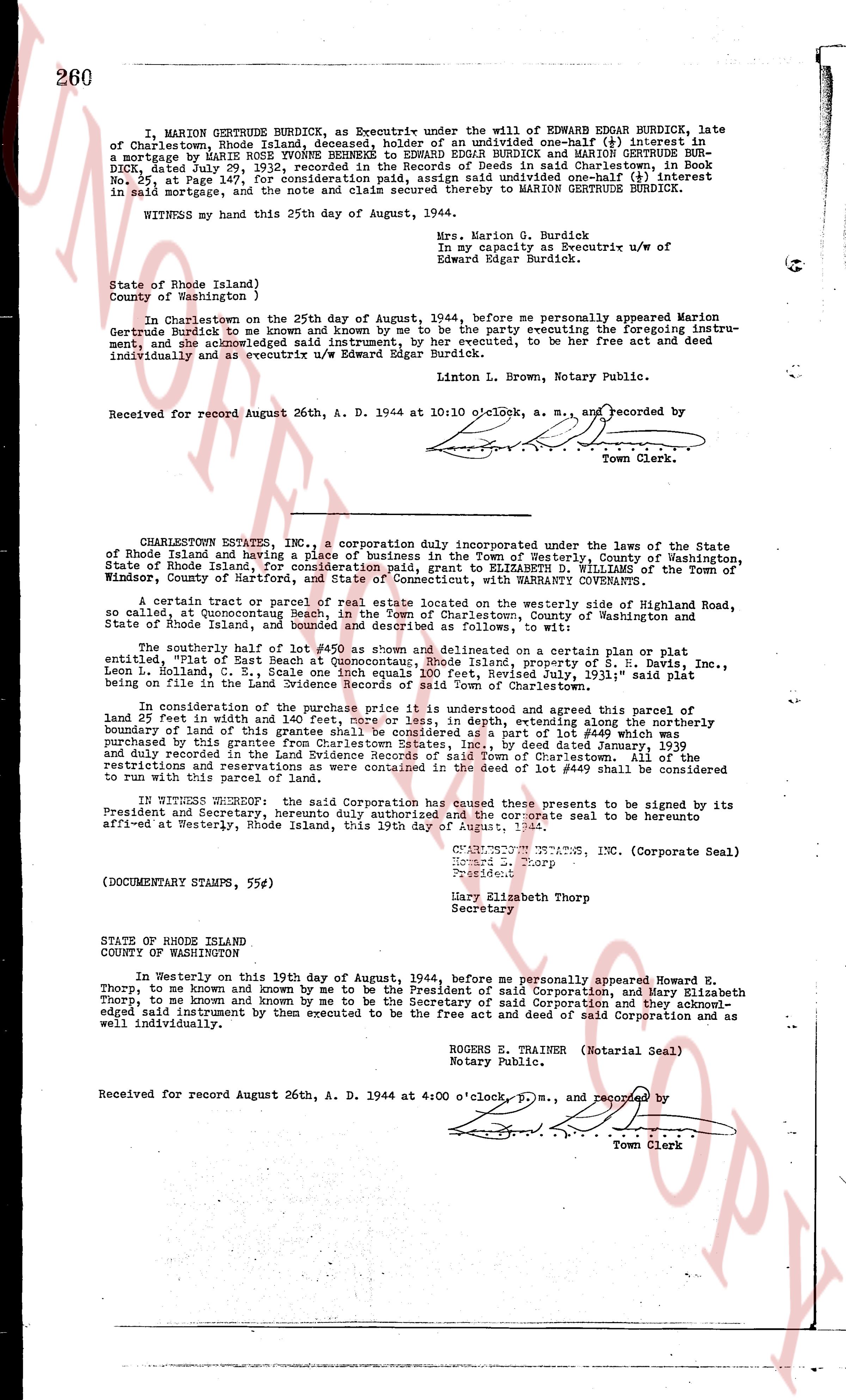
I, MARION GERTRUDE BURDICK, as Executrix under the will of EDWARD EDGAR BURDICK, late of Charlestown, Rhode Island deceased, hereby sell an undivided one-half (1/2) interest in a mortgage by MARY ROSE TOWNSEND to EDWARD EDGAR BURDICK and MARION GERTRUDE BURDICK, dated July 29, 1932, recorded in the Records of Deeds in said Charlestown in Book No. 25, at Page 147, for consideration paid, and do hereby quitclaim all interest in said mortgage and the note and claim ensuing thereof to MARION GERTRUDE BURDICK.
WITNESS my hand this 25th day of August, 1944.
Mrs. Marion G. Burdick
in my Capacity as Executrix u/w of
Edward Edgar Burdick.
State of Rhode Island)
County of Washington )
In Charlestown on the 25th day of August, 1944, before me personally appeared Marion Gertrude Burdick to me known and by me known to be the party be executing foregoing instrument, and acknowledged said instrument, by her executed, to be her free act and deed individually and as executrix u/w Edward Edgar Burdick.
Linton L. Brown, a M., Notary Public.
Received for record August 26th, A. D. 1944 at 10:10 o'clock, a. m., and recorded by [?]
Town Clerk.
----
CHARLESTOWN ESTATES, INC., a corporation duly incorporated under the laws of the State of Rhode Island and having a place of business in the Town of Westerly, County of Washington, State of Rhode Island, for consideration paid, grant to ELIZABETH D. WILLIAMS of the Town of Windsor, County of Hartford, state of CONNECTICUT, with WARRANTY CONVEYANCE.
A certain tract or parcel of real estate located on the westerly side of Highroad Road, so called, at Quannockson Beach, in the Town of Charlestown, County of Washington, State of Rhode Island, and bounded and described as follows, to wit:
The southerly half of lot #450 as shown and delineated on a certain plan or plat entitled "Plan of East Beach" dated July 1, 1935, property of S. H. Davis, Inc., Leon L. Holland, C. S., Scale one inch equals 100 feet, Revised July, 1931," said plat being recorded in the land evidence records of said Charlestown.
In consideration of the purchase price it is understood and agreed that this parcel of land 25 feet in width and [?] feet, more or less, in depth, extending along the northerly boundary of land of this grantor as conveyed, considered, and described in lot deed recorded for land purchased by this grantee from Charlestown Estates, Inc., by deed dated January, 1939 and recorded in the land evidence records of the Town of Charlestown. All of the restrictions and reservations as were contained in the deed of lot #450 shall be considered to run with this parcel of land.
IN WITNESS WHEREOF, said Corporation has caused these presents to be signed by its President and Secretary, herunto duly authorized and the corporate seal to be herunto affixed at Westerly, Rhode Island, this 19th day of August, 1944.
CHARLESTOWN ESTATES, INC. (Corporate Seal)
Howard E. Thorp
President
Mary Elizabeth Thorp
Secretary
(DOCUMENTARY STAMPS, 55¢)
STATE OF RHODE ISLAND
COUNTY OF WASHINGTON
In Westerly on this 19th day of August, 1944, before me personally appeared Howard E. Thorp, to me known and by me known to be the President of said Corporation, and Mary Elizabeth Thorp to me known and by me known to be the Secretary of said Corporation and they acknowledged said instrument by them executed to be the free act and deed of said Corporation and as well individually.
ROGERS TRAINER (Notarial Seal)
Notary Public.
Received for record August 26th, A. D. 1944 at 4:00 o'clock p. m., and recorded by [?]
Town Clerk
The page as recorded