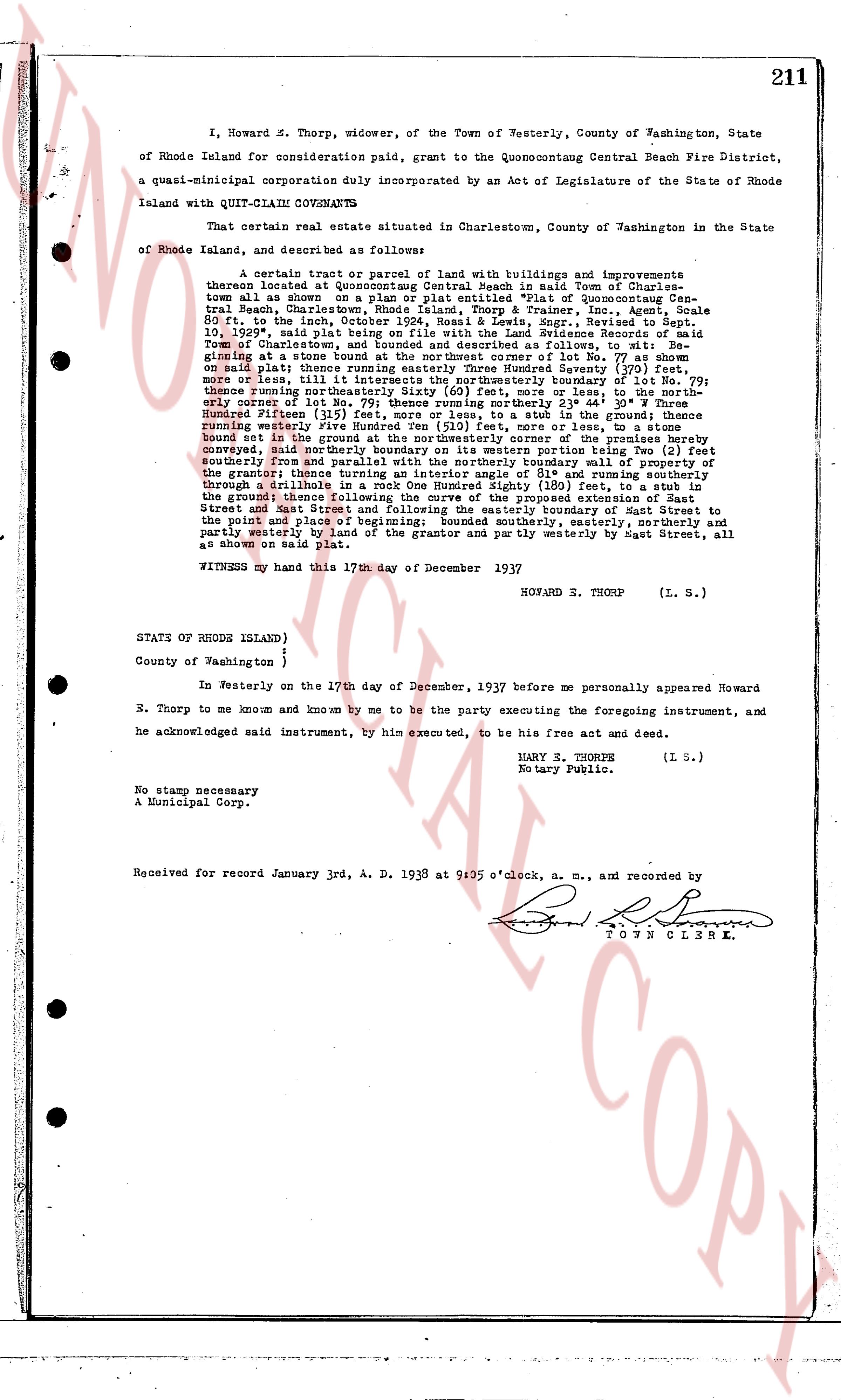
The instrument's own words
page 1
211
I, Howard S. Thorp, widower, of the Town of Westerly, County of Washington, State
of Rhode Island for consideration paid, grant to the Quonsetcontaug Central Beach Fire District,
a quasi-municipal corporation duly incorporated by an Act of Legislature of the State of Rhode
Island with QUIT-CLAIM COVENANTS,
That certain real estate situated in Charlestown, County of Washington in the State
of Rhode Island, and described as follows:
a certain tract or parcels of land with buildings and improvements
thereon located at Quonsetcontaug Central Beach in said Town of Charles-
town all as shown on a plan or plat entitled "Plat of Quonsetcontaug Cen-
tral Beach, Charlestown, R.I." by George A. Bender, Meas., Revised to Sept.
10, 1935 said plat being a record in the Land Evidence Records of the Town
of Charlestown, and bounded and described as follows, to wit: Be-
ginning at a stone post at the north westerly corner of the lot known as lot
one, or lot 1, all in said plat; thence running easterly Sunday Seventy (70) feet,
curve or arc, till at a stone post; thence running southerly Sunday forty (40)
feet on said plat; thence running easterly Sunday Seventy (70) feet, curve
or arc, till at a stone post; thence running southerly Sunday forty (40)
feet, thence running northwesterly Sixty (60) feet, more or less, to the north-
westerly corner of lot Two (2), then running southerly boundary forty (40)
feet, then running northwesterly Thirty (30) feet, then running southerly
the Hundred Fifteen (115) feet, then running southerly boundary forty (40)
feet, then running westerly Five Hundred Five (505) feet, more or less, to a
stone post in the ground; thence running southwesterly in the ground thence
running westerly Five Hundred Five (505) feet, more or less, to a stone
bound in the ground at the north westerly corner of the lot known as lot
southerly four and one half (4 1/2) feet, then running northerly boundary to
conveyed, said northerly boundary on its western portion being Two (2) feet
southerly from the boundary line of the lot known as lot 10 as shown on the
grantor; thence running as interior angle of 91° and running southerly
through a sliver of land to a stone post in the ground Sixty (60) feet in
the ground; thence following the curve of the proposed extension of East
Street and East Street, and then northerly boundary of the lot known as lot
to the point and place of beginning; bounded southerly, easterly, northerly and
partly westerly by land of the grantor and partly westerly by East Street, all
as shown on said plat.
WITNESS my hand this 17th day of December 1937
HOWARD S. THORP (L. S.)
STATS OF RHODE ISLAND)
County of Washington )
In Westerly on the 17th day of December, 1937 before me personally appeared Howard
R. Thorp to me known and known by me to be the party executing the foregoing instrument, and
he acknowledged said instrument, by him executed, to be his free act and deed.
MARY E. THORPE
Notary Public. (L. S.)
No stamp necessary
A Municipal Corp.
Received for record January 3rd, A. D. 1938 at 9:05 o'clock, a. m., and recorded by
TOWN CLERK
The page as recorded