The instrument's own words
page 1 · read by Gemma vision
40
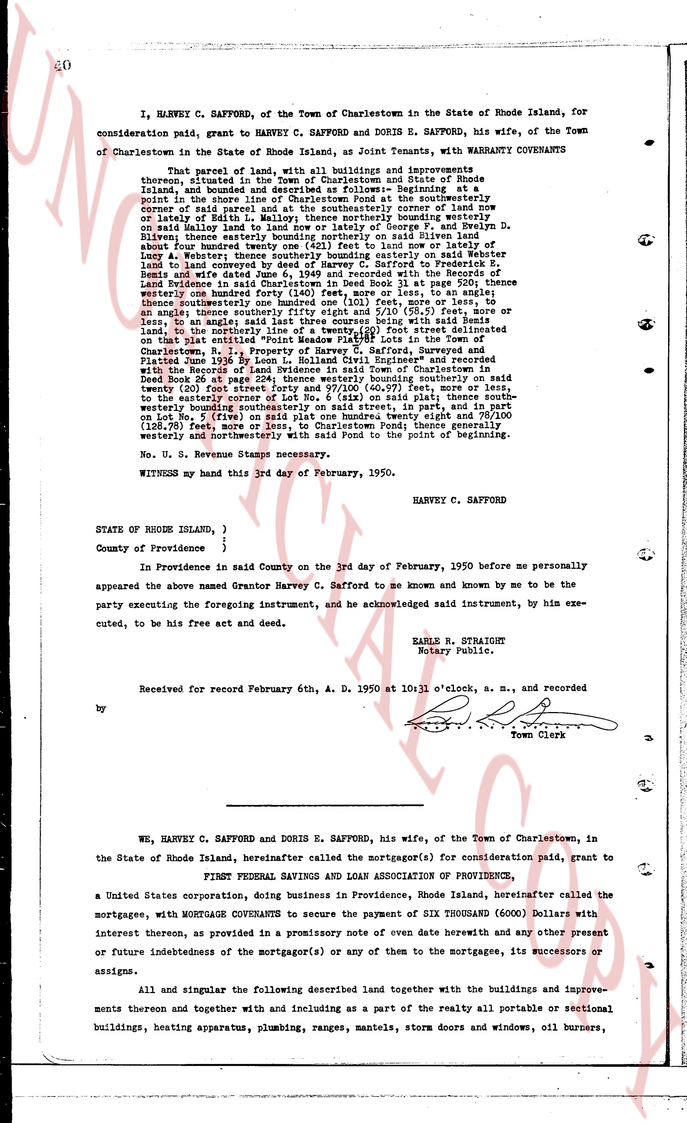
I, HARVEY C. SAFFORD, of the Town of Charlestown in the State of Rhode Island, for
consideration paid, grant to HARVEY C. SAFFORD and DORIS E. SAFFORD, his wife, of the Town
of Charlestown in the State of Rhode Island, as Joint Tenants, with WARRANTY COVENANTS
That parcel of land, with all buildings and improvements thereon, together with
thereong, situated in the Town of Charlestown and State of Rhode Island, and bounded and
described as follows: Beginning at the southeasterly
point in the shore line of Charlestown Pond at the southeasterly corner of land now
owned by said parcel land and at the northeasterly corner of land now
or lately of Edith L. Hall; northerly thence bounding northerly on said easterly
Hall land and westerly on land of George T. and Evelyn D.
Bliven, eleven tenths easterly bounding northerly on said Eliven land
about four hundred twenty feet to the point on land now or late of
Louie A. Webster; southeasterly thence bounding southeasterly on said Webster
land to land conveyed to the Industrial Trust Co. as Trustee for
Remis and wife dated June 6, 1949 and recorded with the Records of the
Land Evidence in Book 28 page 354, said boundary being with said
Remis boundary one hundred forty (140) feet, more or less, to an
angle; thence northerly one hundred forty (140) feet, more or less, to an
angle; thence southeasterly fifty eighty eight and 5/10 (58.5) feet, more or
less, to an angle; thence southeasterly four hundred 11 (411) feet, more or less, to
an angle; thence northerly one hundred forty (140) feet, more or less, to the
land, to the northerly line of a twenty (20) foot street delineated
on that plat entitled "Point Udall" and recorded in the Town Clerk's
of Charlestown, R. I., Property of Harvey C. Safford, Surveyed and
Platted June 1939 by Leon L. Hubbard Civil Engineer" and recorded
with the Record of Land Evidence in Book 26 at page 224; thence
easterly corner of Lot No. 6 (six) on said plat thence southeasterly
boundary bounding southeasterly on said street, 148 60/100 feet, more or less, to
the easterly corner of Lot No. 6 (six) on said plat; thence southeasterly
boundary bounding southeasterly on said street, 148 60/100 feet, more or less, to
on Lot No. 5 (five) on said plat one hundred twenty eight and 78/100
(128.78) feet, more or less, to the shore line of Charlestown Pond; thence south
westerly and northwesterly with said Pond to the point of beginning.
No. U. S. Revenue Stamps necessary.
WITNESSETH my hand this 3rd day of February, 1950.
HARVEY C. SAFFORD
STATE OF RHODE ISLAND, )
)
County of Providence ) ;
In Providence in said County on the 3rd day of February, 1950 before me personally
appeared the named Grantor Harvey C. Safford to me known and by me to be the
party executing the foregoing instrument, and he acknowledged said instrument, by him exe-
cuted, to be his free act and deed.
EARLE R. STRAIGHT
Notary Public.
Received for record February 6th, A. D. 1950 at 10 o'clock, a. m., and recorded
by [?]
Town Clerk
----
WE, HARVEY C. SAFFORD and DORIS E. SAFFORD, his wife, of the Town of Charlestown, in
the State of Rhode Island, hereinafter called the mortgagor(s) for consideration paid, grant to
FIRST FEDERAL SAVINGS AND LOAN ASSOCIATION OF PROVIDENCE,
a United States corporation, doing business in Providence, Rhode Island, hereinafter called the
mortgagee, with MORTGAGE COVENANTS to secure the payment of SIX THOUSAND (6000) Dollars with
interest thereon, as provided in a promissory note of even date herewith and any other present
or future indebtedness of the mortgagor(s) or any of them to the mortgagee, its successors or
assigns.
All and singular the following described land together with the buildings and improve-
ments thereon and together with and including as a part of the realty all portable or sectional
buildings, heating apparatus, plumbing, ranges, mantels, storm doors and windows, oil burners,
The page as recorded