The instrument's own words
page 1 · read by Gemma vision
374
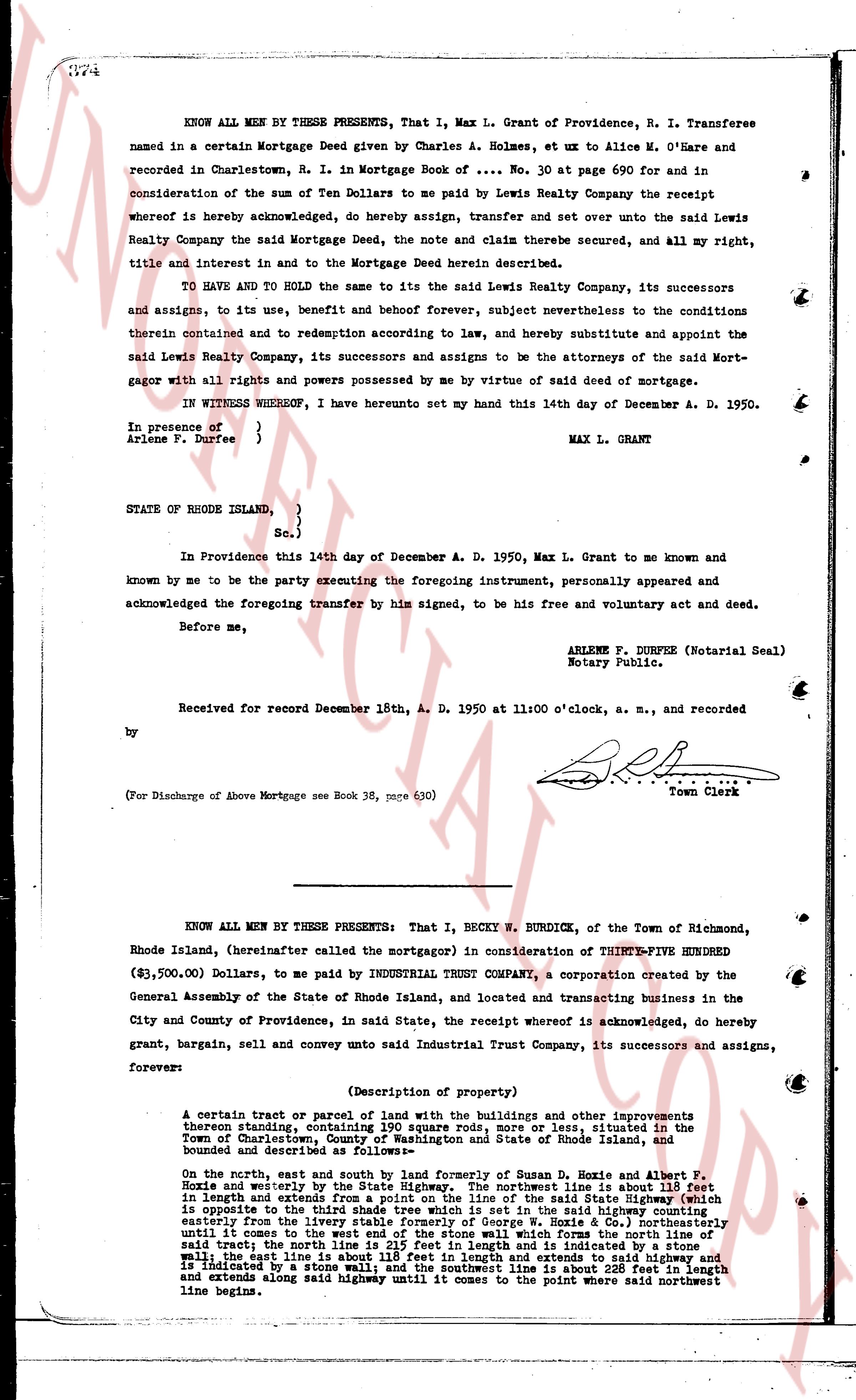
KNOW ALL MEN BY THESE PRESENTS, That I, Max L. Grant of Providence, R. I. Transferee named in a certain Charlestown Mortgage Deed given by Charles A. Holmes, ex ut uxor Alice M. O'Hare and in recorded in Charlestown, R. I. in Mortgage Book of .... No. 30 at page 690 for and in consideration of the sum of Ten Dollars to me paid by Lewis Realty Company the receipt whereof is hereby acknowledged, do hereby assign, transfer and set over unto the said Lewis Realty Company the said Mortgage Deed, the note and claim there secured, and all my right, title and interest in and to the Mortgage Deed herein described.
TO HAVE AND TO HOLD the same to the said Lewis Realty Company, its successors and assigns, to its use, benefit and behoof forever, subject nevertheless to the conditions therein contained and to redemption according to law, and hereby substitute and appoint the said Lewis Realty Company, its successors and assigns to be the attorneys of the said Mort- gagor with all rights and powers possessed by me by virtue of said deed of mortgage.
IN WITNESS WHEREOF, I have hereunto set my hand this 14th day of December A. D. 1950.
In presence of
Arlene P. Durfee } MAX L. GRANT
STATE OF RHODE ISLAND,
} Sc.
In Providence this 14th day of December A. D. 1950, Max L. Grant to me known and known by me to be the party executing the foregoing instrument, personally appeared and acknowledged the foregoing transfer by him signed, to be his free and voluntary act and deed.
Before me,
ARLENE P. DURFEE (Notarial Seal)
Notary Public.
Received for record December 18th, A. D. 1950 at 11:00 o'clock, a. m., and recorded
by [signature] Town Clerk
(For Discharge of Above Mortgage see Book 36, page 630)
----
KNOW ALL MEN BY THESE PRESENTS: That I, BECKY W. BURDICK, of the Town of Richmond, Rhode Island, (hereinafter called the mortgagor) in consideration of THIRTY-FIVE HUNDRED ($3,500.00) Dollars, to me paid by INDUSTRIAL TRUST COMPANY, a corporation created by the General Assembly of the State of Rhode Island, and located and transacting business in the City and County of Providence, in said State, the receipt whereof is acknowledged, do hereby grant, bargain, sell and convey unto said Industrial Trust Company, its successors and assigns, forever:
(Description of property)
A certain tract or parcel of land with the buildings and other improvements thereon standing, containing 190 square rods, more or less, situated in the Town of Charlestown, County of Washington and State of Rhode Island, and bounded and described as follows:
On the north, east and south by land formerly of Susan D. Hoxie and Robert F. Hoxie and westerly by the State Highway. The northeast line is about 118 feet in length and extends from the northeast corner of the said State Highway (which is opposite to the third shade tree which is set in the said Highway counting easterly from the bridge over the river) to a stone wall; then south [?] until it comes to the west end of the stone wall which forms the north line of said trust, the north line being about 115 feet and is indicated by a stone wall; the east line is about 118 feet in length and extends to said highway and is indicated by a stone wall; and the southwest line is about 228 feet in length and extends along said highway until it comes to the point where said northeast line begins.
The page as recorded