The instrument's own words
page 1 · read by Gemma vision
308
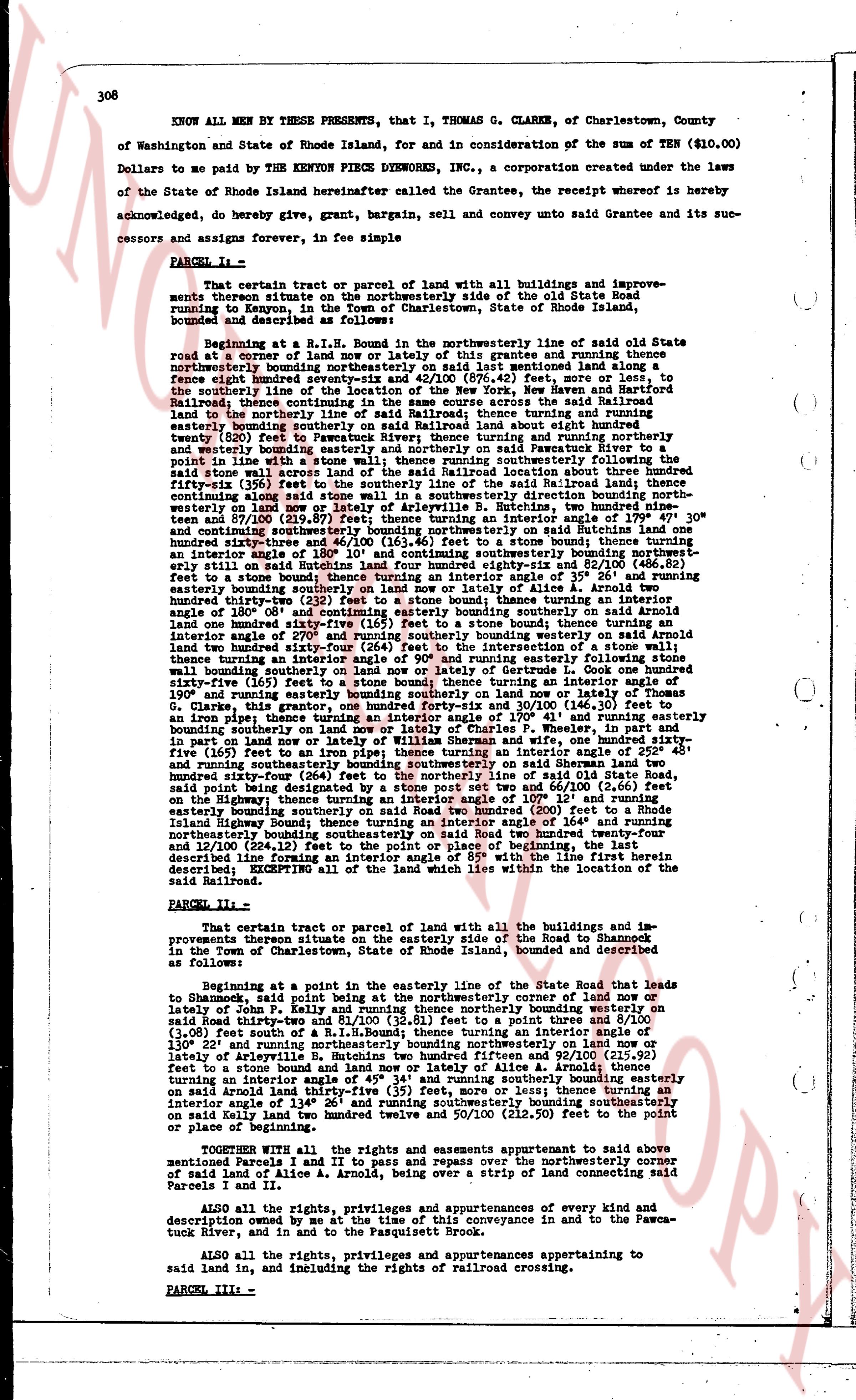
KNOW ALL MEN by THESE PRESENTS, that I, THOMAS G. CLARKE, of Charlestown, County of Washington and State of Rhode Island, for and in consideration of the sum of TEN ($10.00) Dollars to me paid by the KENYON PIECE DYEWORKS INC., a corporation created under the laws of the State of Rhode Island hereinafter called the Grantee, the receipt whereof is hereby acknowledged, do hereby give, grant, bargain, sell and convey unto said Grantee and its successors and assigns forever, in fee simple
PARCEL I--
That certain tract or parcel of land with all buildings and improvements thereon situate in the town of Charlestown, on the side of the old State road running to Kenyon, in the Town of Charlestown, State of Rhode Island, bounded and described as follows:
Beginning at R.L.H. Bounds in the northeasterly line of old state Road situate at corner of a turn of land or piece of land of grantees and running there from northeasterly bounding northeasterly on said last mentioned line along a fence eighty eight linear feet; then turning south 60 deg. 40 min. west 140 feet to the southerly line of the connection of the New York, New Haven and Hartford Steamship company and the New York New Haven and Hartford Rail road; thence running land to the northerly line of said Railroad; thence running and turning easterly bounding easterly southerly on said Railroad line about eight hundred twenty (820) feet to the point where said Railroad line turns and running northerly twenty (20) feet to the point where said Railroad line turns southeasterly followed the said stone wall across land of the said Railroad location three hundred fifty fifty five (355) feet to the point where said Railroad line turns southeasterly then turning south east 100 along said stone wall in a southeasterly direction bounding north westerly on land now or formerly of the said Railroad location three hundred fifty seven and 810/100 (357.81) feet; thence turning an interior angle of 179 deg. 47 min. 30 sec. and running southeasterly bounding southeasterly on said Railroad line three hundred sixty three and 4/100 (363.40) feet to a stone bound; thence turning an interior angle of 135 deg. 20 min. and running northeasterly bounding northeasterly on said Railroad line still on said Railroad line four hundred eighty six and 52/100 (486.52) feet to a stone bound; thence turning an interior angle of 135 deg. 20 min. and running easterly bounding easterly southerly on land now or lately of Alice A. Arnold three hundred thirty one and 10/100 (331.10) feet to a stone bound; thence turning an interior angle of 180 deg. 08 min. and continuing easterly bounding southerly on said Arnold land one hundred fifty feet to a stone bound; thence turning an interior angle of 270 deg. and running southerly bounding westerly on said Arnold land one hundred fifty feet to a stone bound; thence turning an interior angle of 180 deg. 09 min. and running easterly following stone wall bounding southerly on land now or lately of Gertrude L. Cook one hundred ninety three linear feet; thence turning an interior angle of 180 deg. 15 min. and running southeasterly one hundred ninety running easterly bounding southerly on land now or lately of Thomas G. Clarke, then running southeasterly 130 feet to a stone bound; thence turning on an iron pipe; thence turning a interior angle of 170 deg. 41 min. and running easterly bounding northeasterly on said state road one hundred fifty feet; thence turning and in part on land now or lately of William Sherman and wife, one hundred sixty five (165) feet to a stone bound; thence turning an interior angle of 180 deg. 07 min. and running southeasterly bounding southeasterly on said Sherman land two hundred fifty seven and 81/100 (257.81) feet to a stone bound of said state road, said point being designated as the spot post set two and 66/100 (2.66) feet on the easterly bounding easterly southerly on said Road two hundred (200) feet to a Rhode Island state highway; thence turning an interior angle of 180 deg. 51 min. and running southeasterly bounding northeasterly bounding southerly on said Road two hundred twenty four and 12/100 (224.12) feet to the point of beginning of the tract of land herein first described line forming an interior angle of 85 deg. with the line first herein described; EXCEPTING all of the land which lies within the location of the said Railroad.
PARCEL II--
That certain tract or parcel of land with all the buildings and improvements thereon situate on the easterly side of the Road to Shannock in the Town of Charlestown, State of Rhode Island, bounded and described as follows:
Beginning at a point in the northeasterly line of the State Road that leads to Shannock, said point being at the northeasterly corner of land now or lately of John P. Kelly and running thence northeasterly bounding westerly on said Road interior angle of 135 deg. 20 min. to a point then 92 and 8/100 (92.08) (3.06) feet south of a R.L.H. Bounds; thence turning an interior angle of 135 deg. 20 min. and running southeasterly bounding southeasterly on land now or lately of Annabelle B. Hutchins two hundred fifteen and 92/100 (215.92) feet to a stone bound; thence turning an interior angle of 180 deg. 08 min. and running southerly bounding easterly on said Arnold land one hundred fifty feet to a stone bound; thence turning an interior angle of 45 deg. 34 min. and running southerly bounding easterly on said Arnold land one hundred fifty feet to a stone bound; thence turning an interior angle of 134 deg. 26 min. and running southeasterly bounding southeasterly on said Kelly land two hundred thirty two and 50/100 (232.50) feet to the point of beginning.
TOGETHER WITH all the rights and easements appurtenant to said above mentioned Parcels I and II and to pass and repass over the northeasterly corner of said mentioned land of Alice A. Arnold a strip of land connecting said Parcels I and II.
ALSO all the right, privileges and appurtenances of every kind and description owned by me at the time of this conveyance in and to the Pawcatuck River, and in and to the Passequitt Brook.
ALSO all the rights, privileges and appurtenances appertaining to said land in, including the rights of railroad crossing.
PARCEL III--
page 2 · read by Gemma vision
Please provide the image of the document you would like me to transcribe. Once provided, I will follow your instructions exactly.
The page as recorded