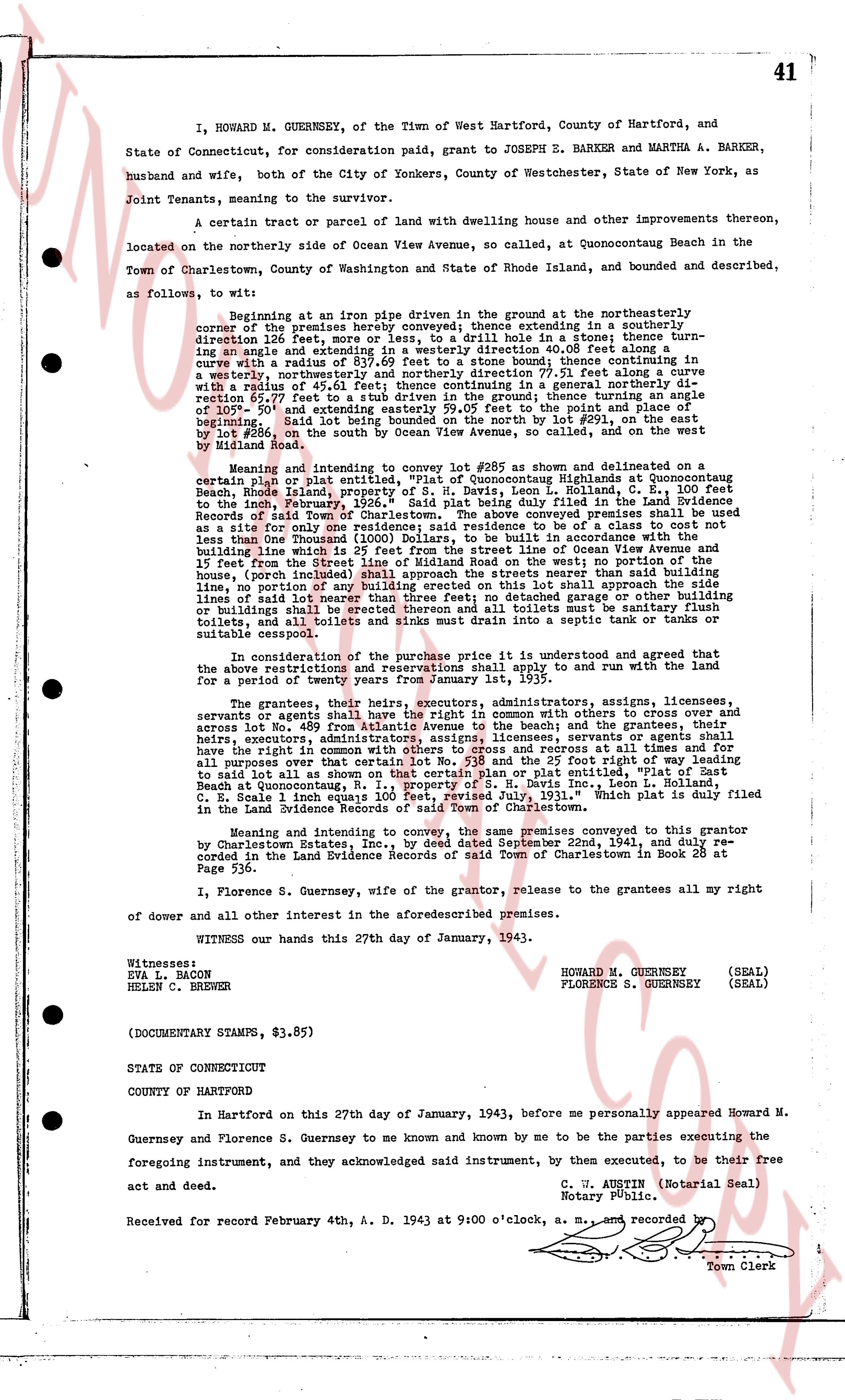
The instrument's own words
page 1 · read by Gemma vision
I, HOWARD M. GUERNSEY, of the Town of Hartford, County of Hartford, and
State of Connecticut, for consideration paid, grant to JOSEPH E. BARKER and MARTHA A. BARKER,
husband and wife, both city of Yonkers, County of Westchester, State of New York, as
Joint Tenants, meaning to the survivor.
A certain tract of parcel of land with dwelling house and other improvements thereon,
located on the northerly side of Ocean View Avenue, so called, at Quonutogaunch Beach in the
Town of Charlestown, County of Washington and State of Rhode Island, and bounded and described,
as follows, to wit:
beginning at an iron pipe driven in the ground at the northeasterly corner
of the premises hereby conveyed; thence extending in a southerly
direction 12.16 feet, more or less, to a stone bound; thence in a south
ering angle and extending in a southerly direction 40.08 feet along a stone bound; thence continuing in a south
erly direction 97.31 feet along a stone bound; thence continuing in a south
easterly direction with a radius of 83.79 feet crossing so far, and thence turning in a south
easterly direction with a radius of 45.61 feet; thence continuing in a general northerly direction extending 69.27 feet to a stone bound; thence extending in a general northerly direction to the point of beginning; said land being bounded on the east by lot 269, of the subdivision of lot 2057, and extending easterly 59.05 feet to the point and place of
beginning; said lot being bounded on the south by lot 269, of the subdivision of lot 2057, and
by lot #286, on the south by Ocean View Avenue, so called, and on the Len
by Meaning land
Meaning and intending to convey lot #285 as shown and delineated on a
certain plan or plat entitled, "Plat of Quonutogaunch Highlands at Quonutogaunch
Beach, Rhode Island, in the Town of Charlestown, Co. Washington, Scale 1" = 100 feet
to the inch, February, 1926." Said plat being duly filed in the Land Evidence
Records of said Town of Charlestown. The above conveyed property, thening the turning
of a site for one dwelling house and associated outbuildings, to be of a class not to cost
less than a sum for only 100,000 Dollars, to be built in accordance with the
building restrictions of said land meaning and intending that no building shall be erected
and 15 feet from the Street line of Milnroad on the West; no portion of the
house, (span included) shall be erected within 20 feet from the nearest boundary
line, no portion of any building erected on this lot shall approach the road
line of said land meaning and intending that no detached garage or other out
buildings shall be erected thereon and all toilets must be sanitary flush
toilets, and all toilets and sinks must drain into a septic tank or tanks or
suitable cesspool.
In consideration of a payment of $50.00, it is understood and agreed that the
above restrictions and reservations shall appertain to and run with the land
for a period of twenty years from January 1st, 1935.
The grantees, their heirs, executors, administrators, assigns, licensees,
servants or agents shall have a right of way in common with others to cross over and
across lot No. 489 from Atlantic Avenue to the beach and the grantees, their
heirs, executors, administrators, assigns, licensees, servants or agents shall
have the right to use and maintain a 20 foot wide road, recorded at page 478,
for all purposes over that certain lot No. 518 and the 25 foot right of way leading
to said lot as shown on the plan of "Quonutogaunch Highlands at Quonutogaunch
Beach at Quonutogaunch, R. I., property of S. H. Davis Inc., Leon L. Rollins,
and Stella L. Rollins, filed in the land evidence records of Charlestown, which plat is duly filed
in the Land Evidence Records of said Town of Charlestown.
Meaning and intending to convey, the same premises convey by a deed from grantor
by Charlestown Better, Inc., to Howard M. Guernsey, dated October 22nd, 1941, and duly re-
corded in the Land Evidence Records of said Town of Charlestown in Book 28 at page
Page 536.
I, Florence S. Guernsey, wife of the grantor, release to the grantees all my right
of dower and all other interest in the aforesaid premises.
WITNESS our hands this 27th day of January, 1943.
HOWARD M. GUERNSEY (SEAL)
FLORENCE S. GUERNSEY (SEAL)
EVA L. BACON
HELEN C. BREWER
(DOCUMENTARY STAMPS, $3.85)
STATE OF CONNECTICUT
COUNTY OF HARTFORD
In Hartford on this 27th day of January, 1943, before me personally appeared Howard M.
Guernsey and Florence S. Guernsey to me known and by me known to be the parties executing the
foregoing instrument, and by them executed, to the best of their free
act and deed.
C. W. AUSTIN (Notarial Seal)
Notary Public.
Received for record February 4th, A. D. 1943 at 9:00 o'clock, A. M. and recorded
Town Clerk
The page as recorded