The instrument's own words
page 1 · read by Gemma vision
468
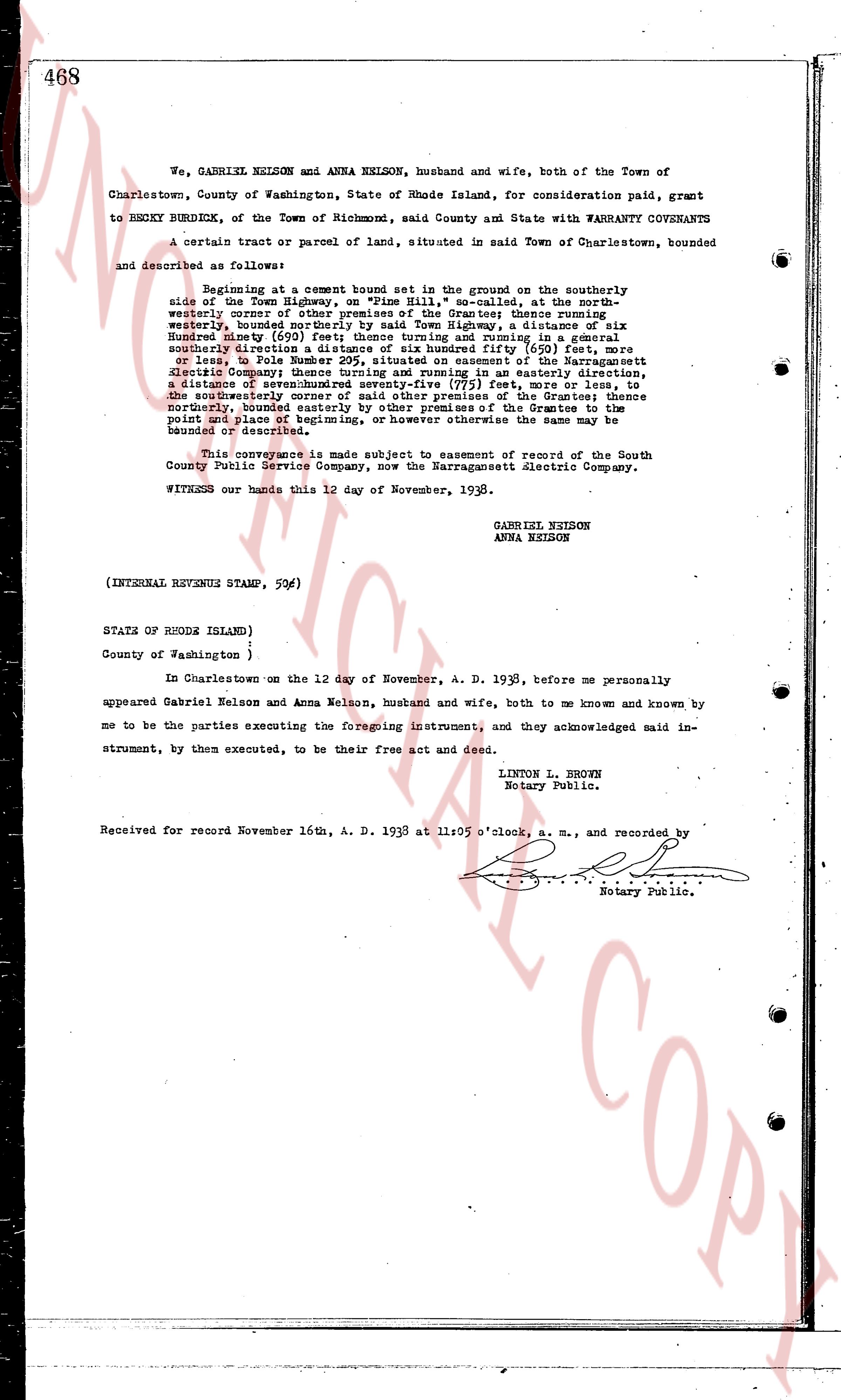
We, GABRIEL NELSON and ANNA NELSON, husband and wife, both of the Town of
Charlestown, County of Washington, State of Rhode Island, for consideration paid, grant
to BECKY BURDICK, of the Town of Richmond, said County and State with WARRANTY COVENANTS
A certain tract or parcel of land, situated in said Town of Charlestown, bounded
and described as follows:
Beginning at a cement bound set in the ground on the southerly
side of the Town Highway, on "Pine Hill," so called, at the north-
easterly corner of other premises of the Burdick family extending
westerly, bounded northerly by said Town Highway, a distance of six
Hundred ninety (690) feet; thence turning and running in a general
southwesterly direction a distance of six hundred fifty (650) feet, more
or less, to Pole Number 295, situated on easement of the Narragansett
Electric Company then running in an easterly direction,
a distance of sevenhundred seventy-five (775) feet, more or less, to
the southeasterly corner of other premises of the Grantee; thence
northerly, bounded easterly by other premises of the Grantee to the
point and place of beginning, or however otherwise the same may be
bounded or described.
This conveyance is made subject to easement of record of the South
County Public Service Company, now the Narragansett Electric Company.
WITNESS our hands this 12 day of November, 1938.
GABRIEL NELSON
ANNA NELSON
(INTERNAL REVENUE STAMP, 52¢)
STATE OF RHODE ISLAND )
)
County of Washington )
In Charlestown on the 12 day of November, A. D. 1938, before me personally
appeared Gabriel Nelson and Anna Nelson, husband and wife, both to me known and known by
me to be the parties executing the foregoing instrument, and they acknowledged said in-
strument, by them executed, to be their free act and deed.
LINTON L. BROWN
Notary Public.
Received for record November 16th, A. D. 1938 at 11:05 o'clock, a. m., and recorded by
[signature]
Notary Public.
The page as recorded