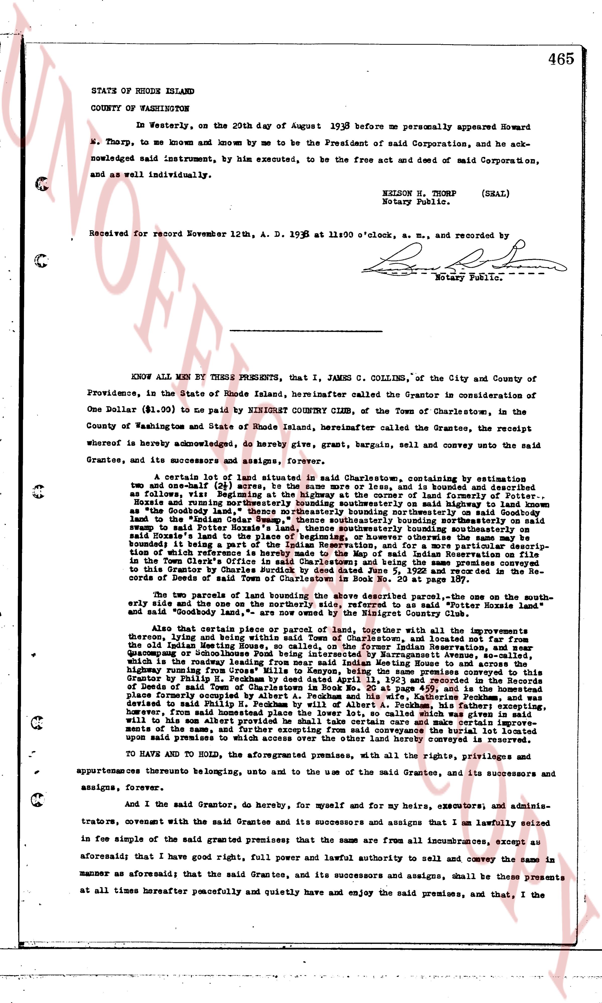
The instrument's own words
page 1 · read by Gemma vision
465
STATE OF RHODE ISLAND
COUNTY OF WASHINGTON
In Westerly, on the 20th day of August 1938 before me personally appeared Howard
W. Thorp, to me known and by me known to be the President of said Corporation, and he ack-
nowledged said instrument, by him executed, to be the free act and deed of said Corporation,
and as well individually.
NELSON H. THORP (SEAL)
Notary Public.
Received for record November 12th, A. D. 1938 at 11:00 o'clock, a. m., and recorded by
[Signature]
Notary Public.
----
KNOW ALL MEN BY THESE PRESENTS, that I, JAMES C. COLLINS, of the City and County of
Providence, in the State of Rhode Island, hereinafter called the Grantor in consideration of
One Dollar ($1.00) to pay me BY NINIGRET COUNTRY CLUB, of the Town of Charlestown, in the
County of Washington and State of Rhode Island, hereinafter called the Grantees, the receipt
whereof is hereby acknowledged, do hereby give, grant, bargain, sell and convey unto the said
Grantees, and its successors and assigns, forever,
A certain lot of land situated in said Charlestown, containing by estimation
two and one-half (2 1/2) acres, or more or less, and is bounded and described as
follows: Beginning at a stake at the intersection of the line of the road known as
Rozzie and running northeasterly bounding southeasterly on said highway to land known
as "the Coney Dell" thence northeasterly bounding northeasterly on said Goodbody
land to the "Indian Cedar" thence southeasterly bounding southeasterly on said
Goodbody land to the "Indian Cedar" on the line of the land which was conveyed
said to the Indian Potter's Home, land thence southeasterly bounding southeasterly on
said Potter's Home land to the "Stone Wall" thence northwestly bounding northwestly on
bounded it being a part of the Indian Reservation, and for a more particular description of
said land refer to the map of the Indian Reservation plotted by George L. Moore, Surveyor,
in the Town Clerk's Office in said Charlestown; and being the same premises conveyed
to this Grantor by Charles H. Moore by deed dated February 2, 1935 recorded in the Re-
cords of Deeds of said Town of Charlestown in Book No. 20 Page 407 at page 105
and said "Goodbody Land," are now owned by the Ninigret Country Club.
The two parcels of land bounding the above described parcel, the one on the south-
easterly side and the one on the north-westerly side as said land is now bounded.
Also that certain piece or parcel of land, together with all the improvements upon
thereon, lying and being in said town, bounded on the north by the land of the
old Indian Meeting House, also noted, on the Former Indian Reservation, and near
Sewing-machine Avenue, also noted, on the aforesaid Sewing-machine Avenue, so-called,
which is the roadway leading from near said Indian Meeting House to the highway
running from "Miles Mill" to "Miles Valley," being the same premises conveyed to this
Grantor by Philip H. Peckham by deed dated June 1, 1934 recorded in the Re-
cords of Deeds of said Town of Charlestown in Book No. 20 at page 450, and is the homestead
place formerly occupied by the Indian Chief, and the land which was conveyed as
devised to said Philip H. Peckham by will of Albert A. Peckham, his father; excepting,
however, from this conveyance, a right of way for the said Ninigret Country Club,
will to his son Albert provides that he shall take certain care and make certain improvements
on the land, and the said right of way shall be for the conveyance of water, and the said
upon said premises to which access over the other land hereby conveyed is reserved.
TO HAVE AND TO HOLD, the aforementioned premises, with all the rights, privileges and
appurtenances thereto belonging, unto and to the use of the said Grantees, and its successors and
assigns, forever.
And I the said Grantor, do, hereby, for myself and for my heirs, executors, and adminis-
trators, covenant with the said Grantee and its successors and assigns that I am lawfully seized
in fee simple of the said granted premises; that the same are from all incumbrances, except as
aforesaid; that I have good right, full power and lawful authority to sell and convey the same in
manner as aforesaid; that the said Grantee, and its successors and assigns, shall be these presents
at all times hereafter peaceably and quietly and have and enjoy the said premises, and that I, the
The page as recorded