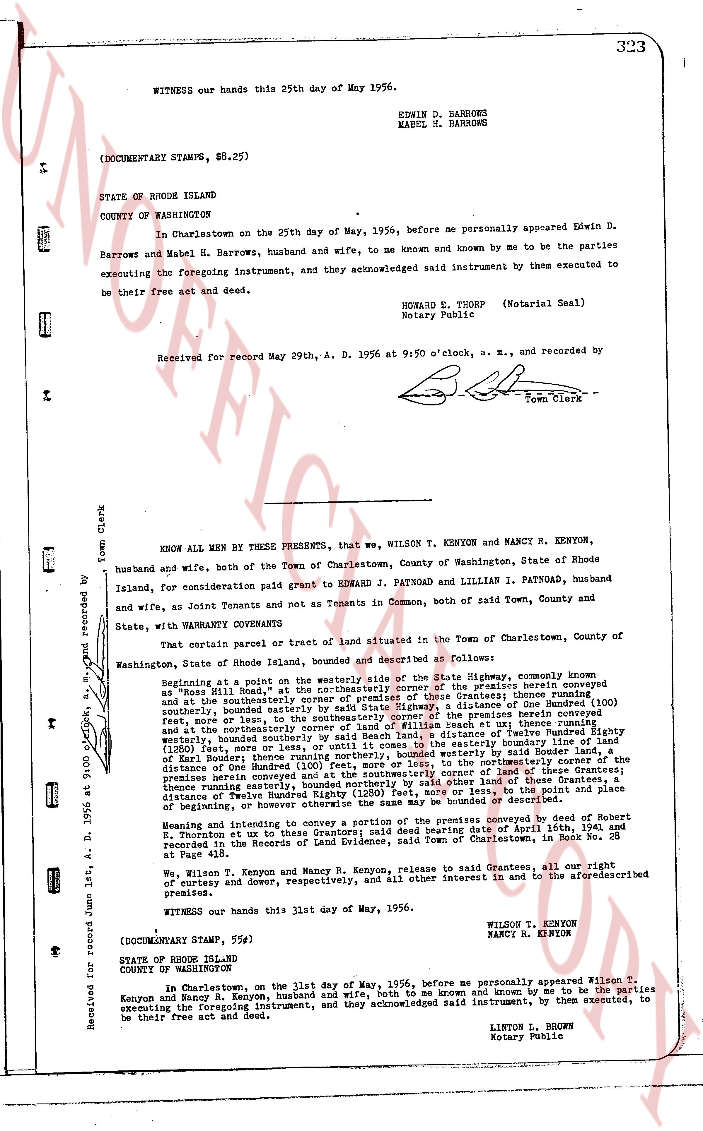
The instrument's own words
page 1
WITNESS our hands this 25th day of May 1956.
EDWIN D. BARROWS
MABEL N. BARROWS
(DOCUMENTARY STAMPS, $8.25)
STATE OF RHODE ISLAND
COUNTY OF WASHINGTON
In Charlestown on the 25th day of May, 1956, before me personally appeared Edwin D.
Barrows and Mabel H. Barrows, husband and wife, to me known and known by me to be the parties
executing the foregoing instrument, and they acknowledged said instrument by them executed to
be their free act and deed.
HOWARD E. THORP (Notarial Seal)
Notary Public
Received for record May 29th, A. D. 1956 at 9:50 o'clock, a. m., and recorded by
[Signature] Town Clerk
KNOW ALL MEN BY THESE PRESENTS, that we, WILSON T. KENYON and NANCY R. KENYON,
husband and wife, both of the Town of Charlestown, County of Washington, State of Rhode
Island, for consideration paid grant to EDWARD J. PATNOAD and LILLIAN I. PATNOAD, husband
and wife, as Joint Tenants and not as Tenants in Common, both of said Town, County and
State, with warranty CONVEYANCE
That certain parcel or tract of land situated in the Town of Charlestown, County of
Washington, State of Rhode Island, bounded and described as follows:
Beginning at a point in at the westerly side of the State Highway, commonly known
as "Moss Hill Road", at the northeasterly corner of the premises herein conveyed
as "Moss Hill Road", at the northeasterly corner of the Grantees; thence running
southerly, bounded easterly by said State Highway, a distance of One Hundred (100)
feet, more or less, or until it comes to the southeasterly corner of the Grantees;
thence running westerly, bounded southerly by the premises herein conveyed
feet, more or less, or until it comes to the southwesterly corner of the
and at the northeasterly corner of land William Et uch; thence running
westerly, bounded southerly by the premises herein conveyed, a distance of Eighty
(80) feet, more or less, or until it comes to the easterly boundary line of land
(1260) feet, more or less, or until it comes to the northeasterly corner of land
of Karl Bauer; thence easterly (100) feet, more or less, to the northeasterly corner of the
premises herein conveyed and at the southeasterly corner of land of Karl Bauer;
premises herein conveyed and at the southeasterly corner of land of Karl Bauer;
thence northerly, bounded easterly by said State Highway or by said other land of these Grantees, a
distance of Twelve Hundred Eighty (1280) feet, more or less, or until it comes to the northeast place
of Beginning; the above described premises being bounded or described as
[blank line]
and intending to convey a portion of the premises conveyed by deed of Robert
E. Thornton et al to use the Grantors hereby said deed bearing date of April 16th, 1941 and
recorded in the Records of Land Evidence, said Town of Charlestown, in Book No. 25
at Page 418.
We, Wilson T. Kenyon and Nancy R. Kenyon, release to said Grantees, all our right
of curtesy and dower, of curtesy respectively, and all other interest in and to the aforementioned
premises.
WITNESS our hands this 31st day of May, 1956.
WILSON T. KENYON
NANCY R. KENYON
(DOCUMENTARY STAMP, $5.00)
STATE OF RHODE ISLAND
COUNTY OF WASHINGTON
In Charlestown, on the 31st day of May, 1956, before me personally appeared Wilson T.
Kenyon and Nancy R. Kenyon, husband and wife, both to me known and known by me to be the parties
executing the foregoing instrument, and they acknowledged said instrument, by them executed, to
be their free act and deed.
LINTON L. BROWN
Notary Public
Received for record June 1st, A. D. 1956 at 9:00 o'clock, a. m., and recorded by
[Signature] Town Clerk
The page as recorded