The instrument's own words
page 1 · read by Gemma vision
508
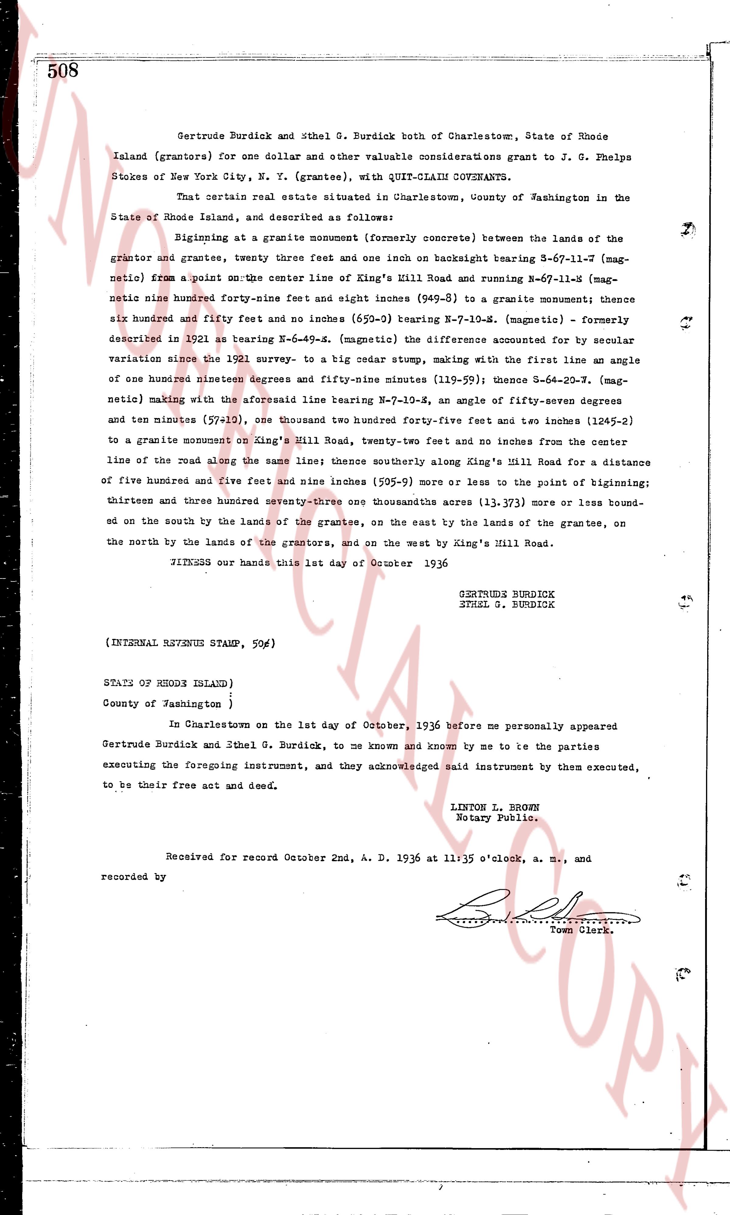
Gertrude Burdick and Ethel G. Burdick both of Charlestown, State of Rhode Island (grantors) for one dollar and other valuable considerations grant to J. G. Phelps Stokes of New York City, N. Y. (grantee), with QUIT-CLAIM COVENANTS.
That certain real estate situated in Charlestown, County of Washington in the State of Rhode Island, and described as follows:
Beginning at a granite monument (formerly concrete) between the lands of the grantor and grantee, twenty three feet and one inch on backside bearing S-67-11.7 [mag-netic] from a point on the center line of King's Hill Road running and N-67-11.7-S [mag-netic] nine hundred forty-four feet and one inch seven (944.07) to a granite monument thence six hundred and fifty forty feet and one inches (650.9) bearing N-67-10-S. [magnetic] - Formerly described in 1921 as bearing N-67-10-S [magnetic] (the difference accounted for by secular variation since the 1921 survey, to a big cedar stake, making with the first line an angle of one hundred nineteen degrees and fifty-nine minutes (119.59) thence S-64-20.7-S [mag-netic] making with the aforesaid line bearing N-67-10-S, an angle of fifty-seven degrees and ten minutes (57.10), one thousand two hundred forty five feet and two inches (1245.2) to a granite monument on King's Hill Road, twenty-two feet and ten inches from the center line of the road along the same line thence southerly along King's Hill Road for a distance of five hundred and five feet and nine inches (505.9) more or less to the point of beginning; thirteen and three hundred seventy-three one thousandths acres (13.373) more or less bound-ed on the south by the lands of the grantees, on the east by the lands of the grantee, on the north by the lands of the grantors, and on the west by King's Hill Road.
WITNESS our hands this 1st day of October 1936
GERTRUDE BURDICK
ETHEL G. BURDICK
(INTERNAL RHODE ISLAND STAMP, 50c)
STATE OF RHODE ISLAND )
County of Washington )
In Charlestown on the 1st day of October, 1936 before me personally appeared Gertrude Burdick and Ethel G. Burdick, to me known and known by me to be the parties executing the foregoing instrument, and they acknowledged said instrument by them executed, to be their free act and deed.
LINTON L. BROWN
Notary Public.
Received for record October 2nd, A. D. 1936 at 11:35 o'clock, a. m., and
recorded by [Signature]
Town Clerk.
The page as recorded