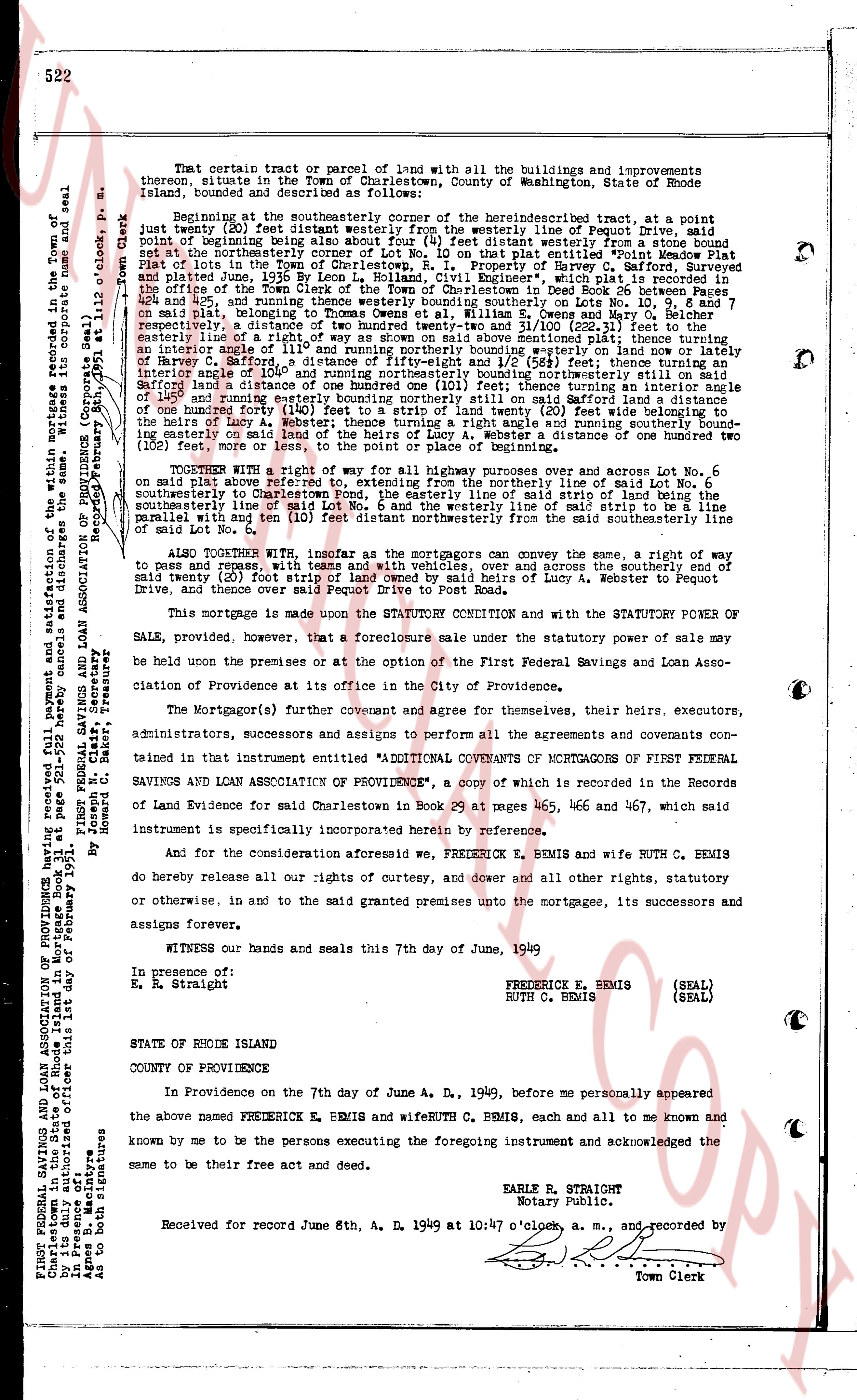
The instrument's own words
page 1 · read by Gemma vision
522
That certain tract or parcel of land with all the buildings and improvements
thereon, situate in the Town of Charlestown, County of Washington, State of Rhode
Island, bounded and described as follows:
Beginning at the southeasterly corner of the herein described tract, at a point
distant Twenty-two (22) feet easterly from the westerly line of Pequot Lane; said
point of beginning being distant four (4) feet southeasterly from a stone bound
set at the northeasterly corner of Lot No. 10 on that plat entitled "Point Meadow Plat"
recorded in the land evidence records of Charlestown, R.I. in Book 26, page 311,
and plated June 25th, 1936 by Leon L. Holland, Civil Engineer", which plat is recorded in
the land evidence records of Charlestown, R.I. in Deed Book 26, page 311, and refers to
Lots No. 9, 10 and 11, being the same land now known as Lots No. 424 and 425, and
thence running westerly twenty boundary southeasterly on and across Lot No. 6
southeasterly to Charlestown Road the point of intersection with the lines of Emma M.
and Mary G. McBee, respectively, a distance of two hundred twenty-three and 1/10 (223.10) feet,
entirely east line of a right-of-way as shown on said map above shown mentioned plus thence turning
an angle easterly and running southeasterly along the line of the right-of-way and the line of
Harvey C. Safford, a distance of fifty-eight and 1/2 (58.5) feet; thence turning an angle
southeasterly and running southeasterly along the line of the right-of-way and the line of
Safford until a distance of one hundred one (101) feet; thence turning an interior angle
on the southeasterly side of the right-of-way and running southeasterly along the line of
one hundred forty (140) feet to a strip of land twenty (20) feet wide belonging to the
said right-of-way and thence turning an angle easterly and running southerly bound
ing easterly on said land of the heirs of Lucia A. Webster, a distance of one hundred two
(102) feet, more or less, to the point of place of beginning.
TOGETHER WITH a right of way for all highway purposes over and across Lot No. 6
on said plat, from the westerly line of the right-of-way described above, along the line of said Lot No. 6
southeasterly to Charlestown Road the point, the easterly line of said lot being the
southeasterly line of the right-of-way and the westerly line of said lot being the line
parallel with and ten (10) feet distant northeasterly from the said southeasterly line of
the right-of-way.
ALSO TOGETHER WITH, insofar as the mortgagors can convey the same, a right of
way to and pass, and convey with them, and with vehicles, over and across the southerly end of
said Lot No. 6, from the said right-of-way to the easterly line of Lucia A. Webster to Pequot
Drive, and thence over said Pequot Drive to Post Road.
This mortgage is made upon the STATUTE CONDITION and with the STATUTORY POWER OF
SALE, provided, however, that a foreclosure sale under the statutory power of sale may
be held on the premises or at the option of the First Federal Savings and Loan Associa-
tion of Providence at its Office in the City of Providence.
The Mortgagors(s) further covenant and agree for themselves, their heirs, executors,
administrators, successors and assigns to perform all the agreements and covenants con-
tained in that instrumentation entitled "ADDITIONAL COVENANTS OF MORTGAGORS OF FIRST FEDERAL
SAVINGS AND LOAN ASSOCIATION OF PROVIDENCE", a copy of which is recorded in the Records
of Land Evidence for said Charlestown in Book 29 at pages 465, 466 and 467, which said
instrument is specifically incorporated herein by reference.
And for the consideration aforesaid we, FREDERICK E. BEMIS and wife RUTH C. BEMIS
do hereby release all our rights of curtesy, and dower and all other rights, statutory
or otherwise, in and to the said granted premises into the mortgagee, its successors and
assigns forever.
WITNESS our hands and seals this 7th day of June, 1949
In presence of:
E. E. Straight
FREDERICK E. BEMIS (SEAL)
RUTH C. BEMIS (SEAL)
STATE OF RHODE ISLAND
COUNTY OF PROVIDENCE
In Providence on the 7th day of June A. D. 1949, before me personally appeared
the above named FREDERICK E. BEMIS and wife RUTH C. BEMIS, each all and to me known and
known by me to be the persons executing the foregoing instrument and acknowledged the
same to be their free act and deed.
EARLE R. STRAIGHT
Notary Public.
Received for record June 8th, A. D. 1949 at 10:47 o'clock, a. m., and recorded by
[Signature]
Town Clerk
FIRST FEDERAL SAVINGS AND LOAN ASSOCIATION OF PROVIDENCE 311 Newport St.
Charlestown, Rhode Island
Filed February 8, 1951
Recorded February 8, 1951 at 11:02 o'clock, p. m.
By Janet Mc. Clary, Secretary
By Janet Mc. Clary, Secretary
As to both signatures
In presence of:
E. E. Straight
As to both signatures
Sworn to and subscribed before me, Notary Public in and for the State of Rhode Island in Mortgage Book 31 new page 522, February 8, 1951
by First Federal Savings and Loan Association of Providence by Janet Mc. Clary, Secretary and satisfaction of the within mortgage recorded in the Town of
Charlestown, Rhode Island in Land Evidence Book 29 page 465, filed 2/8/1951.
Recording February 8th, 1951
Town Clerk
The page as recorded