The instrument's own words
page 1 · read by Gemma vision
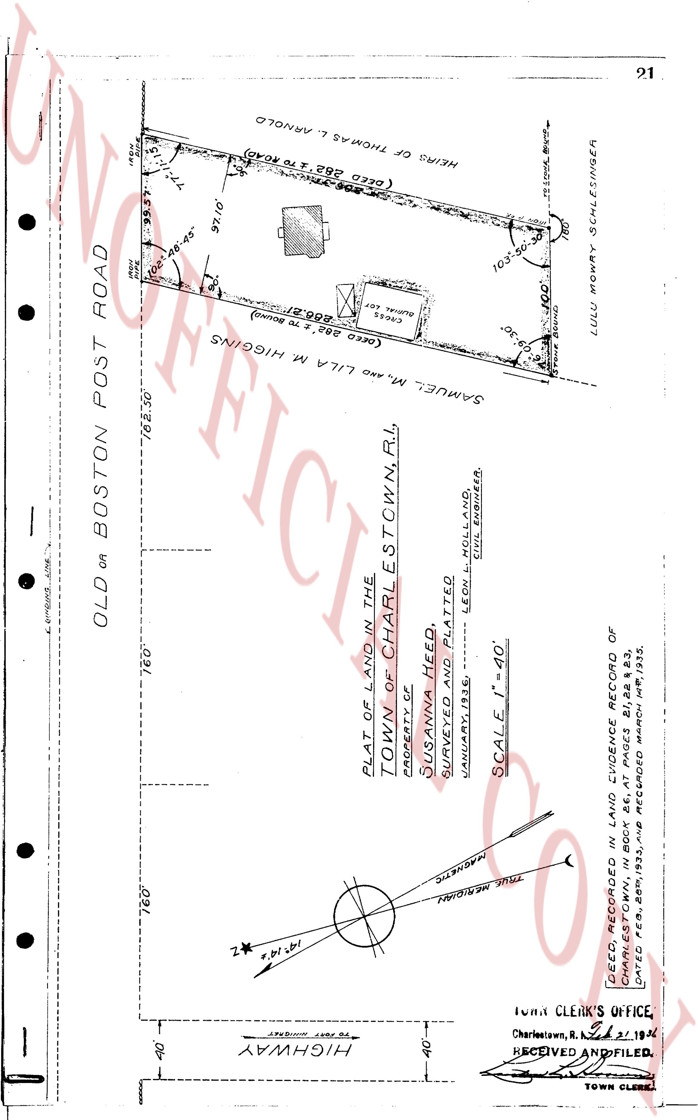
HIGHWAY
40'
----
PLAT OF LAND IN THE
TOWN OF CHARLESTOWN, R.I.
PROPERTY OF
SUSANNA HEED
SURVEYED AND PLATTED
JANUARY, 1936
LEON HOLLAND
CIVIL ENGINEER.
SCALE 1" = 40'
OLD OR BOSTON POST ROAD
160'
160'
182.30'
(DEED 282' TO Bound)
286.21'
(DEED 282's TO ROAD)
77.15'
98.57'
78.42"
97.10'
103.30'
100'
0.30'
SAMUEL M. AND MILA M. HIGGINS
HEIRS OF THOMAS L. ARNOLD
LULU MOLLY SCHLESINGER
TOWN CLERK'S OFFICE
Charlestown, R.I. Oct 21, 1936
RECEIVED AND FILED.
TOWN CLERK
DEED RECORDED AND EVIDENCE RECORD OF
CHARLESTOWN, Bk 26, p 11, dated Feb. 2, 1933
DATED FEB. 28th, 1933, AND RECORDED MARCH, 1933.
page 2 · read by Gemma vision
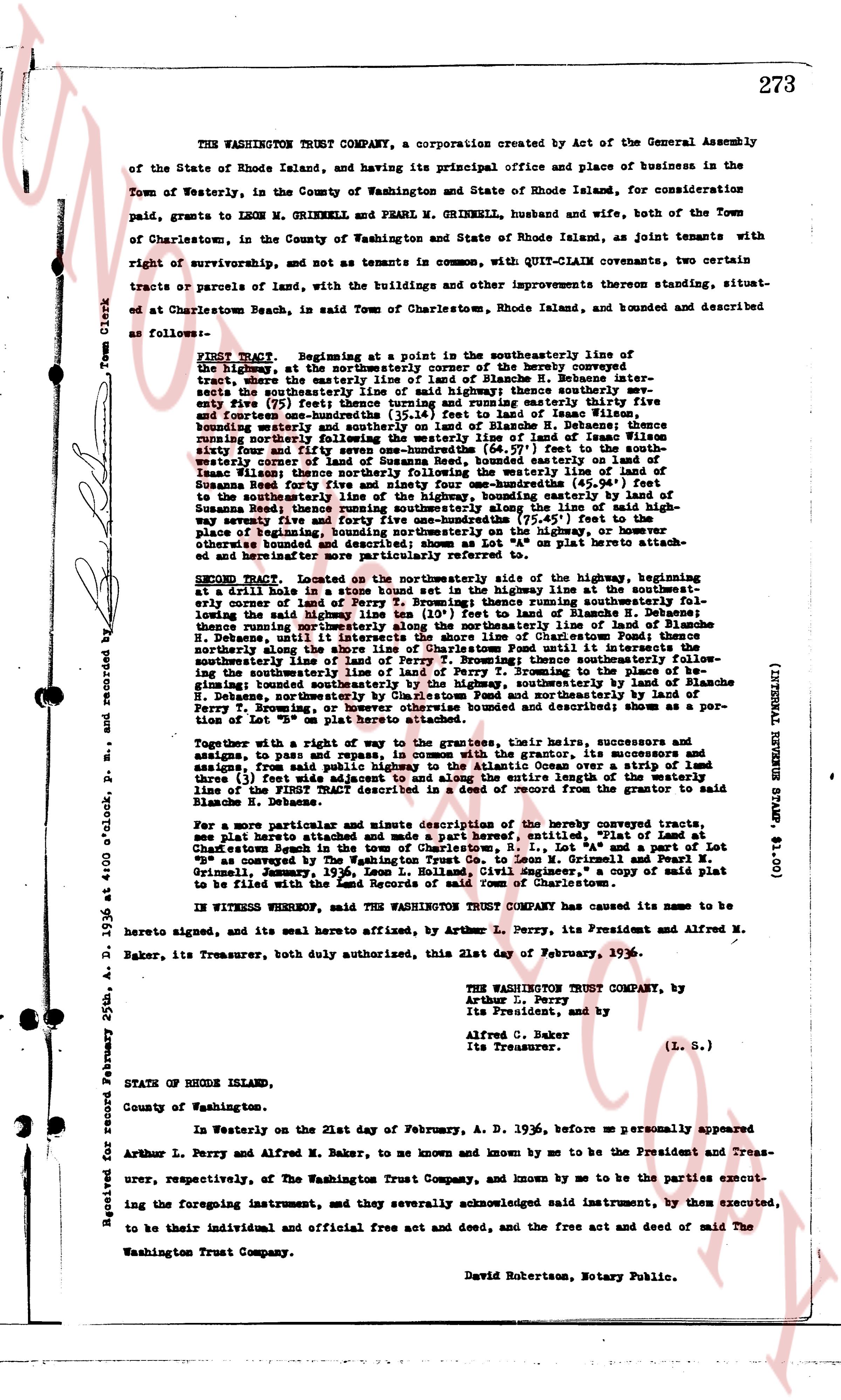
273
THE WASHINGTON TRUST COMPANY, a corporation created by Act of the General Assembly of the State of Rhode Island, and having its principal office and place of business in the Town of Westerly, in the County of Washington and State of Rhode Island, for consideration paid, grants to LEON M. GRIMNELL and PEARL M. GRIMNELL, husband and wife, both of the Town of Charlestown, in the County of Washington and State of Rhode Island, as joint tenants with right of survivorship, and not as tenants in common, with QUIT-CLAIM covenant, two certain tracts or parcels of land, with the buildings and other improvements thereon standing, situated at beach at Charlestown Beach, in said Town of Charlestown, Rhode Island, and bounded and described as follows:
FIRST TRACT, Beginning at a point in the southeasterly line of the highway, being the northeasterly corner of the hereby conveyed tract, then running south easterly 12 1/2 poles to Blanche H. Delano's tract south easterly the southeasterly line of said highway; thence southerly seven hundred ninety five (795) feet thence south easterly one hundred forty three (143) feet to land of Isaac Wilson, bounding easterly and southerly on said land of Blanche H. Delano; thence north westerly 12 1/2 poles to the north westerly line of said land of Isaac Wilson, bounding easterly forty four and seven one hundredths (44.07) feet to the south westerly corner of land of Isaac Wilson; thence north westerly one hundred forty three (143) feet to land of Isaac Wilson; thence north westerly bounding the easterly line of land of Susan Sweeny one hundred seventy one and one hundredths (171.01) feet to the south westerly line of the highway, bounding easterly land of Susan Sweeny eighty seven feet and five hundred forty one hundredths (87.54) feet to the place of beginning; containing 1.43 acres more or less; and being a part of the above described and bounded premises; shown as Lot "4A" on plat hereunto attached of one hundred forty three feet fronting the highway.
SECOND TRACT, located on the northerly side of the highway, beginning at a drill hole in a stone bound stone set boundary in the highway at the south westerly corner of the hereby conveyed tract, then running easterly bounding south easterly the leading line highway 13 1/2 poles to Lot "4" land of Blanche H. Delano; thence along the leading line highway southeasterly line of Charlestown Pond; thence northerly along the shore line of Charlestown Pond until it intersects the north easterly line of Lot "4" land of Blanche H. Delano; thence north westerly following the southeasterly line of land of Perry T. Browning to the place of beginning; bounding south easterly by the highway and by Lot "4" land of Blanche H. Delano, northerly by Charlestown Pond and north easterly by land of Perry T. Browning; containing 0.43 acres more or less; and being a portion of Lot "8" shown on plat hereunto attached.
Together with and right of way to the grantees, their heirs, successors and assigns, to pass and repass over, under and upon, the grantor's premises and successors, from said public highway to the Atlantic Ocean over a strip of land three (3) feet wide, as shown on plat hereunto attached, and running parallel to the easterly line of the FIRST TRACT described in a deed of record from the grantor to said Blanche H. Delano.
For a more particular and minute description of the hereby conveyed tracts; see plat hereunto attached and made a part hereof, entitled, "Plat of Land at Charlestown Beach in the Town of Charlestown, State of Rhode Island, Lot 4A and Lot 8 Charlestown Beach, granted by The Washington Trust Co. to Leon M. Grimnell and Pearl M. Grimnell, January, 1936, Leon L. Rolland, Civil Engineer," a copy of said plat to be filed with the Land Evidence Records of Charlestown.
IN WITNESS WHEREOF, said THE WASHINGTON TRUST COMPANY has caused its name to be here to signed, and its seal here to affixed, by Arthur L. Perry, its President and Alfred M. Baker, its Treasurer, both duly authorized, this 21st day of February, 1936.
THE WASHINGTON TRUST COMPANY, by
Arthur L. Perry
Its President, and by
Alfred C. Baker
Its Treasurer.
(L. S.)
STATE OF RHODE ISLAND,
County of Washington.
In Westerly on the 21st day of February, A. D. 1936, before me personally appeared Arthur L. Perry and Alfred M. Baker, to me known and known by me to be the President and Treasurer, respectively, of The Washington Trust Company, and known by me to be the parties executing the foregoing instrument, and they severally acknowledged said instrument, by them executed, to be their individual and official and free act and deed, and free and clear act and deed of said The Washington Trust Company.
David Robertson, Notary Public.
(INSTRUMENTAL STAMP $1.00)
Received for record February 25th, A. D. 1936 at 4:00 o'clock, P. M. and recorded by
Town Clerk
page 3 · read by Gemma vision
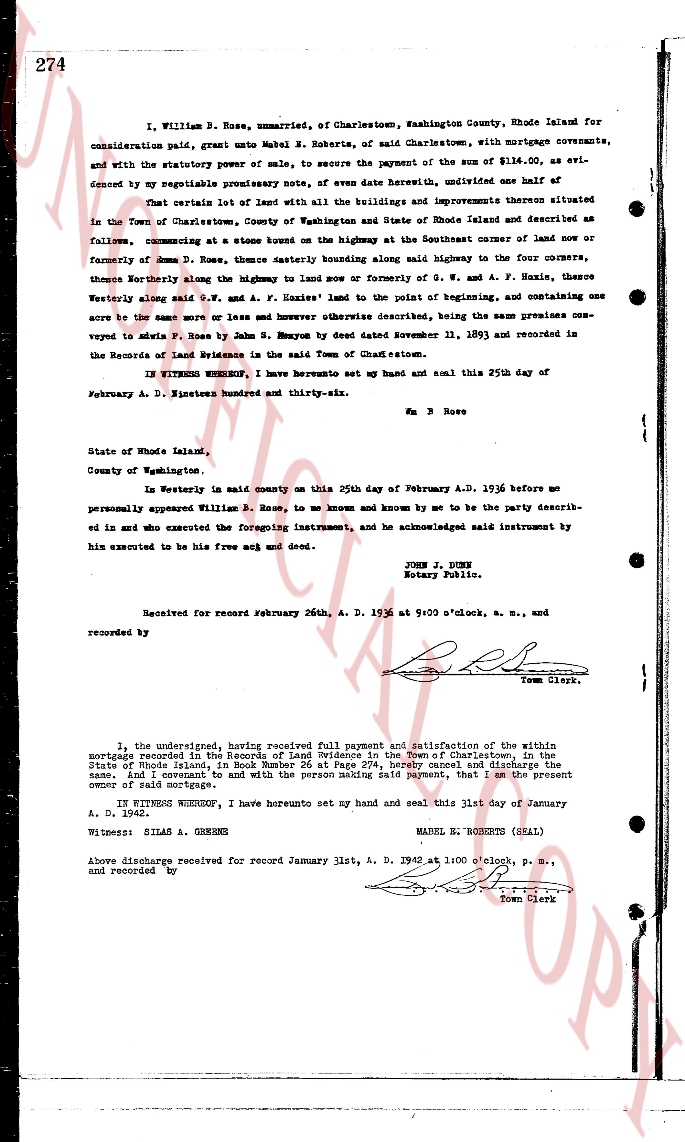
274
I, William B. Rose, unmarried, of Charlestown, Washington County, Rhode Island for consideration paid, grant unto Mabel E. Roberts, of said Charlestown, with mortgage covenants, and with the statutory power of sale, to secure the payment of the sum of $114.00, as evidenced by my negotiable promissory note, of even date herewith, undivided one half of
That certain lot of land with all the buildings and improvements thereon situated in the Town of Charlestown, County of Washington and State of Rhode Island and described as follows, commencing at a stone bound on the highway at the Southeast corner of land now or formerly of Rose D. Rose, thence easterly bounding along said highway to the four corners, thence northeasterly along the highway to land now or formerly of G. W. and A. F. Hoxie, thence westerly along said G. W. and A. F. Hoxies' land to the point of beginning, and containing one acre the same or more and however otherwise described, being the same premises conveyed to Davis P. Rose by John S. Kenyon by deed dated November 11, 1893 and recorded in the Records of Land Evidence in the said Town of Charlestown.
IN WITNESS WHEREOF, I have hereunto set my hand and seal this 25th day of February A. D. Nineteen hundred and thirty-six.
Wm B Rose
State of Rhode Island,
County of Washington,
In Westerly in said county on this 25th day of February A.D. 1936 before me personally appeared William B. Rose, to me known and known by me to be the party described in and who executed the foregoing instrument, and he acknowledged said instrument by him executed to be his free act and deed.
JOHN J. JONES
Notary Public.
Received for record February 26th, A. D. 1936 at 9:00 o'clock, a. m., and recorded by
[Signature]
Town Clerk.
----
I, the undersigned, having received full payment and satisfaction of the within mortgage recorded in the Records of Land Evidence in the Town of Charlestown, in the State of Rhode Island, in Book Number 26 at Page 274, hereby cancel and discharge the same, and I covenant to and with the person making said payment, that I am the present owner of said mortgage.
IN WITNESS WHEREOF, I have hereunto set my hand and seal this 31st day of January A. D. 1942.
Witness: SILAS A. GREENS MABEL E. ROBERTS (SEAL)
Above discharge received for record January 31st, A. D. 1942 at 1:00 o'clock, p. m., and recorded by
[Signature]
Town Clerk
The page as recorded