The instrument's own words
page 1 · read by Gemma vision
474
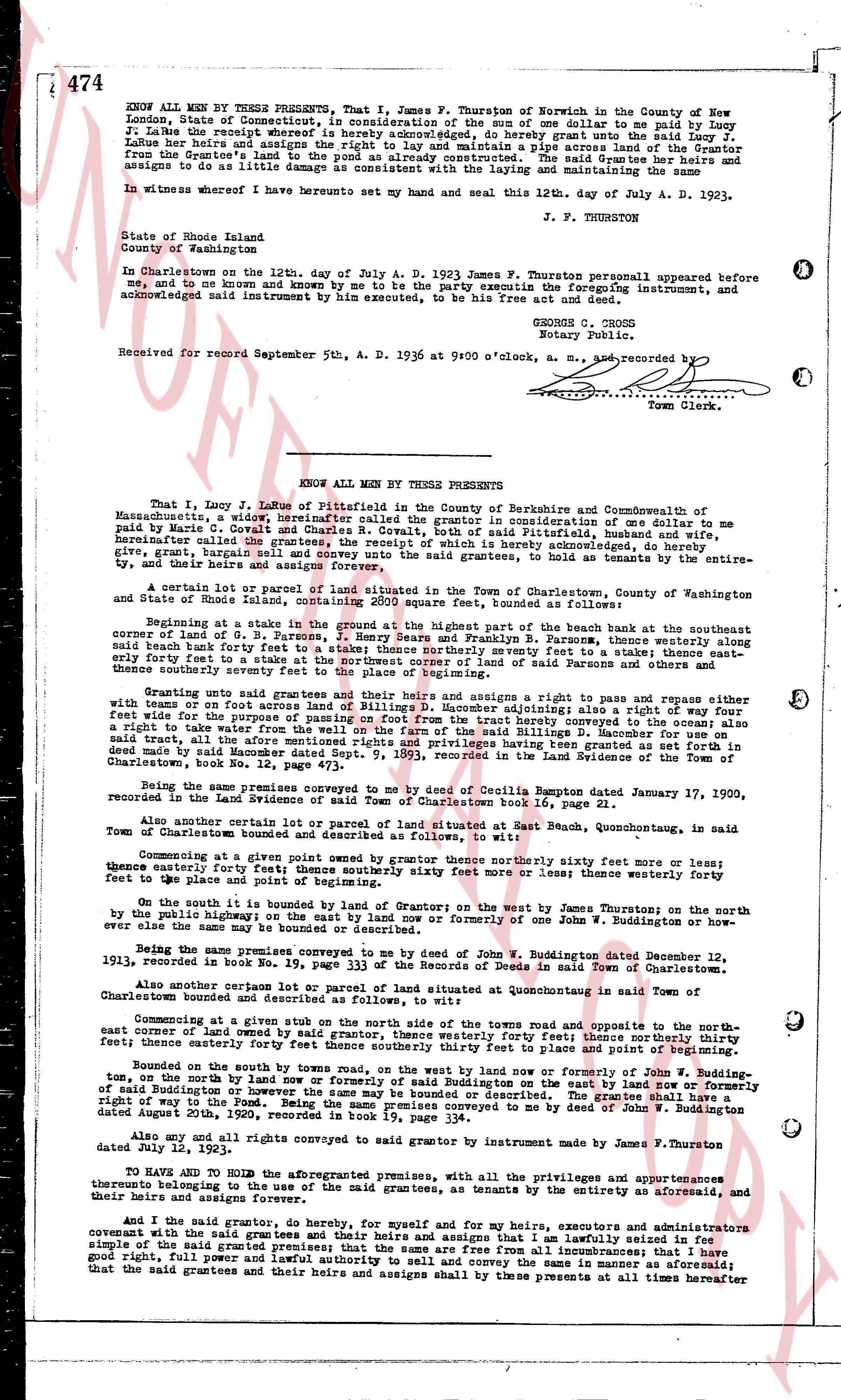
KNOW ALL MEN by THESE PRESENTS, that I, James F. Thurston of Norwich in the County of New London, State of Connecticut, consideration of the sum of one dollar to me paid by Lucy J. LaRue the receipt whereof is hereby acknowledged, do hereby grant and convey to Lucy J. LaRue her heirs and assigns the right and way to lay and maintain a pipe across the land of the Grantor from the Grantee's land to a point where a culvert is already constructed. The said Grantee her heirs and assigns to do as little damage as convenient with the laying and maintaining of the same
In witness whereof I have hereunto set my hand and seal this 12th day of July A. D. 1933.
J. F. THURSTON
State of Rhode Island
County of Washington
In Charlestown on the 12th day of July A. D. 1933 James F. Thurston personally appeared before me any, and said known and known by me to be the party executing the foregoing instrument, and acknowledged said instrument by him executed, to be his free act and deed.
GEORGE C. CROSS
Notary Public.
Received for record September 5th, A. D. 1936 at 9:00 o'clock, a. m. and recorded by [?]
Town Clerk.
KNOW ALL MEN by THESE PRESENTS
That I, Lucy J. LaRue of Pittsfield in the County of Berkshire and Commonwealth of Massachusetts, being of age, present myself called the grantor for consideration of one dollar to me paid by Marie C. Covell and Charles Covell both of said Pittsfield, Mass., hereinafter called the grantees, the receipt of which is hereby acknowledged, do hereby give, grant and relinquish all my right, title and interest in the said grantees, to hold the same as tenants by the entire, and their heirs and assigns forever
A certain lot or parcel of land situated in the Town of Charlestown, County of Washington and state of Rhode Island, containing 2092 square feet, bounded as follows:
Beginning at a stake in the ground at the highest part of the beach bank near the southeasterly corner of land of G. B. Furness, then running thence northwesterly ten feet to a fence, thence westerly along said fence forty feet to a stake; thence northerly westerly ten feet to a stake; thence easterly forty one feet to a stake; thence southerly westerly ten feet to the place of beginning.
Granting unto said grantees and their heirs and assigns a right and way ten feet wide either with or without foot access across the land of the grantor adjoining; also a right of way four feet wide for the purpose of passing into and out of the tract from the highway across the recovery; also a right of way four feet wide for the purpose of passing into and out of the tract from the highway across the land of G. B. Furness; the said tract, all the aforesaid mentions rights and privileges having been granted as set forth in deed from James F. Thurston to Lucy J. LaRue, dated July 5, 1933, recorded in the Land Evidence of the Town of Charlestown, book No. 12, page 473.
Being the same premises conveyed to me by deed of Cecilia Rumpton dated January 17, 1920, recorded in Land Evidence of Town of Charlestown book 16, page 21.
Also another certain lot or parcel of land situated in said East Beach, Quonsetochug, in said Town of Charlestown bounded and described as follows:
Commencing at a given point owned by grantor thence northerly sixty feet more or less; thence easterly forty feet thence southerly sixty feet more or less; thence westerly forty feet to the place and point of beginning.
On the south is bounded by land of Grantor on the west by James Thurston on the north by the public highway on the east by land now or formerly one of the Town of Buddington or however one or others may now or hereafter own the same
Being the same premises conveyed to me by deed of John W. Buddington dated December 12, 1923, recorded in book No. 19, page 333 of the Records of Deeds in said Town of Charlestown.
Also another certain lot or parcel of land situated at Quonsetochug in said Town of Charlestown bounded and described as follows:
Commencing at a given stake in the ground at the southeasterly corner of the town roads and opposite to the northeast corner of land owned by said grantor, thence westerly thirty four feet; thence northerly thirty four feet; thence easterly thirty four feet; thence southerly thirty three feet to place and point of beginning.
Bounded on the north by beach, on the west by land now or formerly of John W. Buddington, on the north by land now or formerly the state of Rhode Island, on the east by the said highway or however the same may be owned or occupied. The grantees shall have right of way to the place and point of beginning, premises conveyed to me by deed of John W. Buddington dated August 20th, 1920, recorded in book 19, page 334.
Also any and all rights and privileges conveyed to said grantor by instrument made by James F. Thurston dated July 5, 1933.
TO HAVE AND TO HOLD the aforesaid premises, with all the privileges and appurtenances thereunto belonging to the use of the said grantees, as tenants by the entire aforesaid, and their heirs and assigns forever.
And I the said grantor, do hereby, for myself and for my heirs, executors and administrators covenant with the said grantees and their heirs and assigns that I am lawfully seized in fee simple of and in the said granted premises; that the same are free from all incumbrances; that I have good right, full power and lawful authority to convey the same in the manner aforesaid; and that the said grantees and their heirs and assigns shall by these presents at all times hereafter
The page as recorded