The instrument's own words
page 1 · read by Gemma vision
421
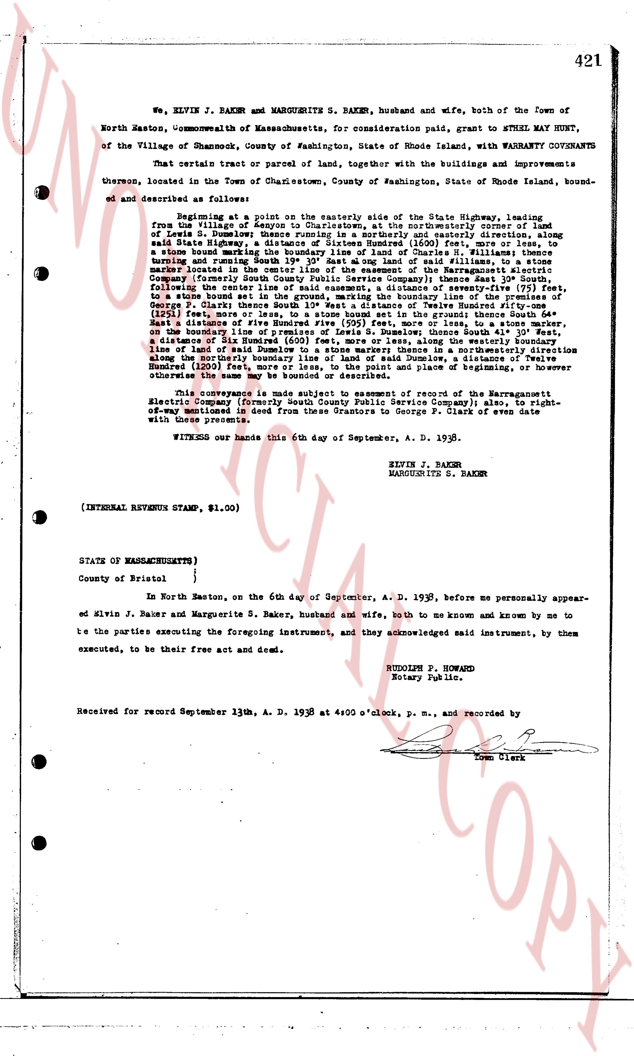
We, ELVIN J. BAKER and MARGUERITE S. BAKER, husband and wife, both of the Town of
North Easton, Commonwealth of Massachusetts, for consideration paid, grant to ETHEL MAY HUNT,
of the Village of Charlestown, County of Washington, State of Rhode Island, with WARRANTY COVENANTS
That certain tract or parcel of land, together with the buildings and improvements
thereon, located in the Town of Charlestown, County of Washington, State of Rhode Island, bound-
ed and described as follows:
Beginning at a point on the easterly side of the State Highway, leading
from the Village of Kenyon to Charlestown, at the northeasterly corner of lot
number 51, Dumpling Brook plat, Charlestown, Rhode Island, and running thence along
said State Highway, a distance of Sixteen Hundred (1600) feet, more or less, to
a stone house bearing east 1/2 North 45 degrees West of North Church St. and then
turning and running South East 19 35/100 East along said land of the New England
Electric Company (formerly South County Public Service Company) thence East 30 50/100,
following the center line of a street, a distance of seventy-five (75) feet,
to a stone house built in the year 1745, and thence running South East 15 30/100,
George P. Clark thence South East 10 50/100 a distance of Twelve Hundred fifty-
one (1251) feet more or less to a stone marker on the boundary line of the land of
East a distance of Five Hundred five (505) feet, more or less, to a stone marker on
the boundary line of the land of George P. Clark, and thence running South West 15 30/100,
a distance of Six Hundred (600) feet, more or less, following a stone marker on
line of said Dumpling Brook plat, and thence running South West 19 35/100, a distance
along the northerly boundary line of said land of Dumpling Brook, a distance of Twelve
Hundred (1200) feet, more or less, to the point of beginning, or place of beginning, or however
otherwise the same may be bounded or described.
This conveyance is made subject to easements in favor of the Narragansett
Electric Company (formerly South County Public Service Company) also, to right-
of-way mentioned in deed from said Grantors to George P. Clark of even date
with these presents.
WITNESS our hands this 6th day of September, A. D. 1938.
ELVIN J. BAKER
MARGUERITE S. BAKER
(INTERNAL REVENUE STAMP, $1.00)
STATE OF MASSACHUSETTS)
County of Bristol }
In North Easton, on the 6th day of September, A. D. 1938, before me personally appear-
ed Elvin J. Baker and Marguerite S. Baker, husband and wife, both to me known and known by me to
be the parties executing the foregoing instrument, and they acknowledged said instrument, by them
executed, to be their free act and deed.
RUDOLPH P. HOWARD
Notary Public.
Received for record September 13th, A. D. 1938 at 4:00 o'clock, p. m., and recorded by
[Signature]
Town Clerk
The page as recorded