The instrument's own words
page 1 · read by Gemma vision
32
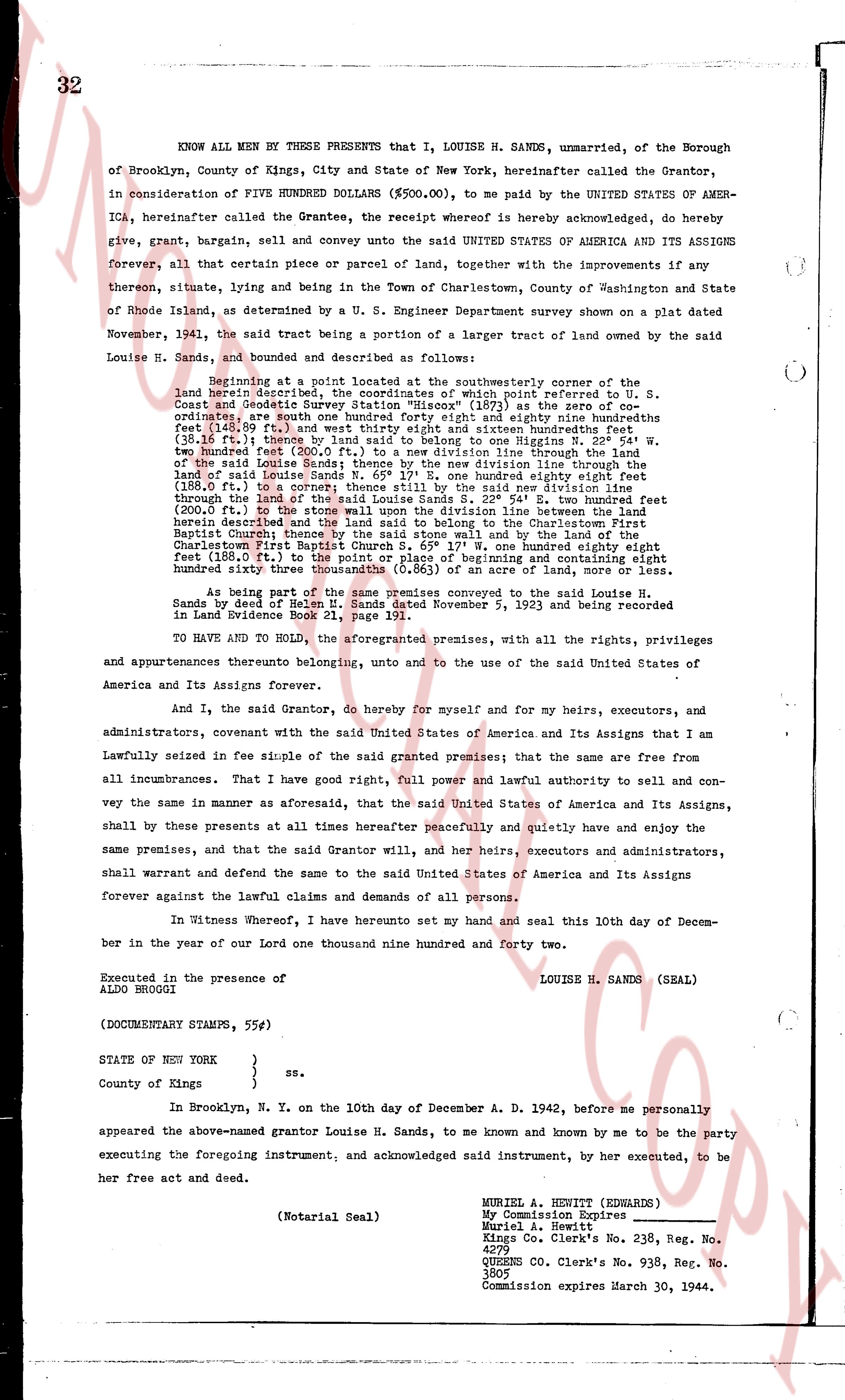
KNOW ALL MEN BY THESE PRESENTS that I, LOUISE H. SANDS, unmarried, of the Borough of Brooklyn, County of Kings, City and State of New York, hereinafter called the Grantor, in consideration of FIVE HUNDRED DOLLARS ($500.00), to me paid by the UNITED STATES OF AMERICA, hereinafter the Grantee, the receipt whereof is hereby acknowledged, do hereby convey, give, grant, bargain, sell and convey unto the said UNITED STATES OF AMERICA and ITS ASSIGNS forever, all that certain piece or parcel of land or lot, together with the improvements if any thereon, situate, lying and being in the Town of Charlestown, County of Washington and State of Rhode Island, as determined by a U. S. Engineer Department survey shown on a plat dated November, 1941, the said tract being a portion of a larger tract of land owned by the said Louise H. Sands, bounded and described as follows:
beginning at a point located at the southeasterly corner of the land herein described, the coordinates of which point referred to U. S. Coast and Geodetic Survey Station "Disco" (107.0) as true north are: 41 degrees 28 minutes south 84 degrees 41 minutes east and eighty nine hundredths linear feet (148.89 ft.) and west thirty eight degrees and sixteen hundredths linear feet (38.16 ft.) thence by a line running parallel to the coastline N 22 degrees 51' W two hundred feet (200.0 ft.) to the end of a new division line through the land of the said Louise H. Sands N 65 degrees 17' E one hundred eighty eight feet (188.0 ft.) to the end of a second new division line through the land of the said Louise H. Sands N 65 degrees 17' E one hundred eighty eight feet (188.0 ft.) to the end of a third new division line through the land of the said Louise H. Sands S 22 degrees 51' W two hundred feet (200.0 ft.) to the end of a fourth new division line through the land of the said Louise H. Sands S 22 degrees 54' E two hundred feet (200.0 ft.) to the end of the new division line between the boundary of the land herein described and the land sold to the Charlestown First Baptist Church by a deed of the said Louise H. Sands to the trustees of the Charlestown First Baptist Church S 65 degrees 17' W one hundred eighty eight feet (188.0 ft.) to the end of the new division line and by the line of the said Charlestown First Baptist Church S 65 degrees 17' W one hundred eighty eight feet (188.0 ft.) to the point of beginning and containing eight hundred sixty three thousandths (0.863) of an acre of land, more or less.
As being part of the same premises conveyed to the said Louise H. Sands by deed of Helen H. Sands dated November 5, 1923 and being recorded in Land Evidence Book 21, page 111.
TO HAVE AND TO HOLD, the aforementioned premises, with all the rights, privileges and appurtenances thereto belonging, unto and to the use of the said United States of America and Its Assigns forever.
And I, the said Grantor, do hereby for myself and for my heirs, executors, and administrators, covenant with the said United States of America and Its Assigns that I am lawfully seized in fee simple of the said granted premises; that the same are free from all incumbrances. That I have good right, full power and lawful authority to sell and convey the same in as manner as aforesaid, that the said United States of America and Its Assigns shall by these presents at all times hereafter peaceably and quietly have and enjoy the same premises, and that the said Grantor will, her heirs, executors and administrators, shall warrant and defend the same to the said United States of America and Its Assigns forever against all the lawful claims and demands of all persons.
In Witness Whereof, I have hereunto set my hand and seal this 10th day of December in the year of our lord one thousand nine hundred and forty two.
LOUISE H. SANDS (SEAL)
Executed in the presence of
ALDO BROGOLI
(DOCUMENTARY STAMPS, 55¢)
STATE OF NEW YORK }
} ss.
County of Kings }
In Brooklyn, N. Y. on the 10th day of December A. D. 1942, before me personally appeared the above-named grantor Louise H. Sands, to me known and by me to be the party executing the foregoing instrument, and acknowledged said instrument, by her executed, to be her free act and deed.
(Notarial Seal)
MURIEL A. HEWITT (EDWARDS)
My Commission Expires
March 30, 1944
Kings Co. Clerk's No. 238, Reg. No. 4299
QUEENS Co. Clerk's No. 938, Reg. No. 3805
Commission expires March 30, 1944.
page 2 · read by Gemma vision
35
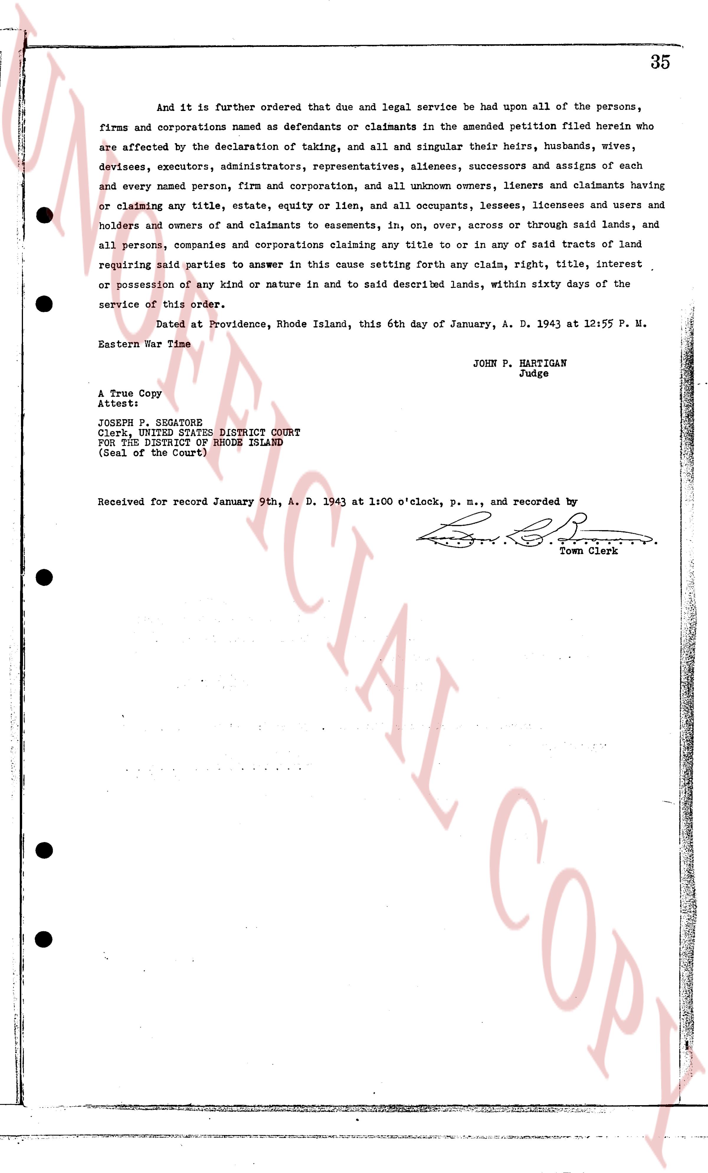
And it is further ordered that due and legal service be had upon all of the persons, firms and corporations named as defendants or claimants in the amended petition filed herein who are affected by the declaration of taking, and all and singular their heirs, husbands, wives, devisees, executors, administrators, representatives, alinees, successors and assigns of each and every named person, firm and corporation, and all unknown owners, lieners and claimants having or claiming any title, estate, equity or lien, and all occupants, lessees, licensees and users and holders and owners of and claimants to easements, in, on, over, across or through said lands, and all persons, companies and corporations claiming any title to or in or of any said tracts of land requiring said parties to answer in this cause setting forth any claim, right, title, interest or possession of any kind or nature in and to said described lands, within sixty days of the service of this order.
Dated at Providence, Rhode Island, this 6th day of January, A. D. 1943 at 12:55 P. M. Eastern War Time
JOHN P. HARTIGAN
Judge
A True Copy
Attest:
JOSEPH P. SEGNORE
Clerk, UNITED STATES DISTRICT COURT
FOR THE DISTRICT OF RHODE ISLAND
(Seal of the Court)
Received for record January 9th, A. D. 1943 at 1:00 o'clock, p. m., and recorded by [Signature]
Town Clerk
The page as recorded