The instrument's own words
page 1 · read by Gemma vision
467
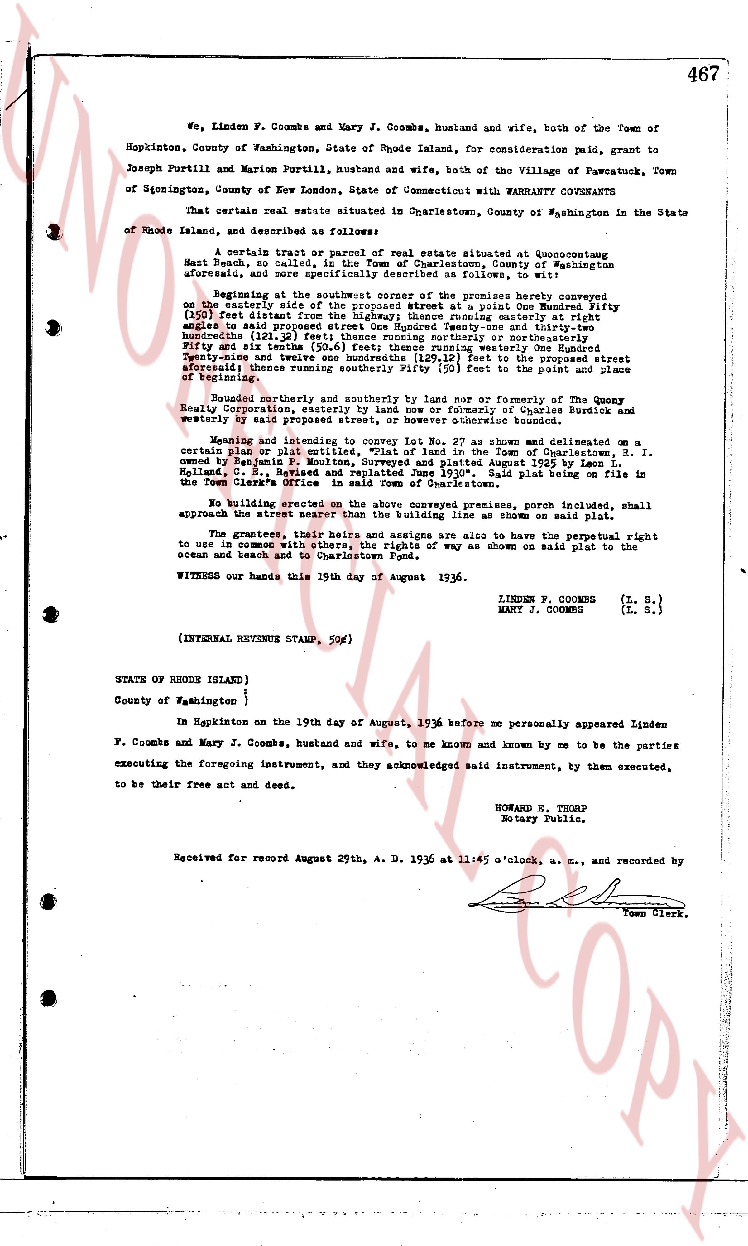
We, Linden F. Coombs and Mary J. Coombs, husband and wife, both of the Town of Hopkinton, County of Washington, State of Rhode Island, for consideration paid, grant to Joseph Purtill and Marion Purtill, husband and wife, both of the Village of Pawcotuck, Town of Glocester, County of New London, State of Connecticut with WARRANTY COVENANTS
That certain real estate situated in Charlestown, County of Washington in the State of Rhode Island, and described as follows:
A certain tract or parcel of real estate situated at Quonocutset East Beach or called "The Beach", Hopkinton, County of Washington aforesaid, and more specifically described as follows, to wit:
Beginning at the southeastermost corner of the premises hereby conveyed on the easterly side of the prospect street at a point One Hundred Ninety Feet (190 feet) distant from the north easterly corner of said street parallel with the lines angles to said prospect street One Hundred Twenty-three and thirty-two hundredths feet, thence running southeasterly a certain distance of Fifty and six tenths (50.6 feet) feet thence running westerly one Hundred Seventy-two hundred twenty-one and twelve hundredths (172.21 feet) feet to the prospect street aforesaid; thence running northwesterly (50 feet) feet to the line of beginning.
Bounded northerly and southerly by land now or formerly of The Quony Realty Corporation, easterly by land now or formerly of Charles Burdick and westerly by said prospect street, or however otherwise bounded.
Meaning and intending to convey Lot No. 27 as shown and delineated on a certain plan or plat entitled "Plan of Lands in the Town of Charlestown, R. I. owned by Benjamin F. Mouton, Surveyed and plotted August 1925 by Leon L. Holland, C. E. Registered Land Surveyor." Said plat being on file in the Town Clerk's Office in said Town of Charlestown.
No building erected on the above conveyed premises, porch included, shall approach the street nearer than the building line as shown on said plat.
The grantees, their heirs, successors and assigns are also to have the perpetual right to use in common with others, the right of way as shown on said plat to the ocean and beach and to Charlestown Pond.
WITNESS our hands this 19th day of August 1936.
LINDEN F. COOMBS (L. S.)
MARY J. COOMBS (L. S.)
(INTERNAL REVENUE STAMP, 50¢)
STATE OF RHODE ISLAND }
County of Washington }
In Hopkinton on the 19th day of August, 1936 before me personally appeared Linden F. Coombs and Mary J. Coombs, husband and wife, to me known and known by me to be the parties executing the foregoing instrument, and they acknowledged said instrument, by them executed, to be their free act and deed.
HOWARD E. THORP
Notary Public.
Received for Record August 29th, A. D. 1936 at 11:45 o'clock, a. m., and recorded by
[Signature]
Town Clerk.
The page as recorded