The instrument's own words
page 1 · read by Gemma vision
415
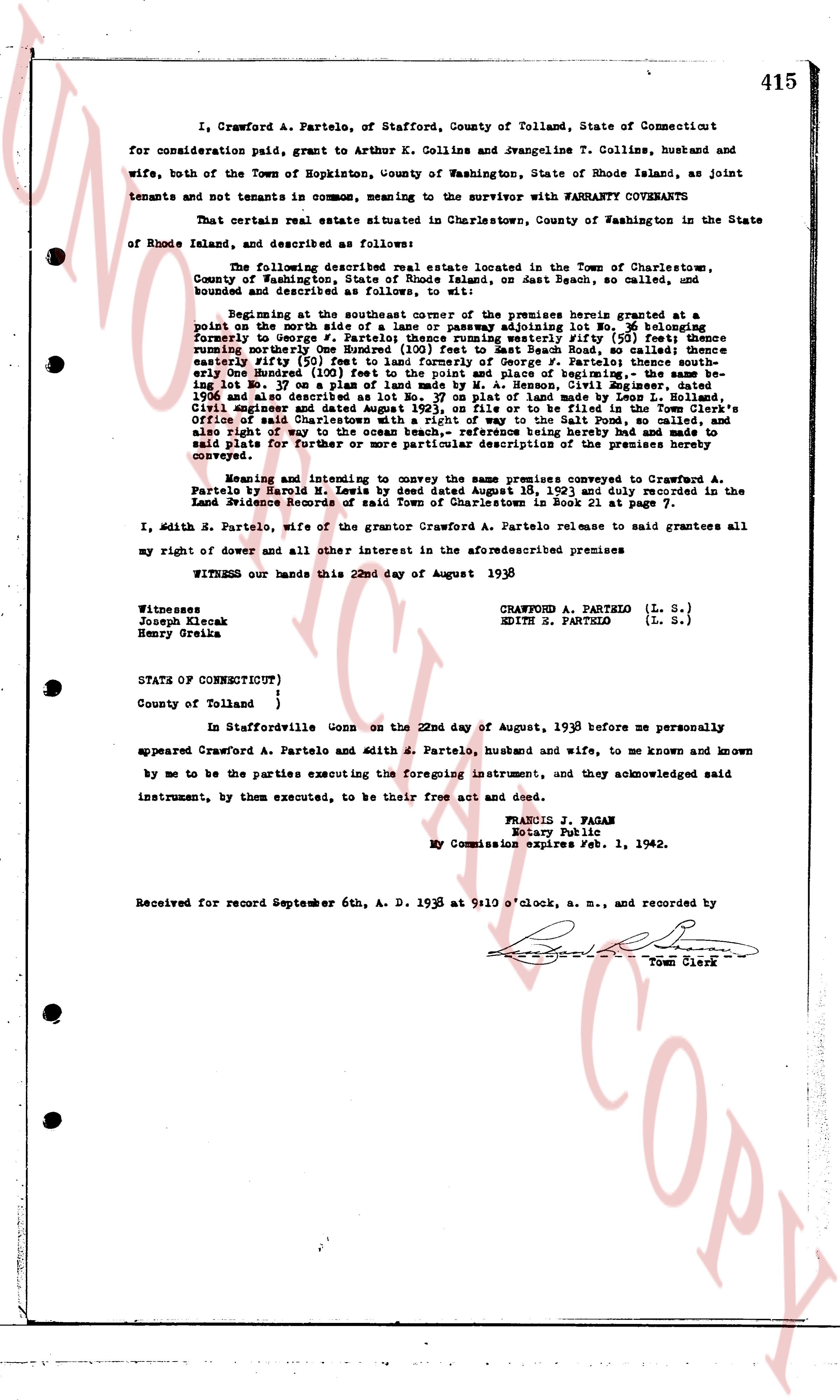
I, Crawford A. Partelo, of Stafford, County of Tolland, State of Connecticut for consideration paid, grant to Arthur K. Collins and Evangeline T. Collins, husband and wife, both of the Town of Hopkinton, County of Washington, State of Rhode Island, as joint tenants and not tenants in common, meaning to the survivor with WARRANTY COVENANTS
That certain real estate situated in Charlestown, County of Washington in the State of Rhode Island, and described as follows:
The following described real estate located in the Town of Charlestown, County of Washington, State of Rhode Island, on Beach Road, so called, and bounded and described as follows, to wit:
Beginning at the southeasterly corner of the premises herein granted at a point on the north side of the road of a lane or passageway leading lot No. 20 belonging formerly to George A. Partelo; thence running westerly 111 1/2 feet to the fence running southerly between said premises and those of land marked Beach Road, so called thence running northerly 55 feet (193) to land formerly of George A. Partelo; thence southeasterly fifty (50) feet to land of Fernando G. Joyce; thence easterly 111 1/2 feet to the point of beginning; the above description being based upon a survey of land being lot No. 17 on a plan of lands made by M. A. Henson, Civil Engineer, dated 1936 and last described in a deed of sale of land made by M. A. Henson, Civil Engineer and dated August 27, 1936, on file or to be filed in the Town Clerk's Office of said Charlestown, Rhode Island, in the Salt Pond Beach subdivision, and also right of way to the ocean beach,- reference being hereby made to and made subject to said plat for further or more particular description of the premises hereby conveyed.
Meaning and intending to convey the same premises conveyed to Crawford A. Partelo by Bertil H. Zinke by deed dated September 1, 1935 and duly recorded in the Land Evidence Records of said Town of Charlestown in Book 25 Page 417.
I, Edith E. Partelo, wife of the grantor Crawford A. Partelo release to said grantees all my right of dower and all other interest in the aforementioned premises
WITNESS our hands this 22nd day of August 1938
Crawford A. Partelo (L. S.)
Edith E. Partelo (L. S.)
Witnesses
Joseph Klecak
Henry Greika
STATE OF CONNECTICUT)
County of Tolland }
}
In Staffordville Conn on the 22nd day of August, 1938 before me personally appeared Crawford A. Partelo and Edith E. Partelo, husband and wife, to me known and known by me to be the parties executing the foregoing instrument, and they acknowledged said instrument, by them executed, to be their free act and deed.
FRANCIS J. FAGAN
Notary Public
My Commission expires Feb 1, 1942.
Received for record September 6th, A. D. 1938 at 9:10 o'clock, a. m., and recorded by
[Signature]
Town Clerk
The page as recorded