The instrument's own words
page 1 · read by Gemma vision
1
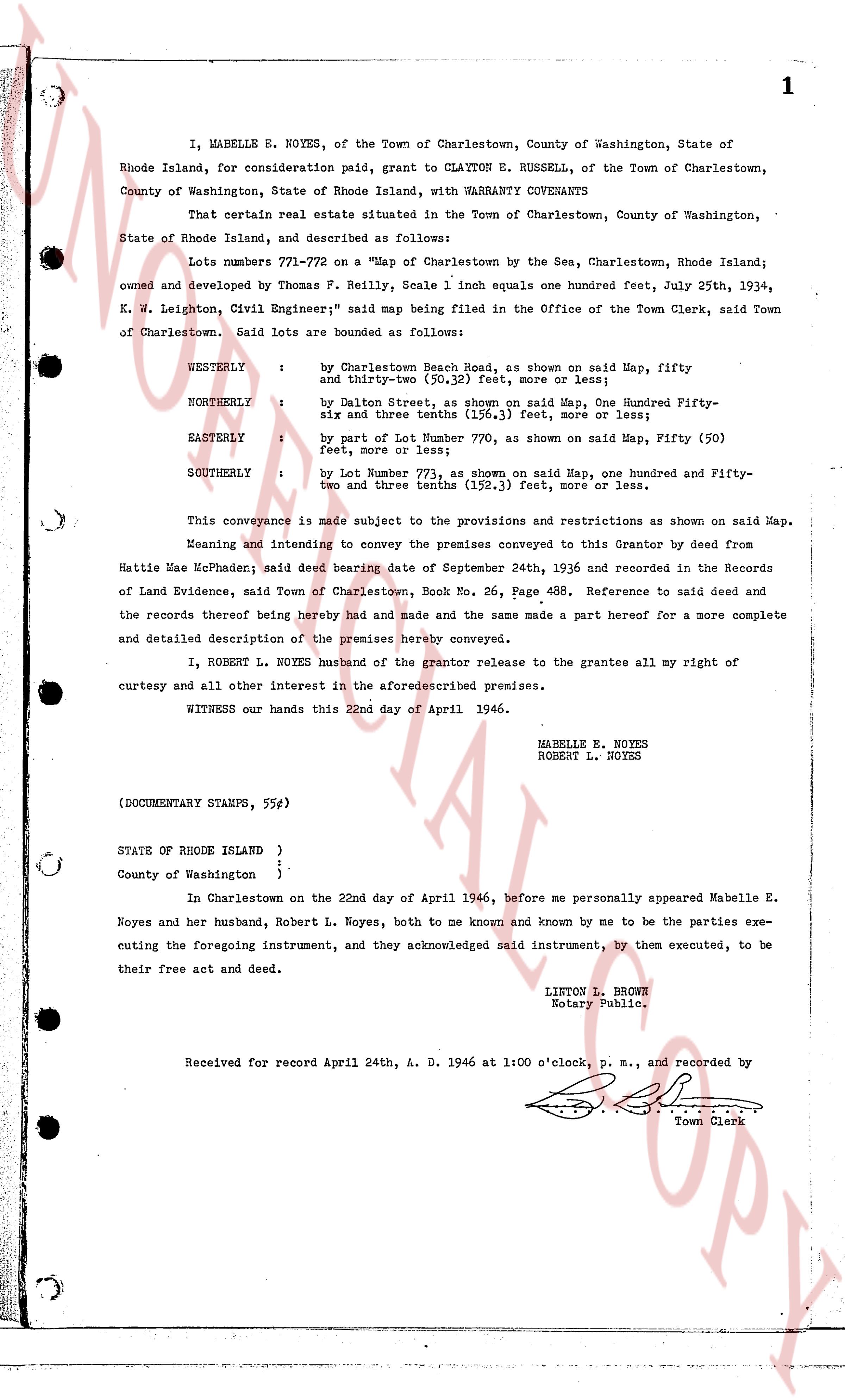
I, WABELLE E. NOYES, of the Town of Charlestown, County of Washington, State of Rhode Island, for consideration paid, grant to CLAYTON E. RUSSELL, of the Town of Charlestown, County of Washington, State of Rhode Island, with WARRANTY COVENANTS
That certain real estate situated in the Town of Charlestown, County of Washington, State of Rhode Island, and described as follows:
Lots number 771-772 on a "Map of Charlestown by the Sea, Charlestown, Rhode Island; owned and developed by Thomas F. Reilly, Scale 1 inch equals one hundred feet, July 25th, 1934, K. W. Leighton, Civil Engineer", said map being filed in the Office of the Town Clerk, said Town of Charlestown. Said lots are bounded as follows:
WESTERLY : by Charlestown Beach Road, as shown on said Map, fifty and thirty-two 100s (50.32) feet, more or less;
NORTHERLY : by Dalen Street, as shown on said Map, One hundred Fifty-six and three tenths (156.3) feet, more or less;
EASTERLY : by part of Lot Number 770, as shown on said Map, Fifty (50) feet, more or less;
SOUTHERLY : by Lot Number 773, as shown on said Map, one hundred and Fifty-two and three tenths (152.3) feet, more or less.
This conveyance is made subject to the provisions and restrictions as shown on said Map. Meaning and intending to convey the premises conveyed to this Grantor by deed from Hattie Mae McPhaden; said Town of Charlestown, Book No. 26, Page 488. Reference to said deed and the records thereof being hereby had and made and the same made a part hereof for a more complete and detailed description of the premises hereby conveyed.
I, ROBERT L. NOYES husband of the grantor release to the grantee all my right of curtesy and all other interest in the aforesaiddescribed premises.
WITNESS our hands this 22nd day of April 1946.
WABELLE E. NOYES
ROBERT L. NOYES
(DOCUMENTARY STAMPS, 55¢)
STATE OF RHODE ISLAND }
}
County of Washington }
In Charlestown on the 22nd day of April 1946, before me personally appeared Wabelle E. Noyes and her husband, Robert L. Noyes, both to me known and known by me to be the parties executing the foregoing instrument, and they acknowledged said instrument, by them executed, to be their free act and deed.
LINTON L. BROWN
Notary Public.
Received for record April 24th, A. D. 1946 at 1:00 o'clock, p. m., and recorded by
[Signature]
Town Clerk
The page as recorded