The instrument's own words
page 1 · read by Gemma vision
367
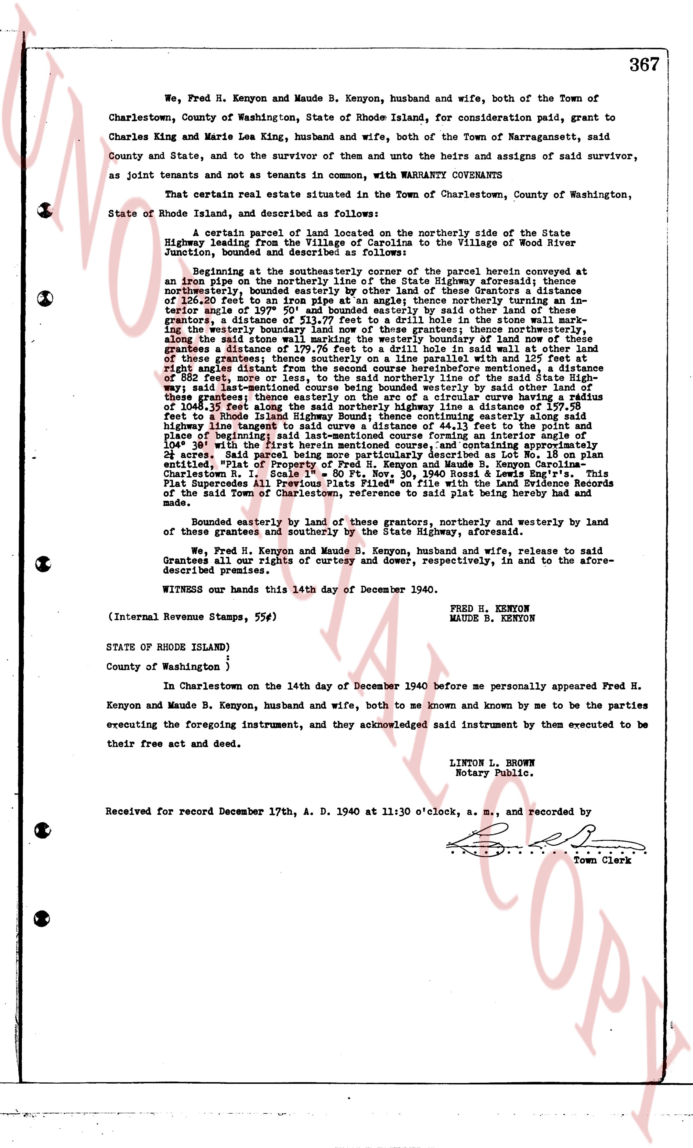
We, Fred H. Kenyon and Maude B. Kenyon, husband and wife, both of the Town of Charlestown, County of Washington, State of Rhode Island, for consideration paid, grant to Charles King and Marie Lea King, husband and wife, both of the Town of Narragansett, said County and State, and to the survivor of them and unto the heirs and assigns of said survivor, as Joint tenants and not as tenants in common, with WARRANTY CONVEYANTS
That certain real estate situated in the Town of Charlestown, County of Washington, State of Rhode Island, and described as follows:
A certain parcel of land located on the northerly side of the State Highway leading from Village of Carlisle to the Village of Wood River Junction, bounded and described as follows:
Beginning at the southeasterly corner of the parcel herein conveyed at an iron pipe on the northerly line of the State highway aforesaid, thence northerly parallel to said highway and distance of 126.20 feet to an iron pipe on a angle; thence northerly turning an interior angle of 102° 50' distance of 197.70 feet to an iron pipe; by said other land of said grantors, a distance of 513.77 feet to a drill hole in the stone wall marking the easterly boundary of the parcel herein conveyed; thence westerly along the said stone wall marking the westerly boundary of land now of these grantees a distance of 139.76 feet to a drill hole said wall at other land of these grantees; thence northerly 111.10 feet to a drill hole with an interior right angle distance from the second course hereinbefore mentioned, a distance of 582 feet more or less to an iron pipe on the line of the said highway; say last mentioned line crossing bounded westerly by said water on the other of these grantees thence northerly along said particular course and a distance of 1048.35 feet along the said northerly highway line a distance of 159.58 feet to an iron pipe lying on the line of the existing easterly right of way of the highway line tangent to said curve a distance of 44.13 feet to the point and place of beginning of the first course hereinbefore mentioned, and containing approximately 28 acres said land being more or less as is described as lot 1 on a plan entitled, "Plat of Property of Fred H. Kenyon and Maude B. Kenyon Carolina-Charlestown, R. I. Situated on the State Road & Wood River Road & Wood River" This Plat Supercedes All Previous Plats Filed" on file with the Land Evidence Records of the said Town of Charlestown, reference to said plat being hereby had and made.
Bounded easterly by land of these grantors, northerly and westerly by land of these grantees and southerly by the State Highway, aforesaid.
We, Fred H. Kenyon and Maude B. Kenyon, husband and wife, release to said Grantees all our rights of curtesy and dower, respectively, in and to the aforesaid described premises.
WITNESS our hands this 14th day of December 1940.
FRED H. KENYON
MAUDE B. KENYON
(Internal Revenue Stamps, 55¢)
STATE OF RHODE ISLAND)
)
County of Washington )
In Charlestown on the 14th day of December 1940 before me personally appeared Fred H. Kenyon and Maude B. Kenyon, husband and wife, both to me known and known by me to be the parties executing the foregoing instrument, and they acknowledged said instrument by them executed to be their free act and deed.
LINTON L. BROWN
Notary Public.
Received for Record December 17th, A. D. 1940 at 11:30 o'clock, a. m., and recorded by
[Signature]
Town Clerk
The page as recorded