The instrument's own words
page 1 · read by Gemma vision
671
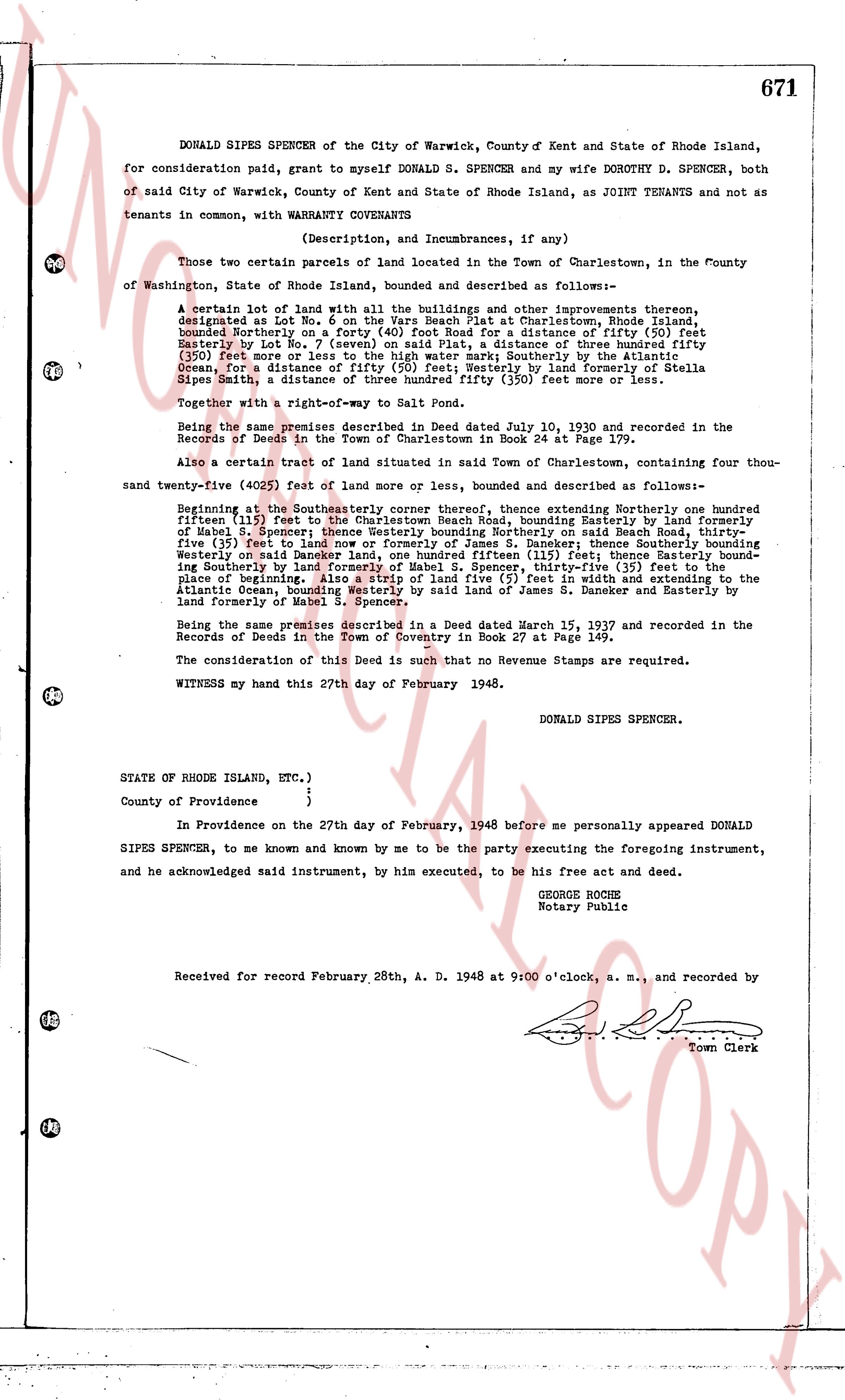
DONALD SIPES SPENCER of the City of Warwick, County of Kent and State of Rhode Island,
for consideration paid, grant to myself DONALD S. SPENCER and my wife DOROTHY D. SPENCER, both
of said City of Warwick, County of Kent and State of Rhode Island, as JOINT TENANTS and not as
tenants in common, with WARRANTY COVENANTS
(Description, and Incumbrances, if any)
Those two certain parcels of land located in the Town of Charlestown, in the County
of Washington, State of Rhode Island, bounded and described as follows--
A certain lot of land with all the buildings and other improvements thereon,
designated as Lot No. 1 on the Plan of the Estate of [?] at Charlestown, Rhode Island,
bounded Northerly on a forty foot Road for Road for distance of fifty (50) feet
Easterly by Lot No. 7 (seven) on said Plat, a distance of three hundred fifty
(350) feet or more; Lot No. 7 (seven) on said Plat, a distance of three hundred fifty
(350) feet or more; Lot No. 7 (seven) on said Plat, Southerly by the land of Stella
Ocean, for a distance of fifty (50) feet, Westerly by land of formerly of Stella
Sipes Smith, a distance of three hundred fifty (350) feet or more less more.
Together with a right-of-way Map to Salt Pond.
Being the same premise described in Deed dated July 10, 1930 and recorded in the
Records of Deeds in the Town of Charlestown in Book 24 at Page 179.
Also a certain tract of land situated in said Town of Charlestown, containing four thou-
sand twenty-five (4025) feet of land or more, bounded and described as follows--
Beginning at the Southeasterly corner thereof, thence extending Northerly one hundreden
fifteen (115) feet to the Charlestown Beach Road, bounding Easterly by land formerly
of Mabel S. Spencer, thence Southeasterly along said Road to a point on said Beach Road,
five (5) feet to land now or formerly of James S. Daneker; thence Southerly three hundred
(300) feet, bounding Easterly by land of James S. Daneker; thence Westerly two hundred
(200) feet, bounding Northerly by land of James S. Daneker; thence Southerly two hundred
(200) feet bounding Southerly by land of formerly of Mabel S. Spencer, thirty-five (35) feet to the
place of beginning; thence extending Easterly one hundred fifteen (115) feet and extending to the
Atlantic Ocean, bounding Westerly by said land of James S. Daneker and Easterly by
land formerly of Mabel S. Spencer.
Being the same premises described in a Deed dated March 15, 1937 and recorded in the
Records of Deeds in the Town of Coventry in Book 27 at Page 149.
The consideration of this Deed is such that no Revenue Stamps are required.
WITNESS my hand this 27th day of February 1948.
DONALD SIPES SPENCER.
STATE OF RHODE ISLAND, ETC.)
)
County of Providence }
In Providence on the 27th day of February, 1948 before me personally appeared DONALD
SIPES SPENCER, to me known and known by me to be the party executing the foregoing instrument,
and he acknowledged said instrument, by his executed, to be his free act and deed.
GEORGE ROCHE
Notary Public
Received for record February 28th, A. D. 1948 at 9:00 o'clock, a. m., and recorded by
[?] Town Clerk
The page as recorded