The instrument's own words
page 1 · read by Gemma vision
15
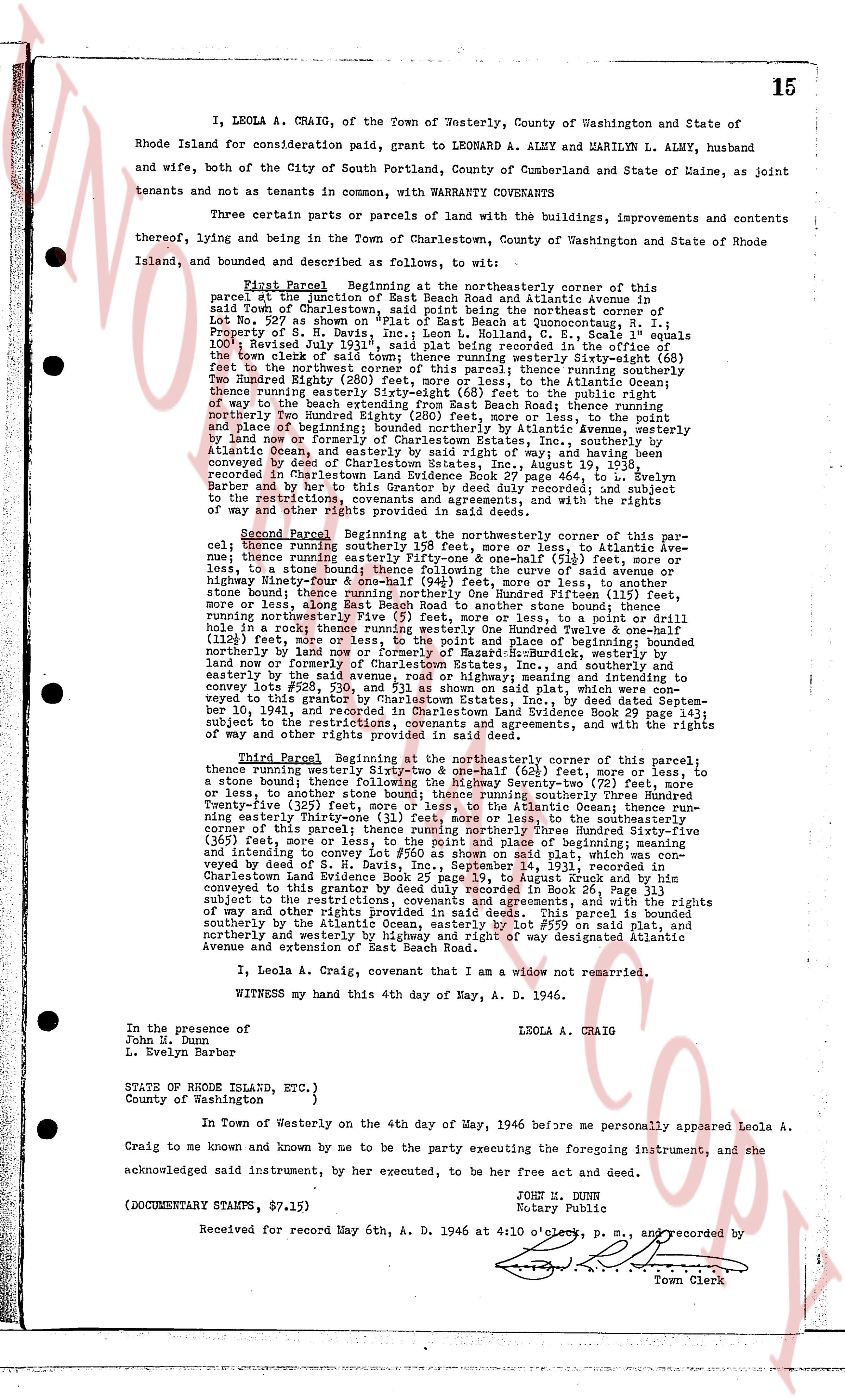
I, LEOLA A. CRAIG, of the Town of Westerly, County of Washington and State of Rhode Island for consideration paid, grant to LEONARD A. ALMY and MARLYN L. ALMY, husband and wife, both of the City of South Portland, County of Cumberland and State of Maine, as joint tenants and not as tenants in common, with WARRANTY COVENANTS
Three certain parcels or parts of land with the buildings, improvements and contents thereof, lying and being in the town of Charlestown, County of Washington and State of Rhode Island, and bounded as and described as follows, to wit:
First Parcel Beginning at the northeasterly corner of this parcel set junction of East Beach Road and Atlantic Avenue in said Town of Charlestown, and running thence, along the northeast corner of Lot No. 207 as shown "on Plat of East Beach at Quonochontank, R. I." Property of S. R. [?] and others, recorded in Charlestown, R. I., F. S. Deeds Volume 100, Revised July 1931", said plat being recorded in the office of the Town Clerk of said town, running westerly Seventy-Seven (77) feet to the northwest corner of this parcel; thence running southerly Seventy-Six (76) feet to the northwest corner of this parcel; thence running southerly Seventy-Two (72) feet, more or less, to the Atlantic Ocean; thence running easterly Sixty-Seven (67) feet to the public right of way to the beach extending from East Beach Road; thence running northerly two Hundred Fifty-Two (252) feet, more or less, to the start of line and place of beginning; bounded northerly by Atlantic Avenue, westerly by land now or formerly of Harold and Eunice [?] Inc., southerly Atlantic Ocean, and easterly by said right of way; and having been conveyed by deed of S. R. [?] and others to me, dated August 8, 1932, recorded in Charlestown Land Evidence Book 27 page 464, to L. Evelyn Barber by deed of S. R. [?] and others, dated July 1, 1931, subject to the restrictions, covenants agreements, and with the rights of way in or other rights mentioned in said deed.
Second Parcel Beginning at the northeasterly corner of this parcel; thence running southerly 158 feet, more or less, to Atlantic Ave; thence running easterly 144 feet, more or less, to a stone wall, more or less, to a stone bound; thence following the curve of said avenue 34 feet, more or less, to another stone bound; thence running Northwest 111 feet, more or less, stone bound thence running East Beach Road to another stone bound; thence running northeasterly 158 feet, more or less, to a point 111 feet (111) hole in a rock thence running westerly One Hundred Twelve & one-half (112 1/2) feet more or less to the start of line and place of beginning; bounded northerly by land now or formerly of Harold and Eunice [?] Burdock, westerly by land now or formerly of Harold and Eunice [?] Inc., southerly Atlantic Ocean, and easterly by the said avenue, road or highway, meaning and intending to convey the land and the buildings thereon as shown on said plat, which was conveyed to grantor by Charlestown Estates, Inc., by deed dated September 1st, 1931, and recorded in Charlestown Land Evidence Book 29 page 143; subject to the restrictions, covenants agreements, and with the rights of way in or other rights mentioned in said deed.
Third Parcel Beginning at the northeasterly corner of this parcel; thence running westerly one hundred and thirty-six (136) feet, more or less, to a stone bound; thence following the Highway Seventy-two feet, more or less, to a stone bound; thence following the boundary one hundred thirty-three feet, more or less, to another stone bound; thence running Twenty-five (25) feet, more or less, to the Atlantic Ocean; thence running southeasterly one hundred thirty-three feet, more or less, to the southeasterly corner of this parcel; thence running northerly Three hundred Sixty-five (365) feet, more or less, to the start of line and place of beginning; bounded and intending to convey Lot #50 as shown on said plat, which was conveyed by deed of L. A. Craig to me, dated June 1, 1931, recorded in Charlestown Land Evidence Book 25 page 39, to August Brck and by him conveyed by deed of L. A. Craig to me, dated July 1, 1931, subject to the restrictions, covenants agreements, and with the rights of way in or other rights mentioned in said deed. This parcel is bounded northerly by the Atlantic Ocean, easterly by Lot #559 on said plat, and northerly and westerly by highway and right of way designated Atlantic Avenue and extension of East Beach Road.
I, Leola A. Craig, covenant that I am a widow not remarried.
WITNESS my hand this 4th day of May, A. D. 1946.
LEOLA A. CRAIG
In the presence of
John M. Dunn
L. Evelyn Barber
STATE OF RHODE ISLAND, ETC.)
County of Washington )
In Town of Westerly on the 4th day of May, 1946 before me personally appeared Leola A. Craig to me known and known by me to be the party executing the foregoing instrument, and she acknowledged said instrument, by her execution, to be her free act and deed.
JOHN B. DUNN
Notary Public
(DOCUMENTARY STAMPS, $7.15)
Received for record May 6th, A. D. 1946 at 4:10 o'clock, p. m., and recorded by
Town Clerk
The page as recorded