The instrument's own words
page 1 · read by Gemma vision
236
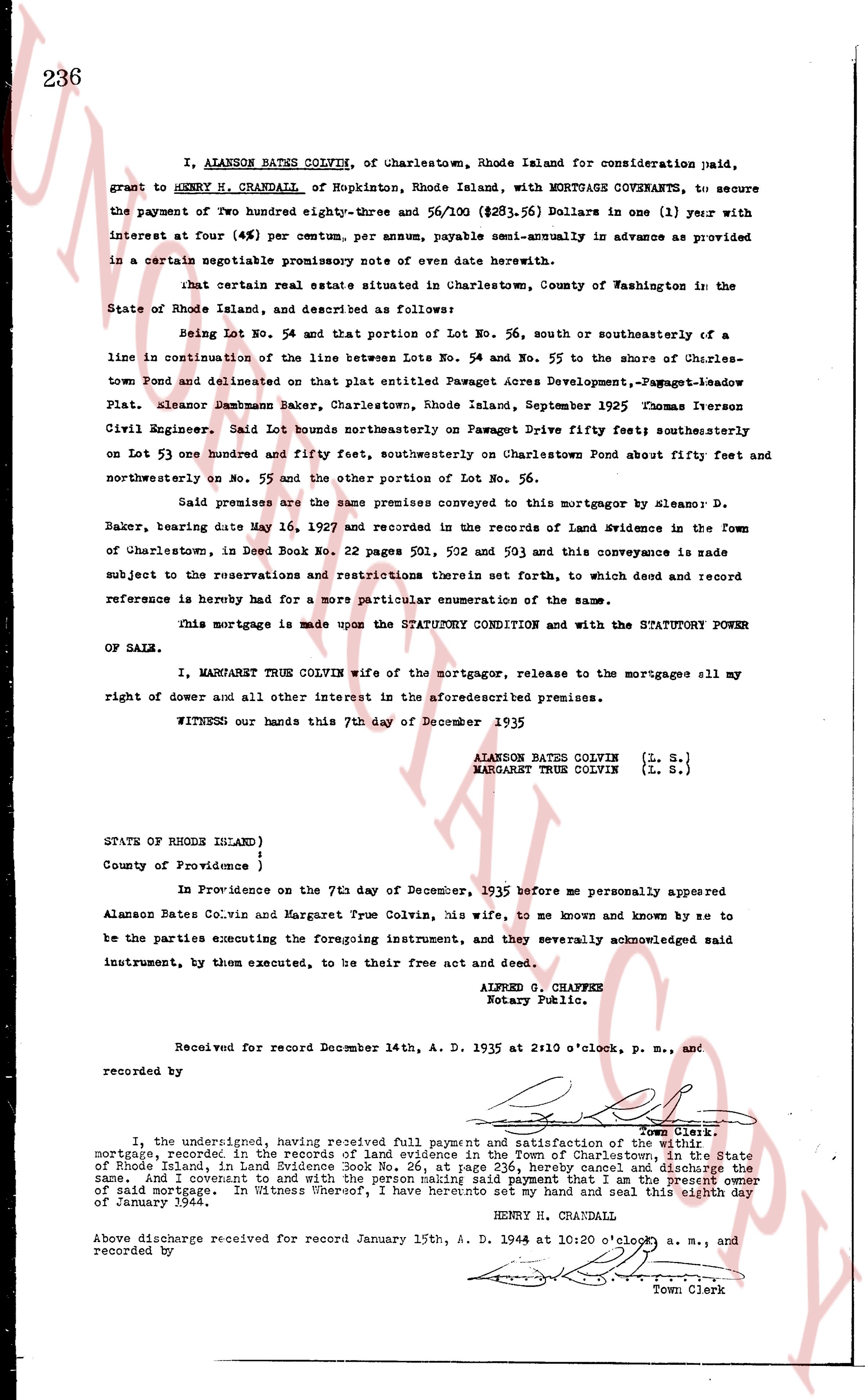
I, ALANSON BATES COLVIN, of Charlestown, Rhode Island for consideration paid, grant to HENRY H. CRANDALL, of Hopkinton, Rhode Island, with MORTGAGE COVENANTS, to secure the payment of Two hundred eighty-three and three 56/100 ($283.56) Dollars in one (1) year with interest at four (4%) per centum per annum, payable semi-annually in advance as provided in a certain negotiable promissory note of even date herewith.
that certain real estate situated in Charlestown, County of Washington in the State of Rhode Island, and described as follows:
Being Lot No. 54 and that portion of Lot No. 56, south and southeasterly of a line in continuation of the line between Lots No. 54 and No. 55 to the shore of Charlestown Pond and delineated on that plat entitled Pavaget Acres Development, -Pavaget-Leadbow Plat. Platon Alanson Dambman Baker, Charlestown, Rhode Island, September 1925 Osman Iverson Civil Engineer. Said lot bounds northeasterly on Pavaget Drive fifty feet; southeasterly on Lot 53 one hundred and fifty feet, southeasterly on Charlestown Pond about fifty feet and northwesterly on No. 55 and the other portion of Lot No. 56.
Said premises are the same premises conveyed to this mortgagor by Alanson D. Baker, bearing date May 16, 1927 and recorded in the records of Land Evidence in the Town of Charlestown, in Deed Book No. 22 pages 501, 502 and 503 and this conveyance is made subject to the reservations and restrictions therein set forth, to which deed and record reference is hereby had for a more particular enumeration of the same.
This mortgage is made upon the STATUTORY CONDITION and with the STATUTORY POWER OF SALE.
I, MARGARET TRUE COLVIN wife of the mortgagor, release to the mortgagee all my right of dower and all other interest in the aforesaid premises.
WITNESS our hands this 7th day of December 1935
ALANSON BATES COLVIN (L. S.)
MARGARET TRUE COLVIN (L. S.)
STATE OF RHODE ISLAND )
County of Providence }
In Providence on the 7th day of December, 1935 before me personally appeared Alanson Bates Colvin and Margaret True Colvin, his wife, to me known and known by me to be the parties executing the foregoing instrument, and they severally acknowledged said instrument, by them executed, to be their free act and deed.
ALFRED G. CHAFFEE
Notary Public.
Received for record December 14th, A. D. 1935 at 2:10 o'clock, p. m., and recorded by [?] Town Clerk.
I, the undersigned, having received full payment and satisfaction of the mortgage, recorded in the records of land evidence in the Town of Charlestown, in the State of Rhode Island, in Land Evidence Book No. 26, at page 236, hereby cancel and discharge the same, and covenant to and with the person making said payment that I am the present owner of said mortgage. In Witness Whereof, I have hereunto set my hand and seal this eighth day of January 1944.
HENRY H. CRANDALL
Above discharge received for record January 15th, A. D. 1944 at 10:20 o'clock a. m., and recorded by [?] Town Clerk
The page as recorded