The instrument's own words
page 1 · read by Gemma vision
396
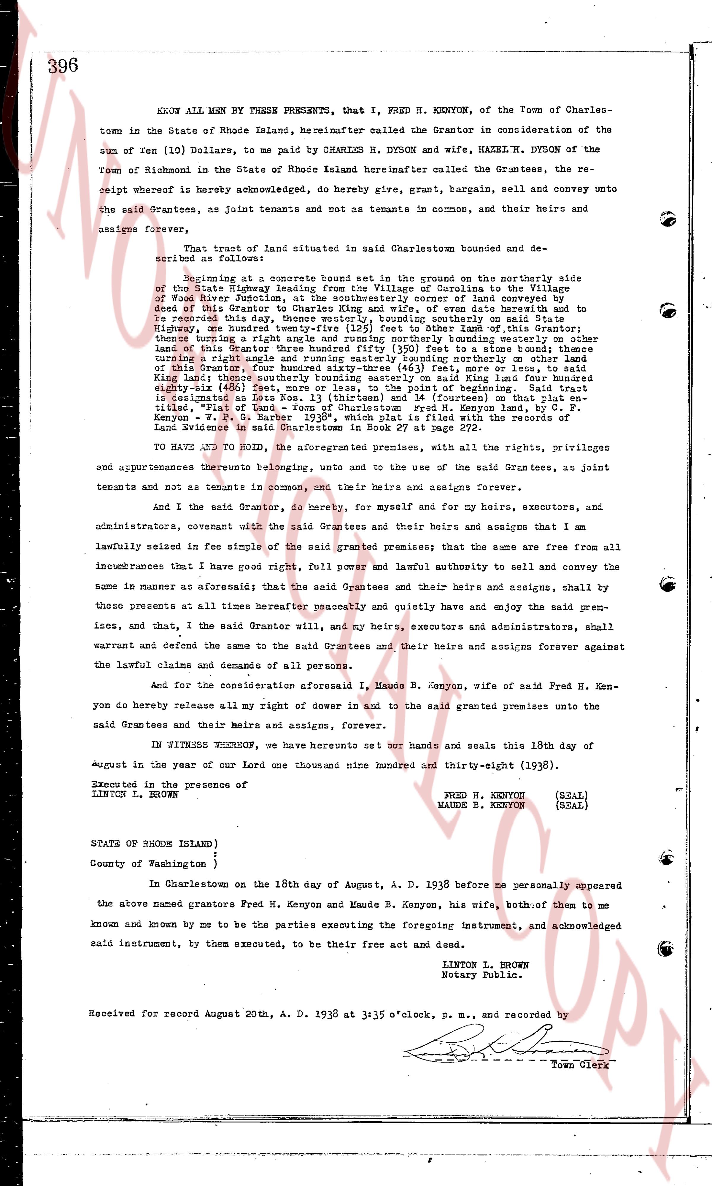
KNOW ALL MEN BY THESE PRESENTS, that I, FRED H. KENYON, of the Town of Charlestown in the State of Rhode Island, hereinafter called the Grantor in consideration of the sum of ten (10) Dollars, to me paid by CHARLES H. DYSON and wife, HAZEL H. DYSON of the Town of Richmond in the State of Rhode Island hereinafter called the Grantees, the receipt whereof is hereby acknowledged, do hereby give, grant, bargain, sell and convey unto the said Grantees, as joint tenants and not as tenants in common, their heirs and assigns forever,
That tract of land situated in said Charlestown bounded and described as follows:
Beginning at a concrete bound set in the ground on the northerly side of the State Highway leading from the Village of Calicut to the Village of Wood River, at a point intersecting the southwesterly corner of land conveying by Deed this Grantor to Charles and wife of oven date herewith and to record that this boundary line running southeasterly along said State Highway, one hundred twenty-five (125) feet to other bound set of this Grantor, thence running southeasterly along the boundary line partitioning other part of this Grantor three hundred fifty (350) feet to a stone bound; thence running a slight angle northerly along the boundary line partitioning other part of this Grantor, four hundred sixty-three (463) feet, more or less, to said line; thence running a slight angle northwesterly along said State Highway one hundred sixty-eight (168) feet, more or less, to the point of beginning. Said tract is designated as Lot Nos. 13 (thirteen) and 14 (fourteen) on that plat entitled "Plan of land owned by Fred H. Kenyon" by Kenyon P. O. Carter September 1935, which plat is filed with the records of said Town page 381 in book 27, and is dated August 1935.
TO HAVE AND TO HOLD, the aforementioned premises, with all the rights, privileges and appurtenances thereunto belonging, and unto the use of the said Grantees, as joint tenants and not as tenants in common, and their heirs and assigns forever.
And I the said Grantor, do hereby, for myself and for my heirs, executors, and administrators, covenant with the said Grantees and their heirs and assigns that I am lawfully seized in fee simple of the said granted premises; that the same are free from all incumbrances that I have good right, full power and lawful authority to sell the same in manner as above aforesaid; that the said Grantees and their heirs and assigns, shall by these presents at all times hereafter peaceably and quietly have and enjoy the said premises, and that, I the said Grantor will, and my heirs, executors and administrators, shall warrant and defend the same to the said Grantees and their heirs and assigns forever against the lawful claims and demands of all persons.
And for the consideration of one dollar I, Maude B. Kenyon, wife of said Fred H. Kenyon do hereby release all my right of dower in and to the said granted premises unto the said Grantees and their heirs and assigns, forever.
IN WITNESS WHEREOF, we have hereunto set our hands and seals this 18th day of August in the year of our Lord one thousand nine hundred and thirty-eight (1938).
Executed in the presence of
LINTON L. BROWN
FRED H. KENYON (SEAL)
MAUDE B. KENYON (SEAL)
STATE OF RHODE ISLAND }
County of Washington }
In Charlestown on the 18th day of August, A. D. 1938 before me personally appeared the above named Grantors Fred H. Kenyon and Maude B. Kenyon, his wife, both of them to me known and known by me to be the parties executing the foregoing instrument, and acknowledged said instrument, by them executed, to be their free act and deed.
LINTON L. BROWN
Notary Public.
Received for record August 20th, A. D. 1938 at 3:35 o'clock, p. m., and recorded by
[Signature]
Town Clerk
The page as recorded