The instrument's own words
page 1 · read by Gemma vision
384
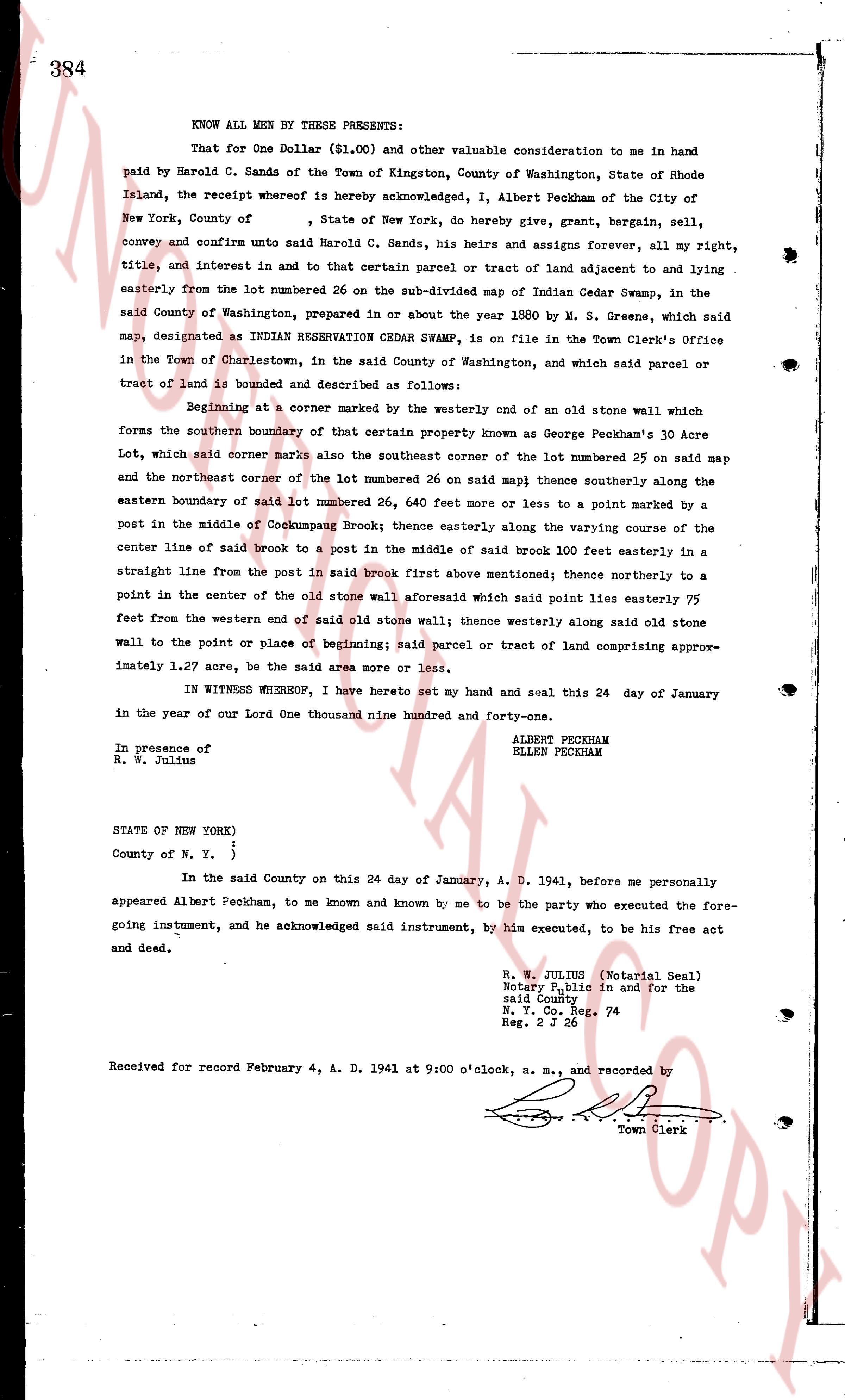
KNOW ALL MEN BY THESE PRESENTS:
That for One Dollar ($1.00) and other valuable consideration to me in hand paid by Harold C. Sands of the Town of Kingston, County of Washington, State of Rhode Island, the receipt whereof is hereby acknowledged, I, Albert Peckham of the City of New York, County of , State of New York, do hereby, give, grant, bargain, sell, convey and confirm unto said Harold C. Sands, his heirs and assigns forever, all my right, title, and interest in and to that certain parcel or tract of land adjacent to and lying easterly from the lot numbered 26 on the sub-divided map of Indian Cedar Swamp, in the said County of Washington, prepared in or about the year 1880 by M. S. Greene, which said map, designated as INDIAN RESERVATION CEDAR SWAMP, is on file in the Town Clerk's Office in the Town of Charlestown, in the said County of Washington and, which said parcel or tract of land is bounded and described as follows:
Beginning at a corner marked by a westerly end of an old stone wall which forms the southern boundary of that certain property known as George Peckham's 30 Acre Lot, which said corner marks also the southeast corner of the lot numbered 25 on said map and the northeast corner of the lot numbered 26 on said map thence southerly thence along the eastern boundary of said lot numbered 26, 440 feet more or less to a point marked by a post in the middle of Cockumpaur Brook; thence easterly along the varying course of the center line of said brook to a post in the middle of said brook 100 feet easterly in a straight line from the post in said brook first above mentioned; thence northerly to a point in the center of the old stone wall aforesaid which said point lies easterly 75 feet from the western end of said old stone wall; thence westerly along said old stone wall to the point or place of beginning; said parcel or tract of land comprising approximately 1.27 acre, be the said area more or less.
IN WITNESS WHEREOF, I have hereto set my hand and seal this 24 day of January in the year of our Lord One thousand nine hundred and forty-one.
ALBERT PECKHAM
ELLEN PECKHAM
In presence of
R. W. Julius
STATE OF NEW YORK)
)
County of N. Y. )
In the said County on this 24 day of January, A. D. 1941, before me personally appeared Albert Peckham, to me known and known by me to be the party who executed the foregoing instrument, and he acknowledged said instrument, by him executed, to be his free act and deed.
R. W. JULIUS (Notarial Seal)
Notary Public in and for the
said County
N. Y. Co. Reg. 74
Reg. 2 J 26
Received for record February 4, A. D. 1941 at 9:00 o'clock, a. m., and recorded by
[Signature]
Town Clerk
The page as recorded