The instrument's own words
page 1 · read by Gemma vision
275
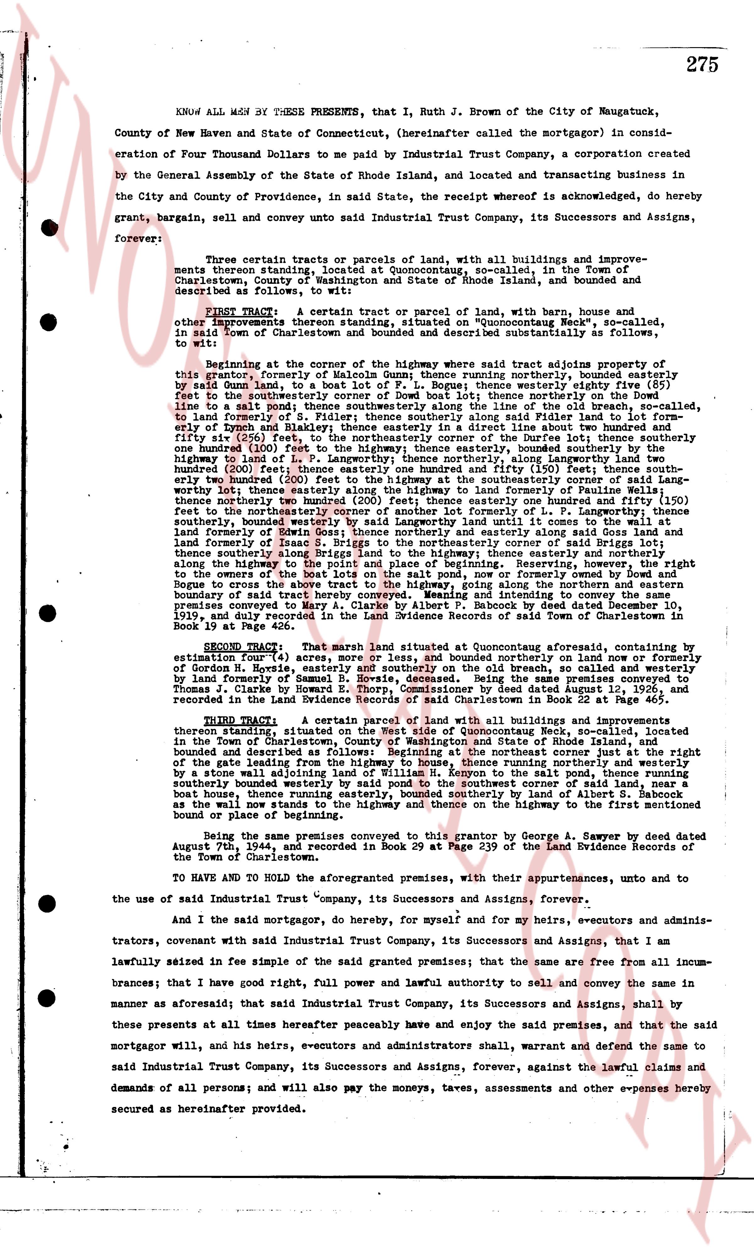
KNOW ALL MEN BY THESE PRESENTS, that I, Ruth J. Brown of the City of Naugatuck, County of New Haven and State of Connecticut, (hereinafter called the mortgagor) in consideration of Four Thousand Dollars to me paid by Industrial Trust Company, a corporation created by the General Assembly of the State of Rhode Island, located and transacting business in the City and County of Providence, in said State, the receipt whereof is acknowledged, do hereby grant, bargain, sell, and convey unto said Industrial Trust Company, its Successors and Assigns, forever:
Three certain tracts or parcels of land, with all buildings and improvements thereons standing, located at Quonocutongo, so-called, in the Town of Charlestown, County of Washington and State of Rhode Island, bounded and described as follows, to wit:
FIRST TRACT: A certain tract or parcel of land, with barn, house and other improvements thereon standing, situated on "Quonocutongo Neck", so-called, in said Town of Charlestown, bounded and described but substantially as follows, to wit:
beginning at the corner of the highway where the said tract adjoins property of this grantor, formerly of Malcolm Gunn; thence running northerly, bounded easterly by said Gunn land, to a house set back of Lot F. Page 1; thence running westerly eighty five (85) feet to the southeasterly corner of the house mentioned above; thence running southerly [?] line to a salt pond; thence southerly along the line of the old beach, so-called, to said pond and formerly of the said Gunn; thence running easterly along said pond line to a salt pond; thence southerly along the line of the old beach, so-called, to the easterly end of Lynch and Bradley; thence easterly along the boundary line in a direct line about two hundred and forty (240) feet, thence northerly along the boundary line of the said Lynch and Bradley one hundred (100) feet to the highway, thence easterly, bounded southerly by the highway, thence north to a land of P. A. Langworthy; thence northerly, along Langworthy land two hundred (200) feet; thence easterly along the boundary line of the said Langworthy two hundred twenty (220) feet (200) feet to the highway at the southeasterly corner of said Langworthy land; thence easterly along the highway one hundred and fifty (150) feet, thence northerly two hundred (200) feet; thence easterly one hundred and fifty (150) feet to the northeasterly corner of the said tract; thence running southerly along the boundary line of the said tract, bounded easterly by the highway, thence southerly, bounded westerly by said Langworthy land until it comes to the wall at the land formerly of Ezra S. Briggs; thence running southerly along the boundary line of said land and formerly of Isaac S. Briggs to the northeasterly corner of said Briggs land; thence southerly along the boundary line of the said Briggs land, bounded easterly along the highway to the point and place of beginning. Reserving, however, the right to the owner of the said tract to use the highway, known as the "Old Beach Road" or "Cogges Bridge to across the salt tract to the highway, going along the northern and eastern boundary of said tract, for the purpose of accessing the beach. The said tract of land comprises property conveyed to Mary A. Clarke by Albert P. Babcock by Deed dated December 10, 1936, duly recorded in the Land Evidence Records of said Town of Charlestown in Book 19 at Page 426.
SECOND TRACT: That marsh land situated at Quonocutongo aforesaid, containing by estimation four (4) acres, more or less, and bounded northerly on land now or formerly of Horatio R. Hopkins, easterly on the "Old Beach Road", southerly on the salt pond, by land formerly of Samuel S. Bowie, deceased. Being the same premises conveyed to Thomas J. Clarke by Horatio R. Hopkins by Deed dated June 1, 1932, duly recorded and recorded in the Land Evidence Records of Charlestown in Book 22 at Page 465.
THIRD TRACT: A certain parcel of marsh land with all buildings and improvements thereon standing situated at Quonocutongo, so-called, in the Town of Charlestown, bounded and described as follows, to wit: beginning at the right of the gate leading from the highway to house a farm, on a road leading from the highway, bounded and described as follows, to wit: beginning at the right of the gate leading from the highway to house a farm, on a road leading from the highway, thence running northerly and westerly a short distance to the southeasterly corner of said farm; thence running northerly, bounded southerly bounded westerly bounded westerly to said southeast corner of said land, near a boat house, thence running easterly, bounded westerly by land of Albert S. Babcock as the wall now stands to the highway, thence easterly along the highway to the first mentioned bound or place of beginning.
Being the same premises conveyed to this grantor by George A. Sawyer by deed dated August 7th, 1924, and recorded in Book 29 at Page 439 of the Land Evidence Records of the Town of Charlestown.
TO HAVE AND TO HOLD the aforementioned premises, with their appurtenances, unto and to the use of said Industrial Trust Company, its Successors and Assigns, Forever.
And I the said mortgagor, to do, hereby, for myself, and for my heirs, executors and administrators, covenant with said Industrial Trust Company, its Successors and Assigns, that I am lawfully seized in fee simple of the said grant promised premises; that the same are free from all incumbrances; that I have good right, full power and lawful authority to sell and convey the same in manner as aforesaid; that said Industrial Trust Company, its Successors and Assigns, shall by these presents at all times hereafter peaceably and enjoy the said premises, and that the said mortgagor will, and his heirs, executors and administrators shall, forever, warrant and defend the same to said Industrial Trust Company, its Successors and Assigns, forever, against the lawful claims and demands of all persons; and will also pay the moneys, taxes, assessments and other expenses hereby secured as hereinafter provided.
The page as recorded