The instrument's own words
page 2 · read by Gemma vision
293
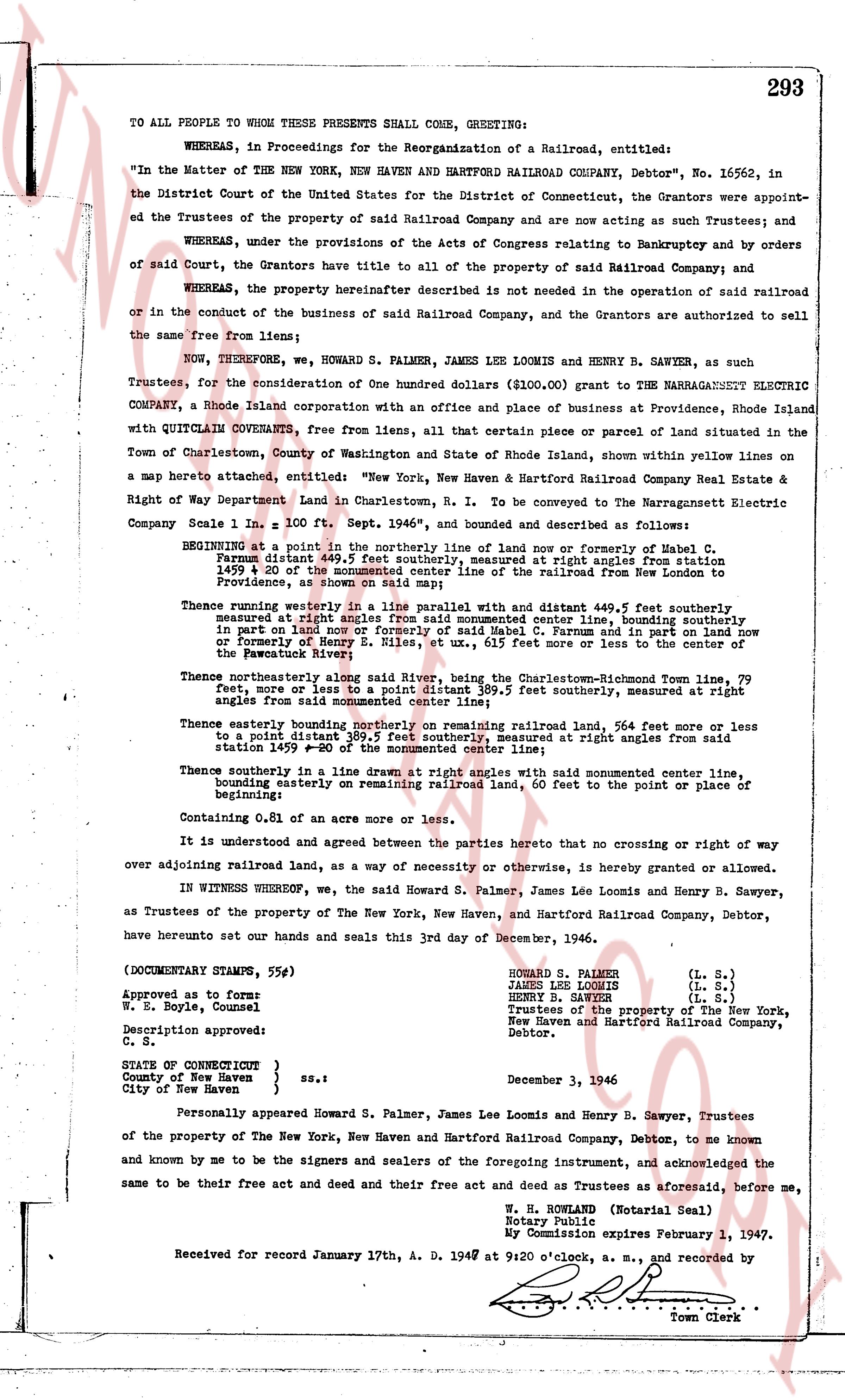
TO ALL PEOPLE TO WHOM THESE PRESENTS SHALL COME, GREETING:
WHEREAS, in Proceedings for the Reorganization of a Railroad, entitled:
"In the Matter of the NEW YORK NEW HAVEN AND HARTFORD RAILROAD COMPANY, Debtor", No. 16562, in the District Court of the United States for the District of Connecticut, the Grantors were appointed Trustees of the property of said Railroad Company and are now acting as such Trustees; and
WHEREAS, under the provisions of the Acts of Congress relating to Bankruptcy and by orders of said Court, the Grantors have title to all of the property of said Railroad Company; and
WHEREAS, the property hereinafter described is not needed in the operation of said railroad or in the conduct of the business of said Railroad Company, and the Grantors are authorized to sell the same free from liens;
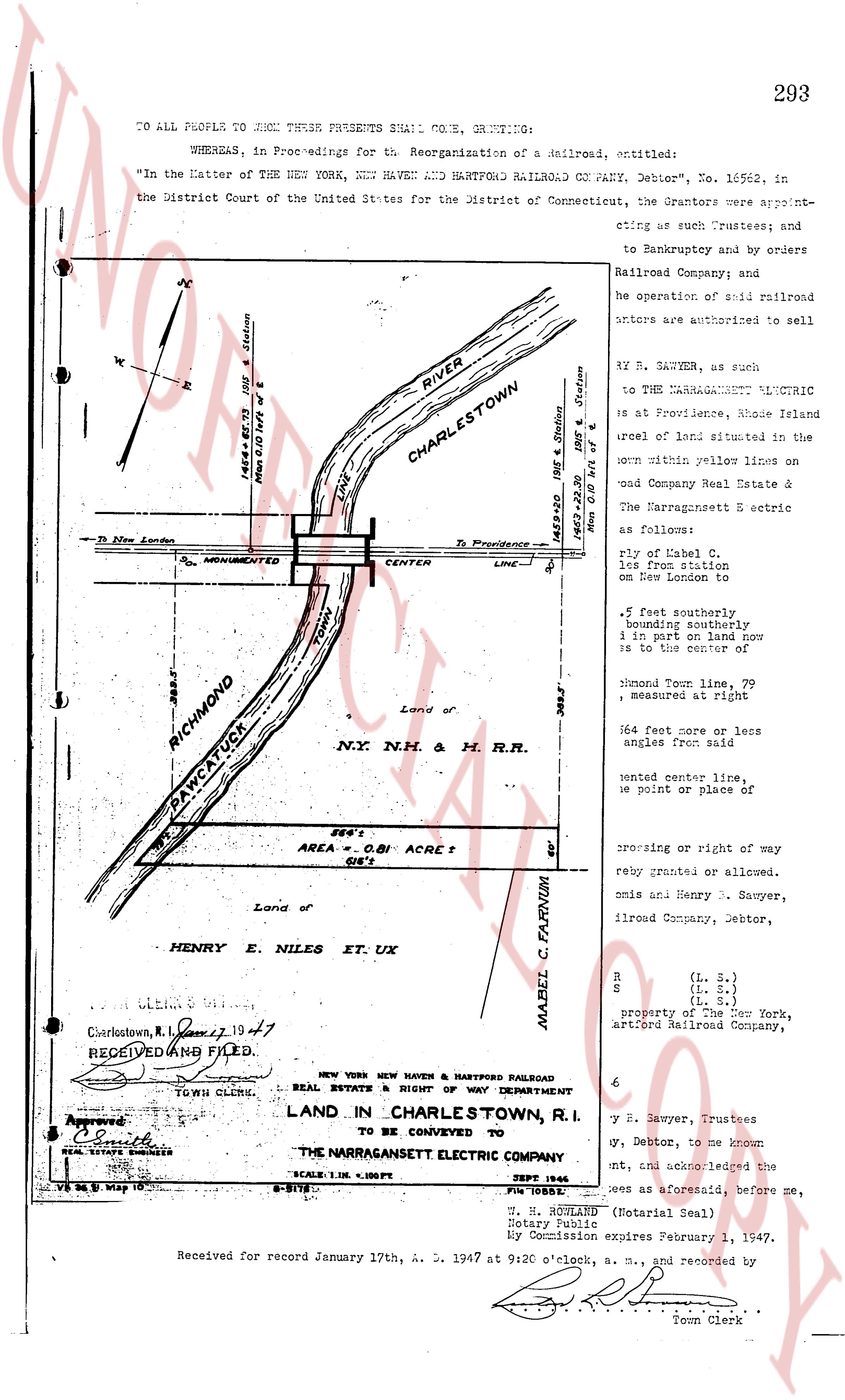
NOW, THEREFORE, we, HOWARD S. PALMER, JAMES LEE LOOMIS and HENRY B. SAWYER, as Trustees, for the consideration of One hundred dollars ($100.00) grant to the NARRAGANSETT ELECTRIC COMPANY, a Rhode Island corporation with an office and place of business at Providence, Rhode Island with QUITCLAIM CONVEYANCE, free from liens, all that certain piece or parcel of land situated in the town of Charlestown, County of Washington and State of Rhode Island, shown within yellow lines on a map hereto attached, entitled: "New York, New Haven & Hartford Railroad Company Real Estate & Right of Way Department Land in Charlestown, R. I. to be Conveyed to The Narragansett Electric Company Scale 1 in. = 100 ft. Sept. 1946", and bounded and described as follows:
BEGINNING at a point in the northerly line of land now or formerly of Mabel C. Farnum distal 149.5 feet southerly, measured at right angles from station 149+20 a 20 mm spike driven into the tie of the railroad from station 149+00, a 20 mm spike, Providence, as shown on said map;
Thence running westerly in a line parallel with a parallel distant 499.5 feet southerly, measured at right angles from said spike and monumented center line, bounding southerly in part on land now or formerly of said Mabel C. Farnum and in part on land now or formerly of Henry J. Moore, R. I. Blvd. at ux., 615 feet more or less to the center of the Patuxasset River; Thence northerly along said river to the Charlestown-Richmond Town line, 79 feet, more or less to a point distant 389.5 feet southerly, measured at right angles from said monumented center line;
Thence easterly bounding northerly on remaining railroad land, 564 feet more or less to a point distant 389.5 feet southerly, measured at right angles from said station 149+20 a 20 mm spike;
Thence southerly in a line drawn at right angles with said monumented center line, bounding easterly on remaining railroad land, 60 feet to the point or place of beginning.
Containing 0.81 of an acre more or less.
It is understood and agreed between the parties hereto that no crossing or right of way over adjoining railroad land, as a way of necessity or otherwise, is hereby granted or allowed.
IN WITNESS WHEREOF, we, the said Howard S. Palmer, James Lee Loomis and Henry B. Sawyer, as Trustees of the property of The New York, New Haven, and Hartford Railroad Company, Debtor, have hereunto set our hands and seals this 3rd day of December, 1946.
(DOCUMENTARY STAMPS, 55¢)
Approved as to form:
W. E. Boyle, Counsel
Description approved:
C. S.
STATE OF CONNECTICUT } ss.:
County of New Haven }
City of New Haven }
December 3, 1946
Personally appeared Howard S. Palmer, James Lee Loomis and Henry B. Sawyer, Trustees of the property of The New York, New Haven and Hartford Railroad Company, Debtor, to me known and by me to be the signers and sealers of the foregoing instrument, and acknowledged the same to be their free act and deed and their free act and deed as Trustees aforesaid, before me.
W. H. ROWLAND (Notarial Seal)
Notary Public
My Commission expires February 1, 1947.
Received for record January 17th, A. D. 1947 at 9 o'clock, a. m., and recorded by
Town Clerk
The page as recorded