The instrument's own words
page 1 · read by Gemma vision
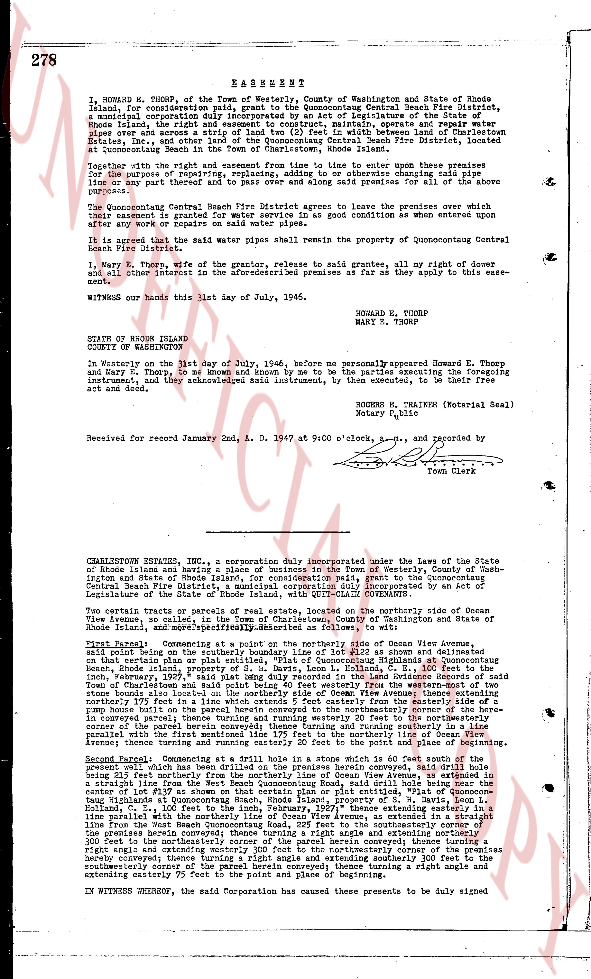
278 EASEMENT
I, HOWARD E. THORP, of the Town of Westerly, County of Washington and State of Rhode Island, for consideration paid, grant to the Quonocontaug Central Beach Fire District, a municipal corporation duly incorporated by an act of Legislature of the State of Rhode Island, the right and easement to construct, maintain, operate, repair and operate said pipes over and across a strip of land two (2) feet in width between land of Charlestown Estate Fire District and the land of the Quonocontaug Central Beach Fire District, located at Quonocontaug Beach in the Town of Charlestown, Rhode Island.
Together with the right and easement from this time to enter upon these premises for the purpose of repairing, replacing, adding to or otherwise changing said pipe lines and to keep said thoroughfare open and running said premises for all of the above purposes.
The Quonocontaug Central Beach Fire District agrees to leave the premises over which their easement is granted for water service in as good condition as when entered upon after any work or repairs on said water pipes.
It is agreed that the said water pipes shall remain the property of Quonocontaug Central Beach Fire District.
I, Mary E. Thorp, wife of the grantor, release to said grantee, all my right of dower and all other interest in the aforementioned premises as far as they apply to this easement.
Witness our hands this 31st day of July, 1946.
HOWARD E. THORP
MARY E. THORP
STATE OF RHODE ISLAND
COUNTY OF WASHINGTON
In Westerly on the 31st day of July, 1946, before me personally appeared Howard E. Thorp and Mary E. Thorp, to me known and known by me to be the parties executing the foregoing instrument, and acknowledged said instrument, by them executed, to be their free act and deed.
ROGERS E. TRAINER (Notarial Seal)
Notary Public
Received for record January 2nd, A. D. 1947 at 9:00 o'clock, a.m., and recorded by
Town Clerk
----
CHARLESTOWN ESTATES, INC., a corporation duly incorporated under the Laws of the State of Rhode Island and having a place of business in the Town of Westerly, County of Washington State of Rhode Island, for consideration paid, grant to the Quonocontaug Central Beach Fire District, a municipal corporation duly incorporated by an act of Legislature of the State of Rhode Island, with QUIT-CLAIM COVENANTS.
Two certain parcels or tracts of real estate, located on the northerly side of Ocean View Avenue, are palled in red on a plat map in the records of Washington and State of Rhode Island, and more specifically Described as follows, to wit:
First Parcel: Commencing at a point on the northerly side of Ocean View Avenue described in a deed from Samuel S. Moore to Howard E. Thorp as shown and delineated on that certain plan or plat entitled, "Plat of Quonocontaug Highlands at Quonocontaug Beach, Rhode Island," dated June 1, 1936, and recorded in the land evidence book, February, 1937," said plat being duly recorded within the Land Evidence Records of said Town of Charlestown, Rhode Island, as follows, to wit: commencing at a point at the center stone bounds also located on the northerly side of Ocean View Avenue; thence extending northerly 175 feet in a line which extends 5 feet easterly from the center line of a pump house built on the said land and running parallel to the northeasterly corner of the premises conveyed in parcel two; thence turning and running easterly 20 feet to the northeasterly corner of the parcel hereunto conveyed; thence turning and running southerly 175 feet to the center line of Ocean View Avenue; thence turning and running westerly 20 feet to the point of beginning, running parallel with the transient line 175 feet to the northerly line of Ocean View Avenue parallel with the transient line 175 feet to the point and place of beginning.
Second Parcel: Commencing at a drill hole in a stone which is 60 feet south of the present well which has been drilled on the premises herein conveyed said drill hole being 25 feet west of the center line of Ocean View Avenue, as extended in a straight line from the West Beach Quonocontaug Road, said drill hole being near the center line of Lot 9, Block 2, on the plan entitled, "Plat of Quonocontaug Highlands at Quonocontaug Beach, Rhode Island, property of S. H. Davis, Leon L. Cohoon et al.," dated June 1, 1936, and recorded in the land evidence records; thence extending in a line parallel northerly with the parallel line of Ocean View Avenue, as extended in a straight line from the West Beach Quonocontaug Road, to the northeasterly corner of the premises herein conveyed; thence turning a right angle and extending northerly 300 feet to the northeasterly corner of the parcel herein conveyed; thence turning a right angle and extending easterly 75 feet to the northeasterly corner of the premises hereby conveyed; thence turning a right angle and extending southerly 300 feet to the southerly corner of the premises hereby conveyed; thence turning a right angle and extending westerly 75 feet to the point and place of beginning.
IN WITNESS WHEREOF, the said Corporation has caused these presents to be duly signed
The page as recorded