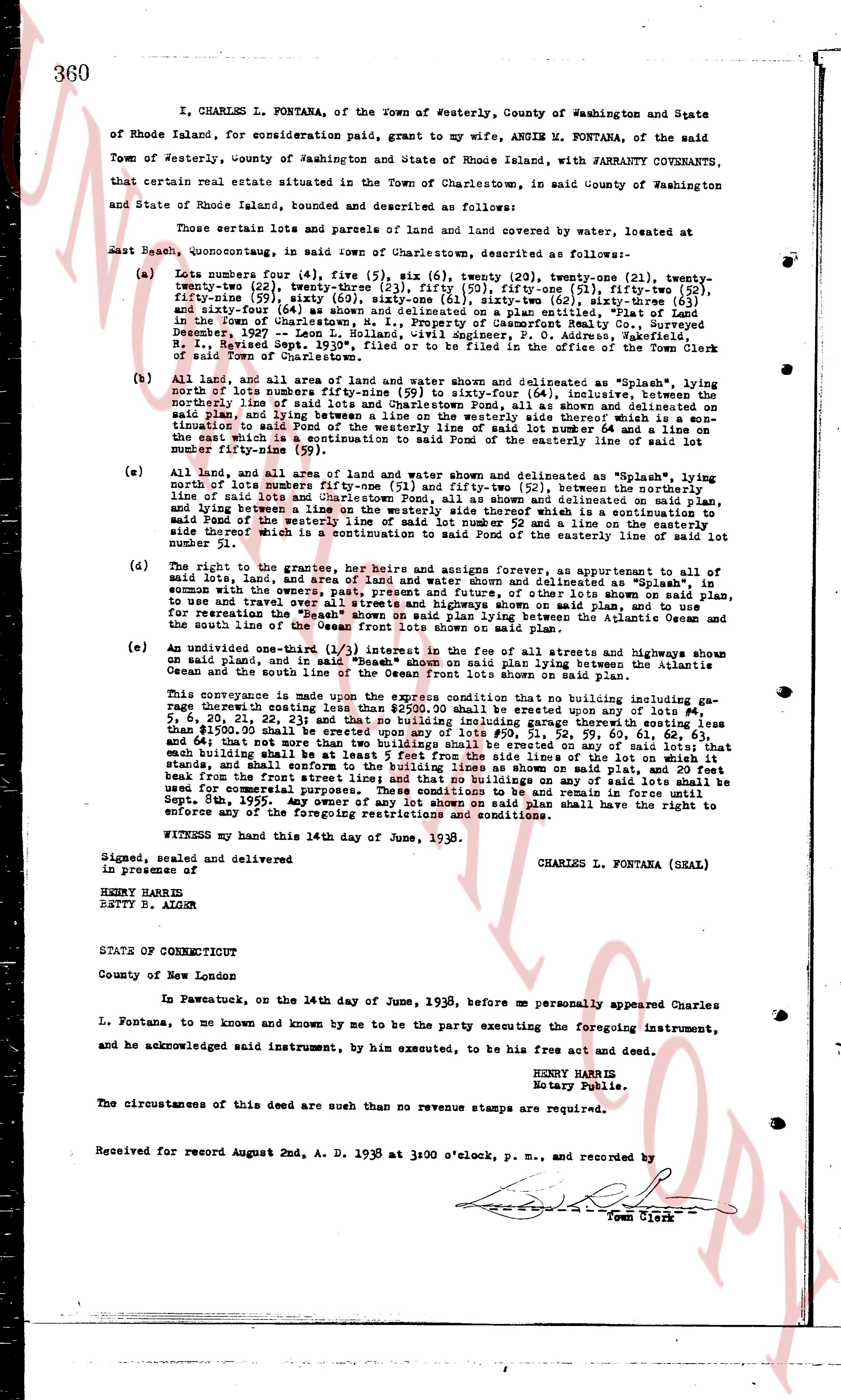
The instrument's own words
page 1
360
I, CHARLES L. FONTANA, of the Town of Westerly, County of Washington and State
of Rhode Island, for consideration paid, grant to my wife, ANGIE M. FONTANA, of the said
Town of Westerly, county of Washington and State of Rhode Island, with WARRANTY COVENANTS,
that certain real estate situated in the Town of Charlestown, in said County of Washington
and State of Rhode Island, bounded and described as follows:
Those certain parcels of land and parts of land covered by water, located at
East Beach, quonocutaug, in said town of Charlestown, described as follows:—
(a) Lots number four (4), five (5), six (6), seven (7), twenty (20), twenty-one (21), twenty-
two (22), twenty-three (23), twenty-four (24), twenty-five (25), fifty-nine (59), fifty-two (52),
fifty-nine (59), sixty (60), sixty-one (61), sixty-two (62), sixty-three (63), sixty-
two (62) and sixty-four (64) all being shown and described on a plan made by
in the Town of Charlestown, M. I. Property of Dascomb Realty Co., Surveyed
December 1937, and filed with Civil engineer, P. O. Office, Westerly,
R. I., Received Sept. 1939, filed on October 2, 1939, in the office of the Register
of land Town of Charlestown.
(b) All that area of land and area of land and water shown and delimited as "Splash", lying
north of lots number fifty-nine (59) to sixty-four (64) inclusive, between the
northerly line of said lots and line of Charlestown Pond, all as shown and delivered on
said plan, and lying between a line running north 51 deg. east 34 1/2 perches from the ter-
mination to said Pond of the westerly line of said lot number 64 and a line on
the easterly side of which is a south east corner of lot number 64 and a line on lot num-
ber fifty-nine (59).
(c) All land, and all area of land and water shown and delimited as "Splash", lying
north of lots number fifty-one (51) and fifty-two (52), between the northerly
line of said lots and Charlestown Pond, all as shown and delivered on said plan,
and lying between a line running north 51 deg. east 34 1/2 perches from the ter-
mination to said Pond of the westerly line of said lot number 52 and a line on the easterly
side thereof which is a continuation to said Pond of the easterly line of said lot
number 51.
(d) The right to the grantees, her heirs and assigns forever, as appurtenant to all of
said lots, land, and area of land and water shown and delimited as "Splash", in
common with the owners, past present and future, of the lines thus delimited and
to use and travel over all streets and highways shown on said plan, and to use
for recreation the "Splash" area of land and water lying between the Atlantic Ocean
and the south line of the Ocean front lots shown on said plan.
(e) An undivided one-third (1/3) interest in the fee of all the streets and highways shown
on said plan, and in all area of land and water lying between the Atlantic
Ocean and the south line of the Ocean front lots shown on said plan.
This conveyance is made subject upon the express condition that no building including ga-
rage thereof existing since date hereof shall be erected upon lots number 1, 2, 3, 4,
5, 6, 20, 21, 22, 23 and 24 and that no building including garage thereof existing less
than $100.00 shall be erected upon lots number 25, 51, 52, 59, 60, 61, 62, 63 and
64, and that not more than two buildings shall be erected on any of said lots; that
each building shall be set back at least 25 feet from the northerly line of the lot it
stands on, and shall conform to the building lines as shown on said plan, and 20 feet
from the front street line; that no other buildings on any of said lots shall be
used for commercial purposes. These conditions shall remain in full force and
effect for ten years. And every owner of any lot shown on said plan shall have the right to
enforce any of the foregoing restrictive covenants and conditions.
WITNESS my hand this 14th day of June, 1938.
Signed, sealed and delivered
in presence of
HENRY HARRIS
BETTY R. AIKIN
CHARLES L. FONTANA (SEAL)
STATE OF CONNECTICUT
County of New London
In Pawcatuck, on the 14th day of June, 1938, before me personally appeared Charles
L. Fontana, to me known and known by me to be the party executing the foregoing instrument,
and he acknowledged said instrument, by him executed, to be his free act and deed.
HENRY HARRIS
Notary Public.
The circumstances of this deed are such that no revenue stamps are required.
Received for record Augnd 2nd, A. D. 1938 at 3:00 o'clock, p. m., and recorded by
[Signature]
Town Clerk
The page as recorded