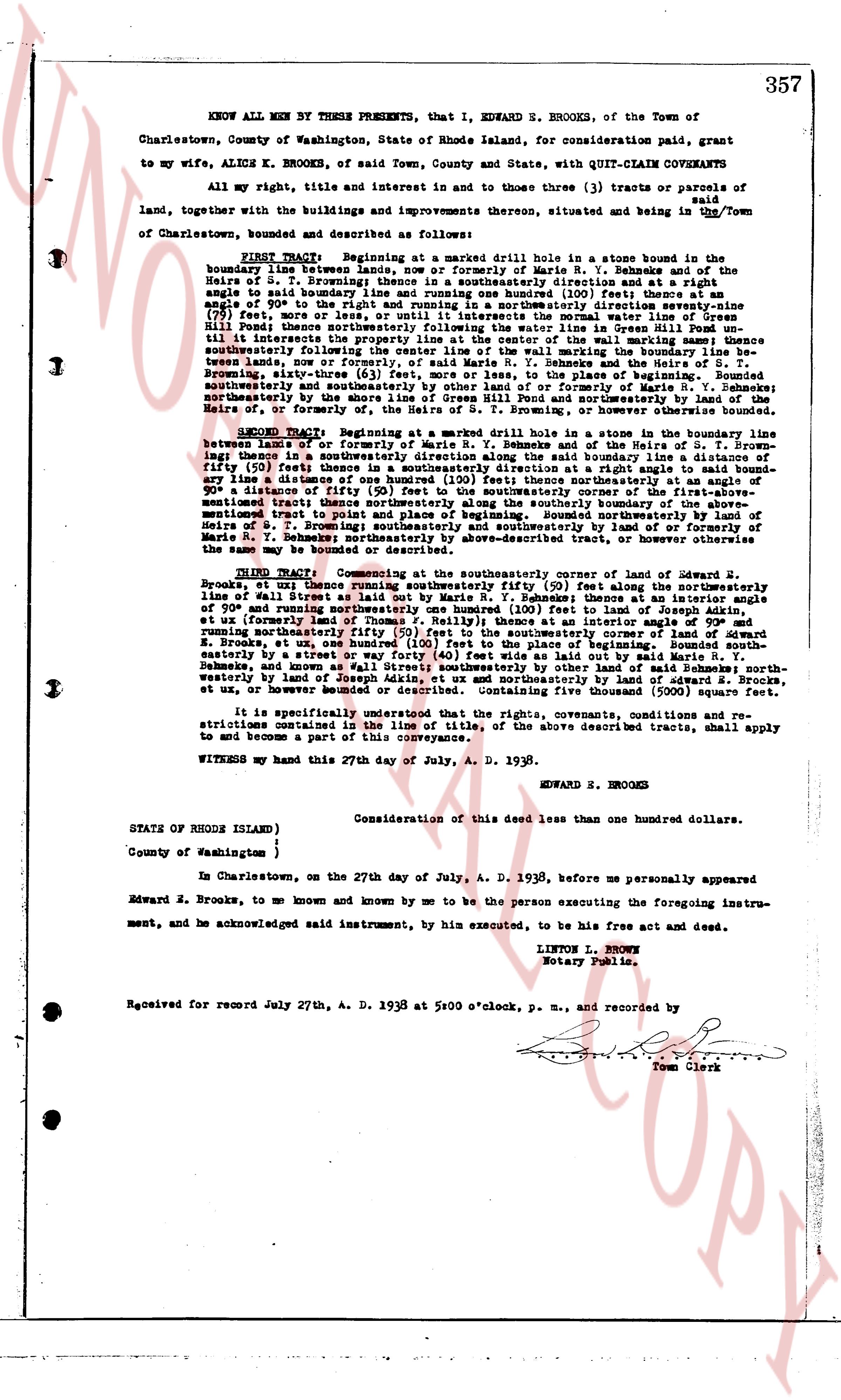
The instrument's own words
page 1
357
KNOW ALL MEN BY THESE PRESENTS, that I, EDWARD E. BROOKS, of the Town of
Charlestown, County of Washington, State of Rhode Island, for consideration paid, grant
to my wife, ALICE K. BROOKS, of said Town, County and State, with QUIT-CLAIM COVENANTS
all my right, title and interest in and to those three (3) tracts or parcels of land,
together with the buildings and improvements thereon, situated and being in the Town of
Charlestown, bounded and described as follows:
FIRST TRACT: Beginning at a marked drill hole in a stone bound in the
southwesterly corner of a lot formerly of Marie R. Y. Behekes and of the
Heirs of S. T. Browning; thence running southeasterly one hundred (100) feet thence at a
right
angle to said boundary line and running one hundred (100) feet thence at an angle of
approximately 90 degrees to the southwesterly line of the road known as "Old Post Road"
(79) feet, more or less, or until it intersects the normal water line of Green
Hill Pond; thence along said normal water line of Green Hill Pond, running south
till it intersects the property line at the center of the wall marking same; thence
southwesterly following said wall to the stone bound in the southwesterly corner of the
treads lands, now or formerly, of said Marie R. Y. Behekes and the Heirs of S.
T. Browning; thence northwesterly following the boundary line of said lands, running
southwesterly and southeasterly by other land of or formerly of Marie R. Y. Behekes;
northeasterly by the boundary line of the lands of or formerly of Marie R. Y. Behekes
Heir of, or formerly of, the Heirs of S. T. Browning, or otherwise otherwise bounded.
SECOND TRACT: Beginning at a marked drill hole in a stone in the boundary line
between lands of Edward E. Brooks and of Marie R. Y. Behekes, running south-
ing line; thence in a southeasterly direction along the said boundary line a distance of
fifty (50) feet; thence at a right angle to said boundary line and running southwesterly
any line a distance of one hundred (100) feet; thence northeasterly at an angle of
approximately 90 degrees to the boundary line forming the corner of the first-above-
mentioned tract; thence northeasterly along the southwesterly boundary line of the first-
mentioned tract to point and place of beginning; thence southeasterly by land of
Heirs of S. T. Browning; thence southwesterly by land of or formerly of Marie R. Y.
Behekes; northeasterly by the boundary line of the lands of or formerly of Marie R.
Y. Behekes; northeasterly by the above-described tract, or otherwise otherwise bounded.
THIRD TRACT: Commencing at the southeasterly corner of lot owned by Edward E.
Brooks, or uti thence running southeasterly fifty (50) feet along the northeasterly
line of street laid out in said town; thence running thereafter a distance of
909 and running northeasterly one hundred (100) feet to land of Joseph Adkin,
uti or formerly land of Marie R. Y. Behekes; thence running southwesterly a distance of
and running northeasterly fifty (50) feet to the southeasterly corner of lot owned by
Edward E. Brooks, or uti thence running southeasterly fifty (50) feet along the street
easterly by a street or way forty (40) feet wide as laid out by said Marie R. Y.
Behekes, and running northwesterly a distance of 909 feet to the point of beginning;
westerly by land of Joseph Adkin, ut ox and northeasterly by land of Edward S. Brooks,
ut ox, or users otherwise bounded or described. Containing five thousand (5000) square feet.
It is specifically provided that all the rights, covenants, conditions and re-
strictions contained in the line of title of, the above described tracts, shall apply
to and become a part of this conveyance.
WITNESS my hand this 27th day of July, A. D. 1938.
EDWARD E. BROOKS
Consideration of this deed less than one hundred dollars.
STATE OF RHODE ISLAND }
County of Washington }
In Charlestown, on the 27th day of July, A. D. 1938, before me personally appeared
Edward E. Brooks, to me known and known by me to be the person executing the foregoing instru-
ment, and he acknowledged said instrument, by him executed, to be his free act and deed.
LINTON L. BROOKS
Notary Public.
Received for record July 27th, A. D. 1938 at 5:00 o'clock, p. m., and recorded by
Town Clerk
The page as recorded