The instrument's own words
page 1 · read by Gemma vision
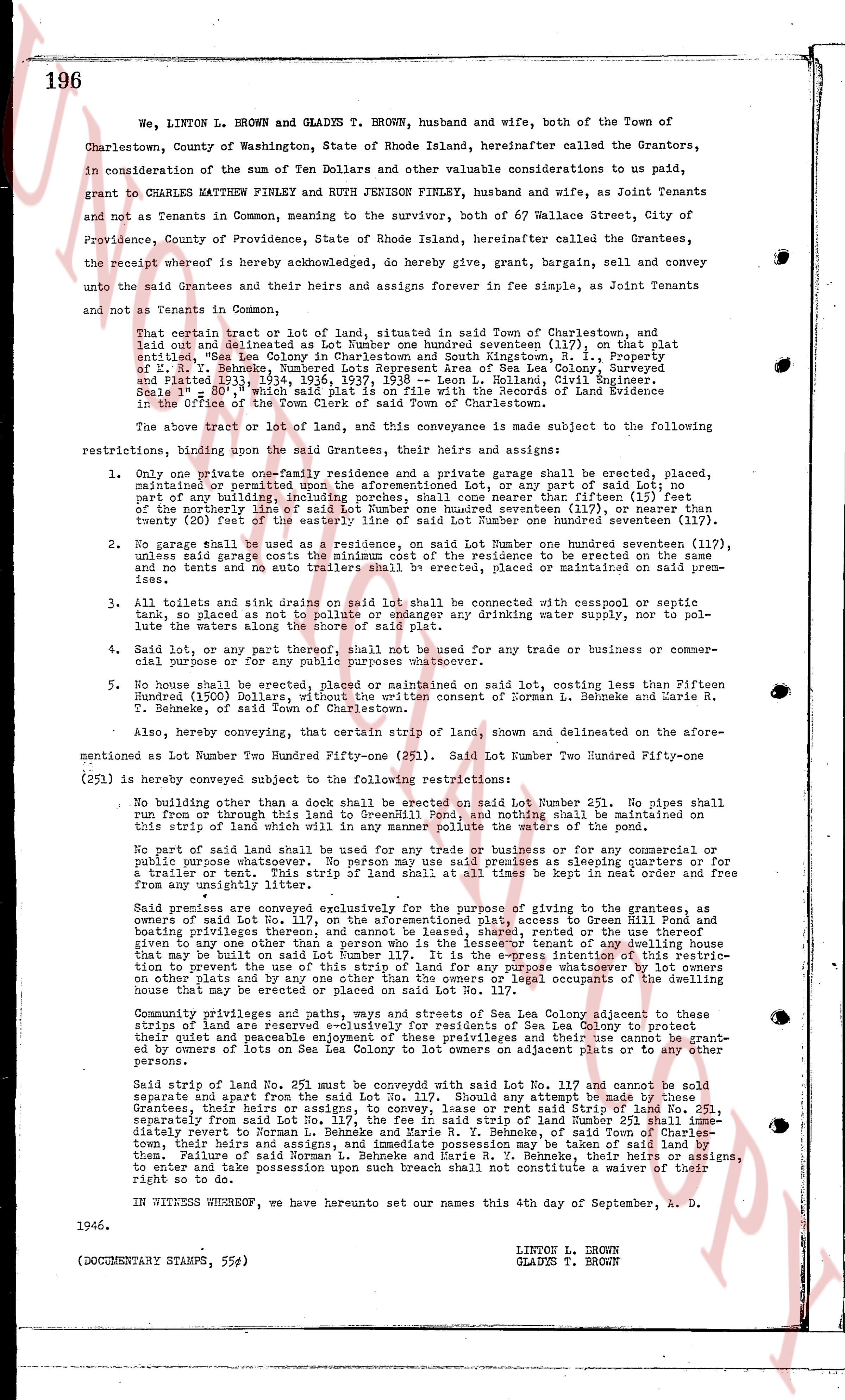
196
We, LINTON L. BROWN and GLADYS T. BROWN, husband and wife, both of the Town of Charlestown, County of Washington, State of Rhode Island, hereinafter called the Grantors, in consideration of the sum of Ten Dollars and other valuable considerations to us paid, grant to CHARLES MATTHEW FINLEY and RUTH JENISON FINLEY, husband and wife, as Joint Tenants and not as Tenants in Common, meaning to the survivor, both of 67 Wallace Street, City of Providence, County of Providence, State of Rhode Island, hereinafter called the Grantees, the receipt whereof is hereby acknowledged, do hereby give, grant, bargain, sell and convey unto the said Grantees and their heirs and assigns forever in fee simple, as Joint Tenants and not as Tenants in Common,
That certain tract or lot of land, situated in said Town of Charlestown, and laid out and delineated as Lot Number one hundred nineteen (117), on that plat annexed unto the "Sea Colony" Map of Charlestown, R. I., Prepared by E. R. V. Behnke, Numbered Lots Represent Area of Sea Lea Colony, Surveyed and Plotted July 29th, 1934, August 1935, 1937, by E. R. V. Behnke, Civil Engineer, Signed and Filed July 29th, 1934, in the Office of the Recorder of the Land Evidence in the Office of the Town Clerk of said Town of Charlestown.
The above tract or lot of land, and this conveyance is made subject to the following restrictions, binding upon the said Grantees, their heirs and assigns:
1. Only one private one-family residence and a private Garage shall be erected, placed, situated, or permitted on said lot; no other building shall be erected, or any part of said lot; no part of any building, including porches, cornices shall come nearer than fifteen (15) feet of the easterly line of said Lot Number one hundred nineteen (117), or nearer than twenty (20) feet of the easterly line of said Lot Number one hundred nineteen (117).
2. No garage shall be used as a residence, on said Lot Number one hundred nineteen (117). Unless said grant contains the right to erect a garage, no garage shall be erected on said lot and no tenants and no auto trailers shall be erected, or placed or maintained on said premises.
3. All toilets and sink drains on said lot shall be connected with cesspool or septic tank, so as not to pollute or endanger any drinking water supply, nor to pollute the waters along the shore of said plat.
4. Said lot, or any part thereof, shall not be used for any trade or business or commercial purposes whatever for any reason.
5. No house shall be erected, placed or maintained on said lot, costing less than Fifteen Hundred (1500) Dollars without the written consent of Norman L. Behnke and Marie R. Behnke, of said Town of Charlestown.
Also, hereby conveying, that certain strip of land, shown and delineated on the aforementioned Lot Number Two Hundred Fifty-one (251). Said Lot Number Two Hundred Fifty-one (251) is hereby conveyed subject to the following restrictions:
No building other than a dock shall be erected on said Lot Number 251. No pipes shall run from or through this land to Green Hill Pond, and nothing shall be maintained on this strip of land which will in any manner pollute the waters of the pond.
No part of said land shall be used for any trade or business or for any commercial or industrial purpose whatever, including but not limited to, its use as sleeping porches or for a trailer or tent. This strip of land shall at all times be kept in neat order and free from any unsightly items.
Said premises are conveyed exclusively for the purpose of giving to the grantees, as owners of said Lot No. 117, the aforementioned plat, access to Green Hill Pond and boating premises thereat, on said Lot No. 251, and the right to use the right of way given to any one other than a person who is the lessee or tenant of any dwelling house on said lot, or who may be built on said lot, in the future. No right of way shall be given or attention to the use of this strip of land for any purpose whatsoever by lot owners on other plats, and by no means shall this right of way legal occupants of the dwelling house that may be erected or placed on said Lot No. 117.
Community privileges and ways, paths and streets of Sea Lea Colony adjacent to these strips of land are reserved exclusively for residents of Sea Lea Colony to protect their peace and tranquility, and the right of way and these rights shall not be granted by owners of lots on Sea Lea Colony to lot owners on adjacent plats or to any other persons.
Said strip of land of Lot No. 251 must be conveyed with said Lot No. 117 and cannot be sold separate and apart from the said Lot No. 117. Should any attempt be made by these Grantees, their heirs and assigns, to sell said Lot No. 117, without said Strip of Land No. 251, separately from said Lot No. 117, the fee in said strip of land Number 251 shall immediately revert to Norman L. Behnke and Marie R. Behnke, and their heirs and assigns of said town, their heirs and assigns, and immediate possession may be taken of said land by them, and the right of said Norman L. Behnke and Marie R. Behnke, their heirs or assigns to enter and take possession upon such breach shall not constitute a warranty of their right to so do.
IN WITNESS WHEREOF, we have hereunto set our names this 4th day of September, A. D. 1946.
LINTON L. BROWN
GLADYS T. BROWN
(DOCUMENTARY STAMPS, 55¢)
page 2 · read by Gemma vision
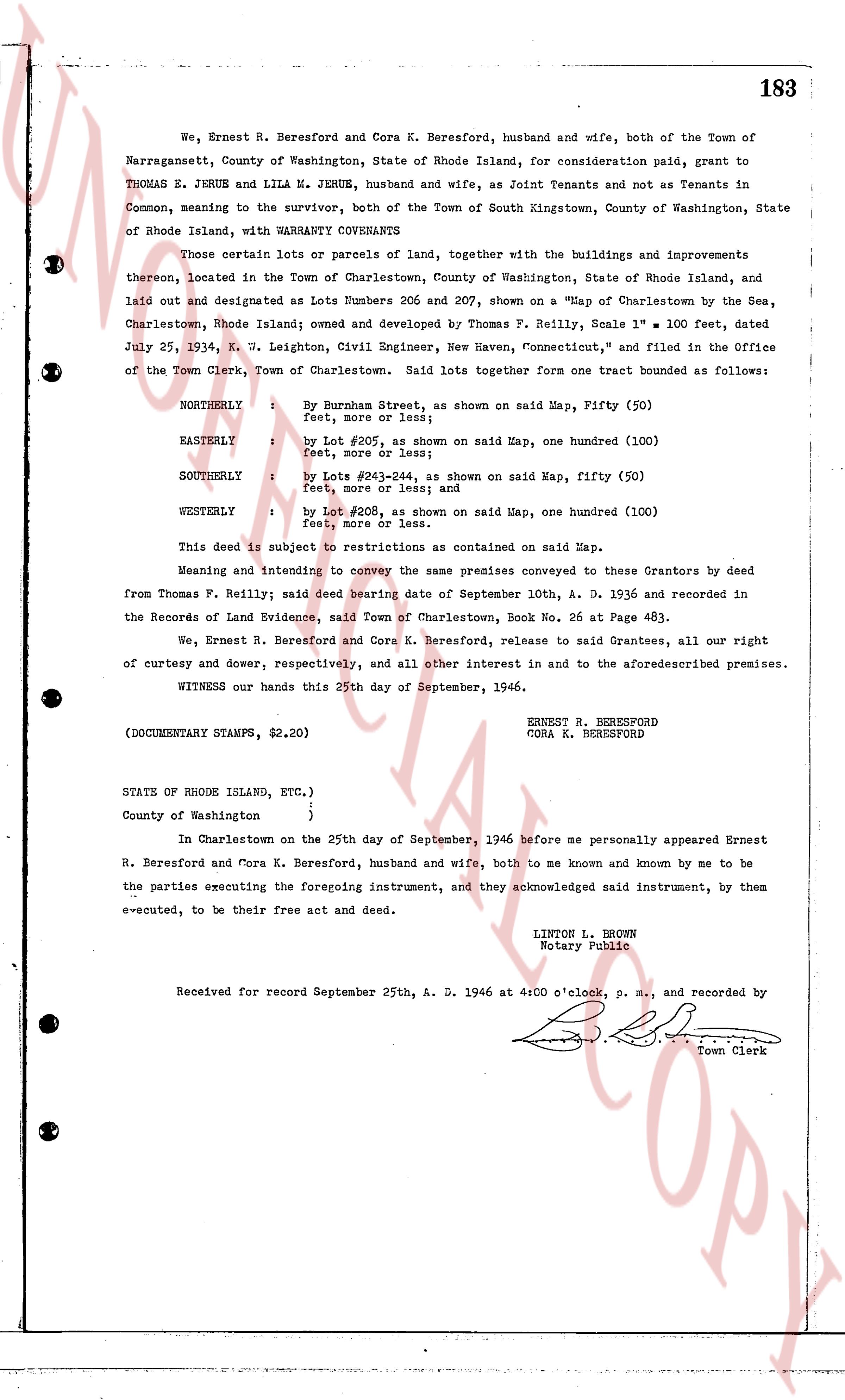
183
We, Ernest R. Beresford and Cora K. Beresford, husband and wife, both of the Town of
Narragansett, County of Washington, State of Rhode Island, for consideration paid, grant to
THOMAS E. JERUE and LILA M. JERUE, husband and wife, as Joint Tenants and not as Tenants in
Common, meaning to the survivor, both of the Town of South Kingstown, County of Washington, State
of Rhode Island, with WARRANTY COVENANTS
Those certain lots or parcels of land, together with the buildings and improvements
thereon, located in the Town of Charlestown, County of Washington, State of Rhode Island, and
laid out and designated as Lots Numbers 206 and 207, shown on a "Map of Charlestown by the Sea,
Charlestown, Rhode Island; owned and developed by Thomas F. Reilly, Scale 1" = 100 feet, dated
July 25, 1934, K. J. Leighton, Civil Engineer, New Haven, Connecticut," and filed in the Office
of the Town Clerk, Town of Charlestown. Said lots together form one tract bounded as follows:
NORTHERLY : by Burness Street, as shown on said Map, Fifty (50)
feet, more or less; and
EASTERLY : by Lot #205, as shown on said Map, one hundred (100)
feet, more or less; and
SOUTHERLY : by Lots #243-244, as shown on said Map, fifty (50)
feet, more or less; and
WESTERLY : by Lot #206, as shown on said Map, one hundred (100)
feet, more or less.
This deed is subject to restrictions as contained on said Map.
Meaning and intending to convey the same premises conveyed to these Grantors by deed
from Thomas F. Reilly; said deed bearing date of September 10th, A. D. 1936 and recorded in
the Records of Land Evidence, said Town of Charlestown, Book No. 26 at Page 483.
We, Ernest R. Beresford and Cora K. Beresford, release to said Grantees, all our right
of curtesy and dower, respectively, and all other interest in and to the aforesaidescribed premises.
WITNESS our hands this 25th day of September, 1946.
ERNEST R. BERESFORD
CORA K. BERESFORD
(DOCUMENTARY STAMPS, $2.20)
STATE OF RHODE ISLAND, ETC.)
)
County of Washington )
In Charlestown on the 25th day of September, 1946 before me personally appeared Ernest
R. Beresford and Cora K. Beresford, husband and wife, both to me known and known by me to be
the parties executing the foregoing instrument, and they acknowledged said instrument, by them
be executed, to be their free act and deed.
LINTON L. BROWN
Notary Public
Received for record September 25th, A. D. 1946 at 4:00 o'clock, p. m., and recorded by [?]
Town Clerk
The page as recorded