The instrument's own words
page 1
(119)
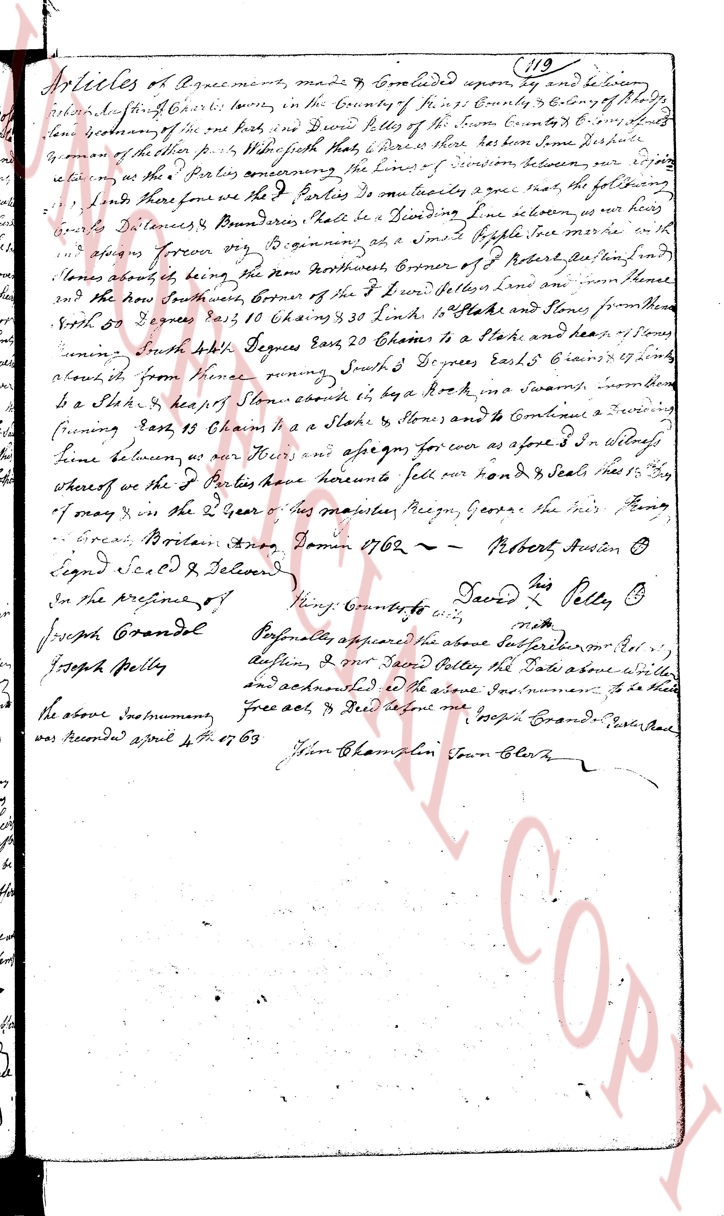
Articles of Agreement, made & Concluded upon, by & between
John Austin Sherriff of the town of Kingstown in the County of Kent & Colony of Rhode
Island governor of the one part, and David Pelles of the town Kent in the County of Kent
governor of the other part; as follows Which said Parties here have done Perpendicular
ly agree, to the following Parties, the lines of division between our respective
lands so the Parties agreeing that we the Parties do mutually agree that, the following
bounds Boundaries, that shall be a Dividing line in between us not her
after to move forever now Beginning at, a small Apple tree mark with the
initials of both, being the North West corner of Robert Postle's land being
in the North South West corner of the land of David Pelles and from there
South 80 Degrees East, 18 Chains & 30 Links to a Stake and Stones and from there
South 40 Degrees East, 20 Chains to a Stake and heap of Stones
running South 40 Degrees East, 20 Chains to a Stake and heap of Stones
about from hence running South 3 Degrees East, 6 chains & 7 links
to a Stake & heap of Stones about by, a Rock in a swamp, and from there
running East, 13 Chains to a Stake & Stones and to Conjoin a Dividing
line between us, and our Heirs and assigns for ever as aforesaid In Witness
whereof we the Parties have hereunto set our Hands & Seals this 15th Day
of May & in the 2nd Year of his Majesties Reign, George the First King
of Great Britain Anno Domini 1762 ~ Robert Austin [seal]
Signed Sealed & Delivered David Pelles [seal]
In the presence of Henry Comber to wit:
Joseph Grandol Personally appeared the above Subscribers mr Robt
Joseph Pelles Austin, & mr David Pelles the Date above written
and acknowledged in the above Instrument to be their
the above Instrument, free act & Deed before me
was recorded april 4th 1763 Joseph Grandol Justice of the Peace
Wm Champlin Town Clerk
The page as recorded