The instrument's own words
page 1 · read by Gemma vision
150
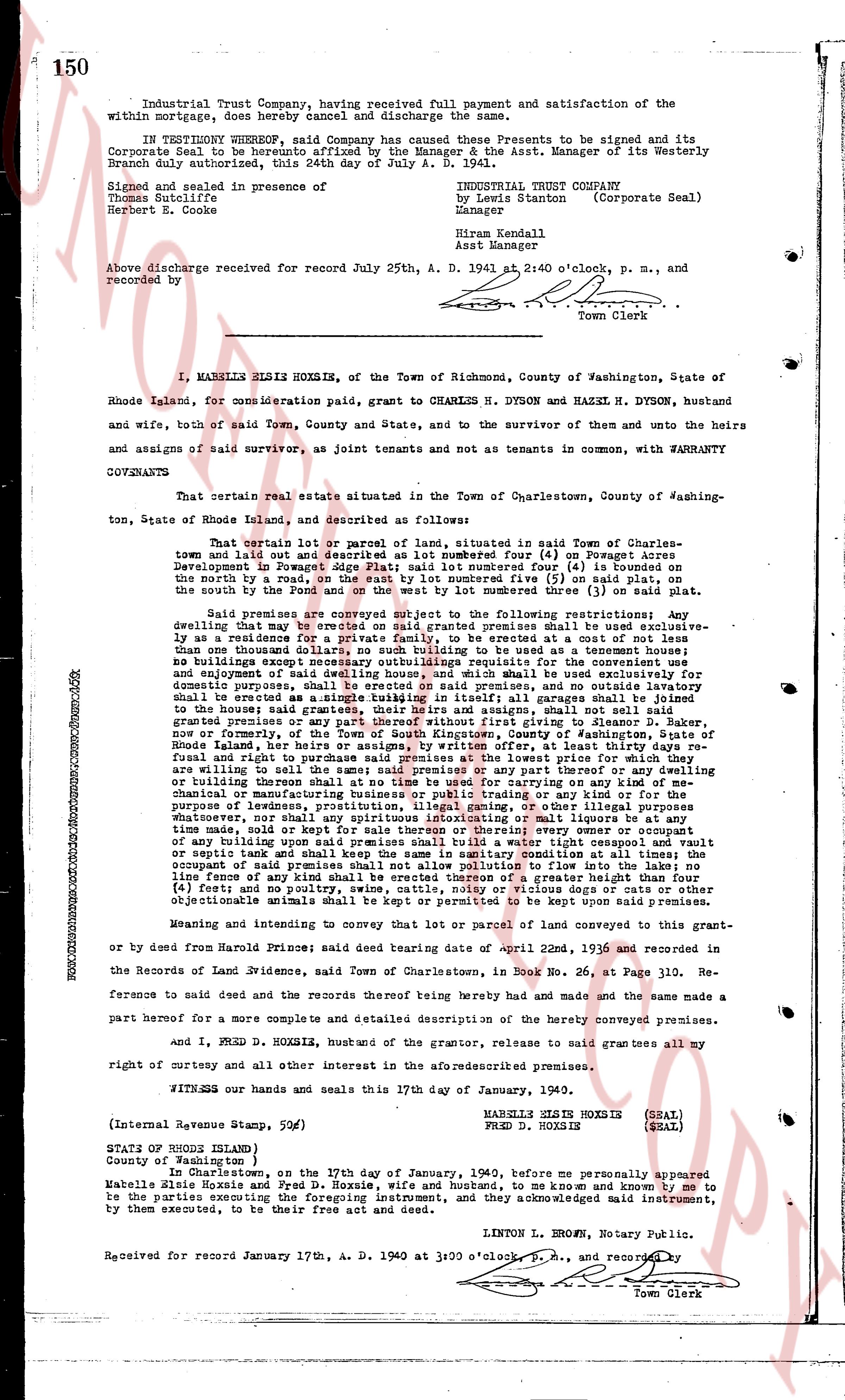
Industrial Trust Company, having received full payment and satisfaction of the within mortgage, does hereby cancel and discharge the same.
IN TESTIMONY WHEREOF, said Company has caused these Presents to be signed and its Corporate seal to be affixed. Signed, sealed and delivered by Asst. Manager of its Westerly Branch duly authorized, this 24th day of July A. D. 1941.
Signed and sealed in presence of
Thomas S. Hall
Herbert E. Cooke
INDUSTRIAL TRUST COMPANY
by Lewis Stanton (Corporate Seal)
Manager
Hiram Kendall
Asst Manager
Above discharge received for record July 25th, A. D. 1941 at 2:40 o'clock, p. m., and recorded by
[Signature]
Town Clerk
----
I, MABELLE ELSIE HOXSIE, of the Town of Richmond, County of Washington, State of Rhode Island, for consideration paid, grant to CHARLES H. DYSON and HAZEL H. DYSON, husband and wife, both of said Town, County and State, and to the survivor of them and unto the heirs and assigns of said survivor, as joint tenants and not as tenants in common, with WARRANTY COVENANTS
That certain real estate situated in the Town of Charlestown, County of Washington, State of Rhode Island, and described as follows:
That certain lot or parcel of land marked number four (4), located in said Town of Charlestown and laid out in a plat recorded in book four (4) on Pages seventy (70) and seventy-one (71) Development in Fawcett's Edge plat; said lot numbered four (4) is bounded on the north by a road 60 feet wide, on the east by lot number five (5) on said plat, on the south by the Pound and on the west by lot numbered three (3) on said plat.
Said premises are conveyed subject to the following restrictions: Any dwelling that may be erected on said granted premises shall be used exclusively as a residence for the owner and his family, and shall not be used as a hotel, boarding house or any house that one thousand dollars, no building such as to be used as a tenement house; no buildings except one dwelling house shall be erected on said premises for the convenient employment and enjoyment of said dwelling house, and which shall be used exclusively for domestic purposes such as a garage, greenhouse, greenhouse, and outbuildings shall be erected as a single tubing installation in first parcels all garages shall be joint tenants and not as tenants in common, with WARRANTY COVENANTS. No building shall be granted premises or any part thereof without first giving to Eleanor D. Maker, any person or persons who may be the owner of the adjoining lot of land in the State of Rhode Island, her heirs or assigns, by written offer, at least thirty days reasonable notice of the purchase and premises at the lowest price for which she and her heirs are willing to sell the said adjoining lot or any part thereof or any building or building thereon shall at no time be used for carrying on any kind of the manufacture of chemicals, explosives, refining oil or any other business or industry for the purpose of legumes, prostitution, illegal gaming, or other illegal purposes whatever; no animal of any kind shall be kept on said premises except for the purpose of time made, sold or kept for sale thereon or whether every owner or occupant of any such building shall be responsible for the same. No fence or wall shall be built or septic tank and shall keep the same in sanitary condition at all times; the pomieszczenie shall be limited to a height of 10 feet. No fence of any kind shall be erected of a greater height than four (4) feet, without the written consent of the adjoining lot or lots, and no other objectionable animals shall be kept or permitted to be kept upon said premises.
Meaning and intending to convey that lot or parcel of land conveyed to this grantor and or by deed from Harold Prine; said deed bearing date of April 22nd, 1936, and recorded in the Records of Land Evidence, said Town of Charlestown, in Book No. 26, at Page 310. Reference to said deed and the records thereof being hereby made and the same made a part hereof for a more complete and detailed description of the hereby conveyed premises.
and I, FRED D. HOXSIE, husband of the grantor, release to said grantees all my right of curtesy and all other interest in the aforesaid premises.
WITNESS our hands and seals this 17th day of January, 1940.
MABELLE ELSIE HOXSIE (SEAL)
FRED D. HOXSIE (SEAL)
(Internal Revenue Stamp, 59c)
STATE OF RHODE ISLAND
County of Washington )
In Charlestown, on the 17th day of January, 1940, before me personally appeared Mabelle Elsie Hoxsie and Fred D. Hoxsie, husband and husband, to me known and known to me to be the parties signing and executing the foregoing instrument, and they acknowledged said instrument, by them executed, to be their free act and deed.
LINTON L. BROWN, Notary Public.
Received for record January 17th, A. D. 1940 at 3:00 o'clock, p. m., and recorded by
[Signature]
Town Clerk
The page as recorded