The instrument's own words
page 1 · read by Gemma vision
180
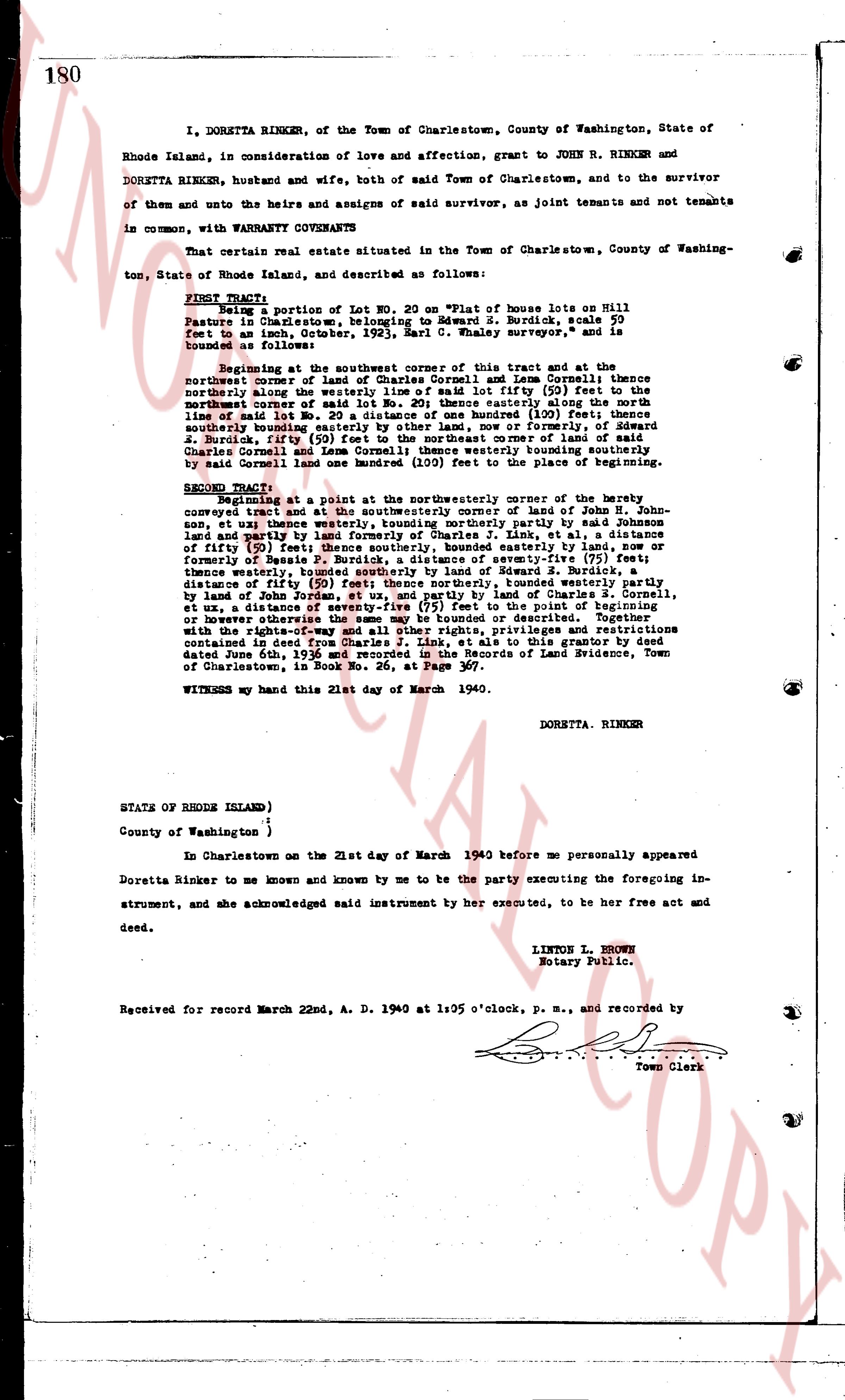
I, DORETTA RINKER, of the Town of Charlestown, County of Washington, State of Rhode Island, in consideration of love and affection, grant to JOHN R. RINKER and DORETTA RINKER, husband and wife, both of said Town of Charlestown, and to the survivor of them and unto the heirs and assigns of said survivor, as joint tenants and not tenants in common, with WARRANTY COVENANTS
That certain real estate situated in the Town of Charlestown, County of Washington, State of Rhode Island, and described as follows:
FIRST TRACT: Being a portion of Lot NO. 20 on "Plat of house lots on Hill Pasture in Charlestown," belonging to Edward S. Burdick, scale 50 feet to an inch, dated October, 1923, said E. Burdick surveyor and is bounded as follows:
Beginning at the Southeast corner of said tract and at the northeast corner of land of Charles Cornell and Leon Cornell thence northerly along the westerly line of said lot fifty (50) feet to the northeast corner of said Lot no. 20; thence easterly along the northeast line of said lot one hundred (100) feet; thence southerly one hundred (100) feet; thence southerly bounding easterly by other land, now or formerly of Edward S. Burdick fifty (50) feet to the southeast corner of land of said Charles Cornell and Leon Cornell thence westerly bounding southerly by said Cornell land one hundred (100) feet to the beginning of southerly
SECOND TRACT: Beginning at a point at the northeasterly corner of the boundary conveyed hereat and at the southeasterly corner of land of John H. Johnson, et ux; thence westerly, bounding northerly part by said Johnson land and really [?] distance of one hundred (100) feet, et al, a distance of fifty (50) feet; thence southerly, bounded easterly by land, now or formerly of Bessie J. Burdick, a distance of seventy-five (75) feet; thence westerly, bounding northerly part by land of Edward S. Burdick, a distance of fifty (50) feet; thence northerly, bounded westerly partly by land of John H. Johnson, and partly by land of Charles S. Cornell, by land of John H. Johnson, a distance of seventy-five (75) feet to the point of beginning or however otherwise described or described. Together with the rights-of-way and all other rights, privileges and restrictions contained in deed from Edward S. Burdick to said tract dated June 6th, 1936 and recorded in the Records of Land Evidence, Town of Charlestown, in Book No. 26, at Page 367.
WITNESS my hand this 21st day of March 1940.
DORETTA RINKER
STATE OF RHODE ISLAND)
County of Washington )
In Charlestown on the 21st day of March 1940 before me personally appeared Doretta Rinker to me known and known by me to be the party executing the foregoing instrument, and she acknowledged said instrument by her executed, to be her free act and deed.
LINTON L. BROWN
Notary Public.
Received for record March 22nd, A. D. 1940 at 1:05 o'clock, p. m., and recorded by
Town Clerk
The page as recorded