The instrument's own words
page 1 · read by Gemma vision
696
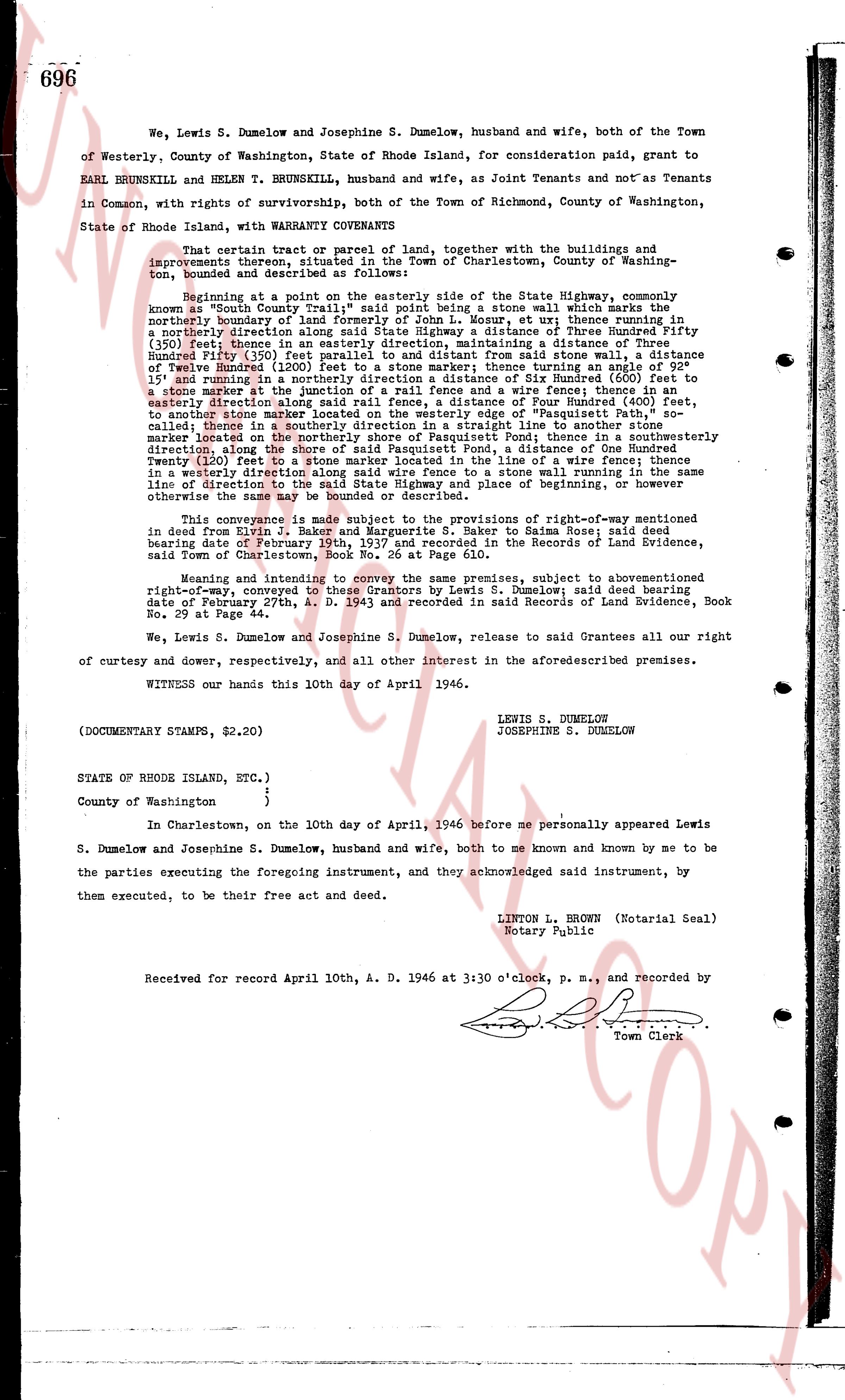
We, Lewis S. Dumelow and Josephine S. Dumelow, husband and wife, both of the Town of Westerly, County of Washington, State of Rhode Island, for consideration paid, grant to EARL BRUNSKILL and HELEN T. BRUNSKILL, husband and wife, as Joint Tenants and not as Tenants in Common, with rights of survivorship, both of the Town of Richmond, County of Washington, State of Rhode Island, with WARRANTY COVENANTS
That certain parcel or tract of land, together with the buildings and improvements thereon, situated in the Town of Charlestown, County of Washington, bounded and described as follows:
Beginning at a point on the easterly side of the State Highway, commonly known as "South County Trail", said point being a stone wall which marks the northerly boundary of land formerly of John L. Moser, et ux; thence running in a northerly direction on the said boundary, a distance of Three Hundred and Fifty (350) feet; thence in an easterly direction, maintaining a distance of Three Hundred and Fifty (350) feet from the said highway, to a stone wall; thence southerly a distance of Twelve Hundred (1200) feet to a stone marker; thence running at an angle of 92 1/2 degrees measured to the east, in an easterly direction Six Hundred (600) feet to a stone marker at the junction of a rail fence and a wire fence; thence fencing in an easterly direction Three Hundred and Fifty (350) feet to a rail fence; thence northerly, to another stone marker on the westerly edge of "Pasquetish Pond", shoa- called; thence in a southerly direction in a straight line to another stone marker located on the shore of the said Pasquetish Pond, a distance of One Hundred feet; thence in a southerly direction, along the shore of said Pasquetish Pond, a distance of One Hundred Twenty (120) feet to a stone wall; thence running in the line of a wire fence easterly a distance of One Hundred (100) feet to a stone wall running in a southerly direction along said wire fence to a stone wall running in the same line direction to the point of beginning or otherwise the same may be bounded or described.
This conveyance is made subject to the provisions of right-of-way mentioned in deed dated from Sept. 1, 1921, from Lewis S. Dumelow to Saima Rose; said deed bearing date of February 20th, 1937 and recorded in the Records of Land Evidence, said Town of Charlestown, Book No. 66 at Page 610.
Meaning and intending to convey the above described premises, subject to abovementioned right-of-way, conveyed to these Grantors by Lewis S. Dumelow; said deed bearing date of February 27th, A. D. 1943 and recorded in said Records of Land Evidence, Book No. 66 at Page 64.
We, Lewis S. Dumelow and Josephine S. Dumelow, release to said Grantees all our right of curtesy and dower, respectively, and all other interest in the aforementioned premises.
WITNESS our hands this 10th day of April 1946.
LEWIS S. DUMELOW
JOSEPHINE S. DUMELOW
(DOCUMENTARY STAMPS, $2,20)
STATE OF RHODE ISLAND, ETC.)
County of Washington }
In Charlestown, on the 10th day of April, 1946 before me personally appeared Lewis S. Dumelow and Josephine S. Dumelow, husband and wife, both to me known and known by me to be the parties executing the foregoing instrument, and they acknowledged said instrument, by them executed, to be their free act and deed.
LINTON L. BROWN (Notarial Seal)
Notary Public
Received for record April 10th, A. D. 1946 at 3:30 o'clock, p. m., and recorded by
[Signature]
Town Clerk
The page as recorded