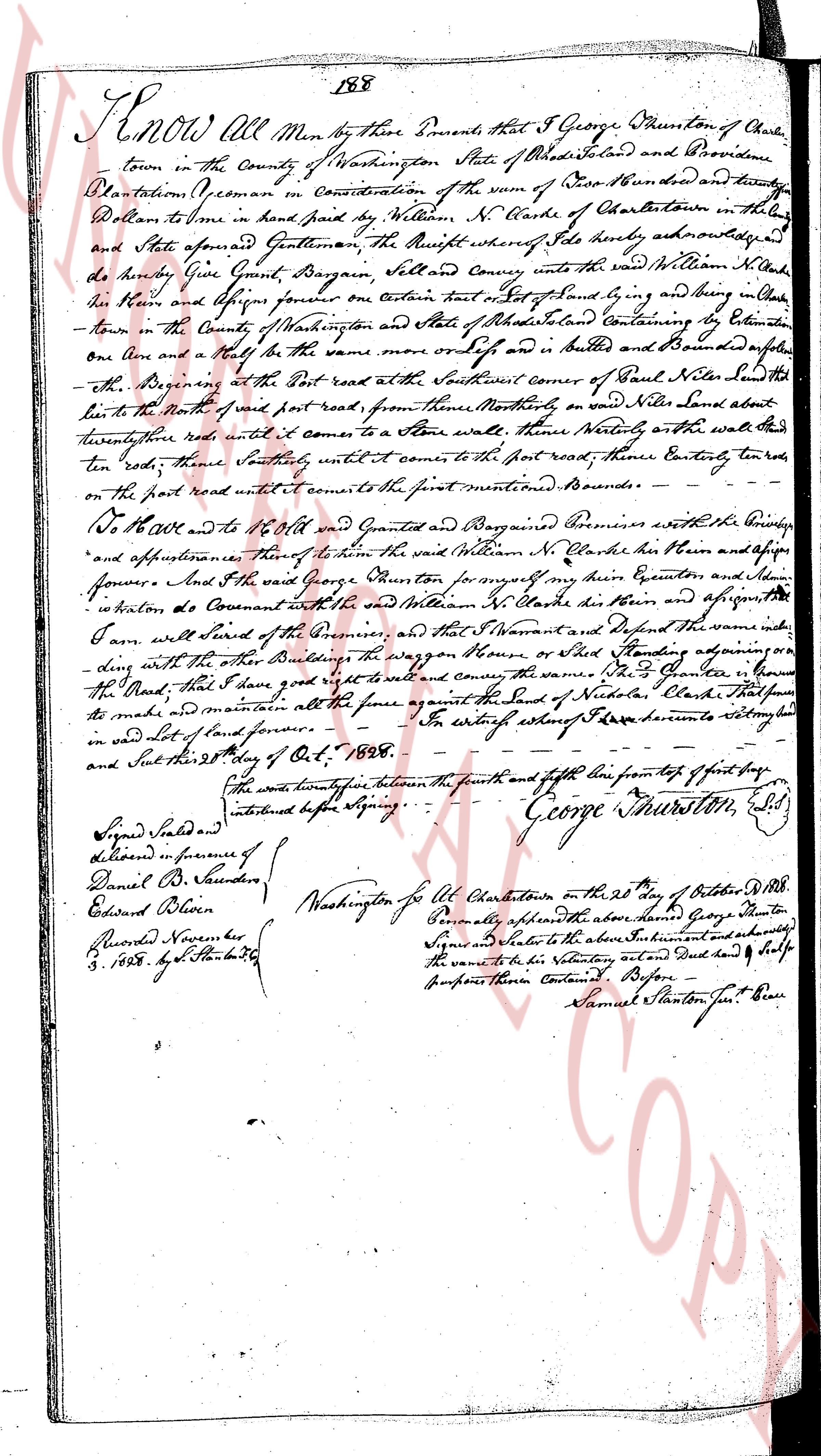
The instrument's own words
page 1
188
Know all Men by these Presents that I George Townsend of Charlestown
town in the County of Washington State of Rhode Island and Providence
Plantation (a freeman in Consideration of the sum of Five Hundred and twenty
Dollars to me in hand paid by William N. Clarke of Charlartown in the
said State aforesaid Gentleman the Receipt whereof I do hereby acknowledge
do hereby Give Grant Bargain Sell and convey unto the said William N. Clarke his
Heirs and assigns forever One certain tract of land lying and being in Charl
town in the County of Washington and State of Rhode Island containing by Estimation
One Acre and a half be the same more or less of and in Butters and Bounded as follows
Beginning at the Post road at the Southwest corner of Plot Near Silds Land South
hence to the North of said post road, from thence Northerly on said Nilds Land about
twenty three rods until it comes to a Stone wall thence Westerly on the said wall
ten rods, thence Southerly, until it comes to the post road, thence Easterly twenty
rods on the post road until it comes to the first mentioned Boundary.
Do have and to hold and Grant and Bargain Premises with all the Privileges
and appurtenances thereof to the said William N. Clarke his Heirs and assigns
forever And I the said George Townsend for myself my Heirs Executors and ad
ministrators do Covenant with the said William N. Clarke his Heirs and assigns
that I will warrant with the boundaries of the Premises and that I Servant and Defend the same unto
the said William N. Clarke his Heirs and assigns forever
long with all the other Buildings the wagon House or Shed standing upon or
The Mark, that I have good right to sell and convey the same To the Grantee or his
heirs make and maintain all the fence against the South of Nickels Clarke that shall be
in said lot of Land forever. In witness whereof I have hereunto set my hand and
seal this 28th day of Oct. 1828.
The words twenty four between the seventh and eighth line from top of first page
instituted before Signing.
George Townsend, L.S.
Signed Sealed and
Delivered in presence of
Daniel B. Saunders
Edward Oliven
Recorded November
3, 1828 by S. Stanton Cl.
Washington for Ct Charlestown on the 28th day of October 1828.
Personally appeared before me the above named George Townsend
Signed and sealed to the above Instrument and acknowledged
the same to be his Voluntary act and deed for the
purposes therein Contained Before
Samuel Stanton Jur. Peace
The page as recorded