The instrument's own words
page 1 · read by Gemma vision
216
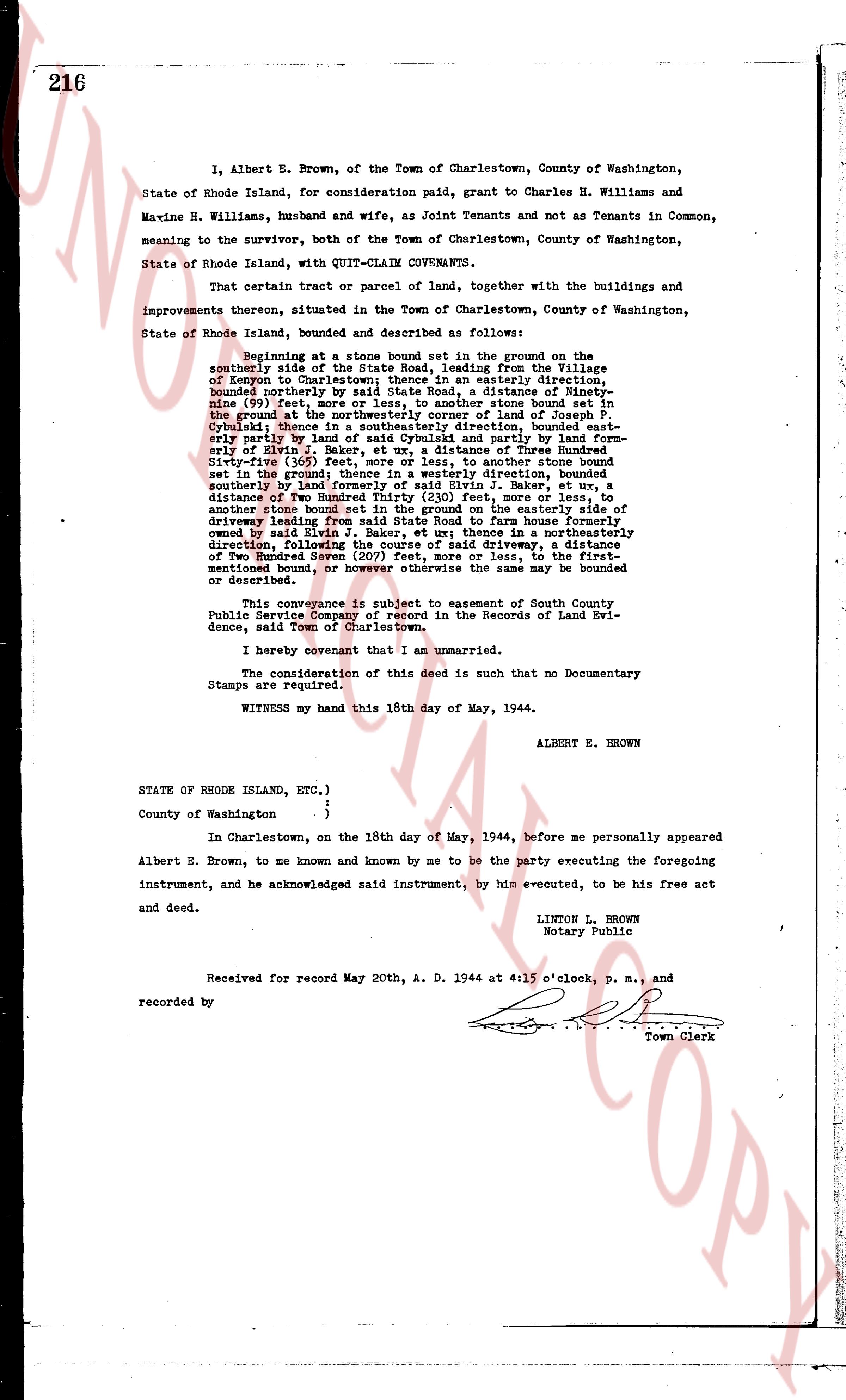
I, Albert E. Brown, of the Town of Charlestown, County of Washington, State of Rhode Island, for consideration paid, grant to Charles H. Williams and Maxine H. Williams, husband and wife, as Joint Tenants and not as Tenants in Common, meaning to the survivor, both of the Town of Charlestown, County of Washington, State of Rhode Island, with QUIT-CLAIM COVENANTS.
That certain tract or parcel of land, together with the buildings and improvements thereon, situated in the Town of Charlestown, County of Washington, State of Rhode Island, bounded and described as follows:
Beginning at a stone bound set in the ground on the southerly side of the State Road, leading from the Village of Fogland to Charlestown, running in a westerly direction, bounded northerly by said State Road, a distance of Ninety-nine (99) feet, more or less, to another stone bound set in the ground at the north east corner of land of Joseph J. Cybulski; thence in a southeasterly direction, bounded east partly by land of Joseph J. Cybulski and partly by land formerly of Elvin G. Baker, ut a distance of three Hundred Eighty-five (385) feet, more or less, to another stone bound set in the ground thence in a westerly direction, bounded southeasterly by land formerly of Elvin G. Baker, ut a distance of Two Hundred Thirty (230) feet, more or less, to another stone bound set in the ground on the easterly side of driveway leading from said State Road to farm house formerly owned by said Elvin G. Baker; thence in a northerly direction, following the course of said driveway, a distance of Two Hundred Seven (207) feet, more or less, to the first-mentioned bound, more or less, the areas thus may be bounded or described.
This conveyance is subject to easement of South County Public Service Company of record in the Records of Land Evidence, said Town of Charlestown.
I hereby covenant that I am unmarried.
The consideration of this deed is such that no Documentary Stamps are required.
WITNESS my hand this 18th day of May, 1944.
ALBERT E. BROWN
STATE OF RHODE ISLAND, ETC.)
County of Washington }
{
In Charlestown, on the 18th day of May, 1944, before me personally appeared Albert E. Brown, to me known and known by me to be the party executing the foregoing instrument, and he acknowledged said instrument, by his executed, to be his free act and deed.
LINTON L. BROWN
Notary Public
Received for record May 20th, A. D. 1944 at 4:15 o'clock, p. m., and recorded by [?] Town Clerk
The page as recorded