The instrument's own words
page 1 · read by Gemma vision
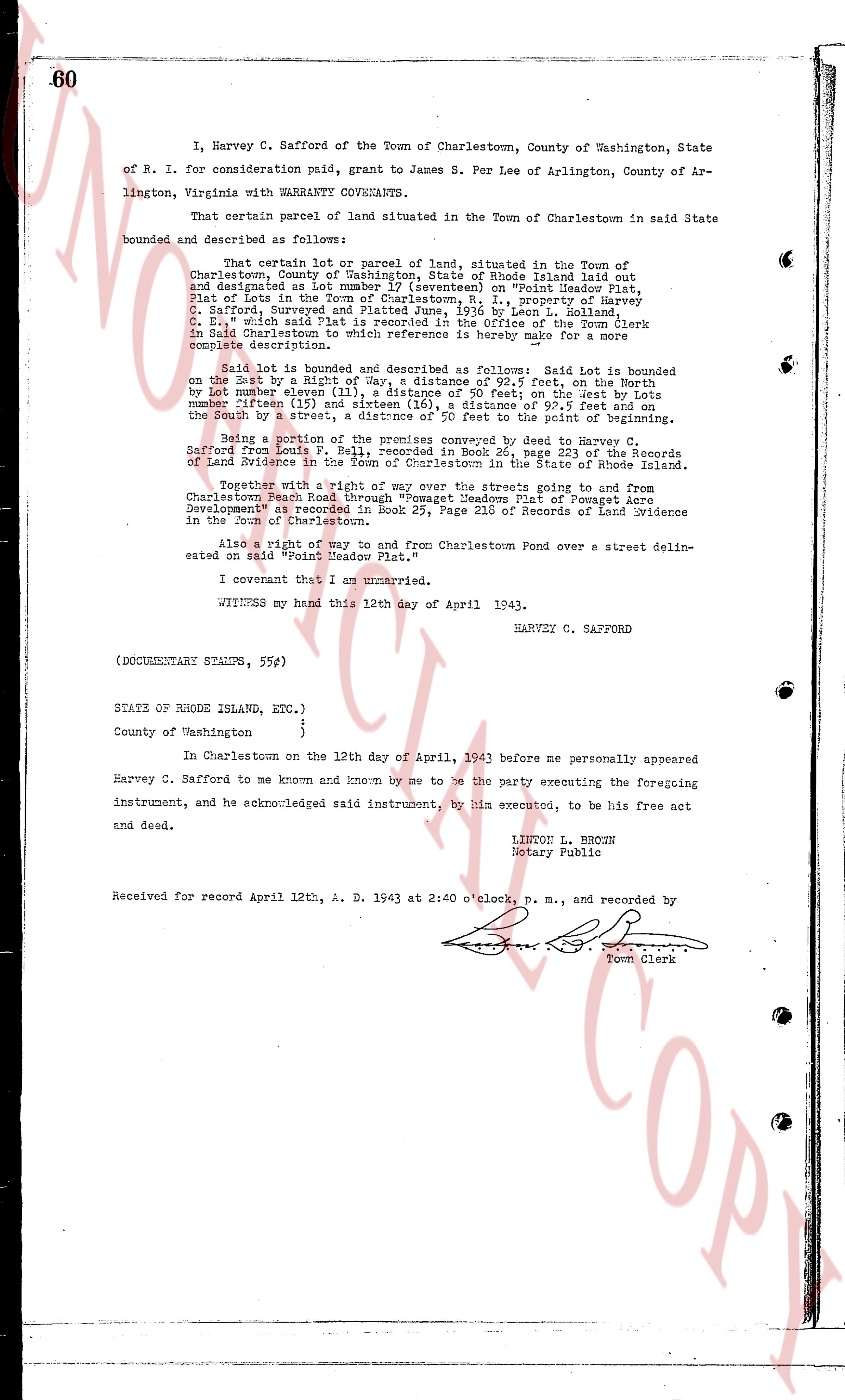
60
I, Harvey C. Safford of the Town of Charlestown, County of Washington, State of R. I. for consideration paid, grant to James S. Per Lee of Arlington, County of Arlington, Virginia with WARRANTY COVENANTS,
That certain parcel of land situated in the Town of Charlestown in said State bounded and described as follows:
That certain lot or parcel of land, situated in the Town of Charlestown, County of Washington, State of Rhode Island, laid out and designated as lot number 17 (seventeen) on "Point Meadow Plat, Plat of Lots in the Town of Charlestown, R. I., property of Harvey C. Safford, Recorded in Book 24, page 196 by Leon C. Holland, C. E." which said Plat is recorded in the Office of the Town Clerk in said Charlestown to which reference is hereby made for a more complete description.
Said lot is bounded and described as follows: Said Lot is bounded on the East by a straight line, way a distance of 92.5 feet, on the North by lot number eleven (11) 40 feet, and on the West by lots number fifteen (15) and sixteen (16), a distance of 92.5 feet and on the South by the street, a straight line back to the point of beginning.
Being a portion of the premises conveyed by deed to Harvey C. Safford from Louis P. Bell, recorded in Book 26, page 223 of the Records of Land Evidence in the State of Rhode Island.
Together with a right of way over the streets going to and from Charlestown Beach Road through "Pomagnet Meadows Plat of Pomagnet Acre Developments" recorded in Book 25, Page 218 of Records of Land Evidence in the Town of Charlestown.
Also a right of way to and from Charlestown Pond over a street delineated on said "Point Meadow Plat."
I covenant that I am unmarried.
WITNESS my hand this 12th day of April 1943.
HARVEY C. SAFFORD
(DOCUMENTARY STAMPS, 55¢)
STATE OF RHODE ISLAND, ETC.)
)
County of Washington )
In Charlestown on the 12th day of April, 1943 before me personally appeared Harvey C. Safford to me known and known by me to be the party executing the foregoing instrument, and he acknowledged said instrument, by him executed, to be his free act and deed.
LINTON L. BROWN
Notary Public
Received for record April 12th, A. D. 1943 at 2:40 o'clock, p. m., and recorded by [?]
Town Clerk
The page as recorded