The instrument's own words
page 1 · read by Gemma vision
691
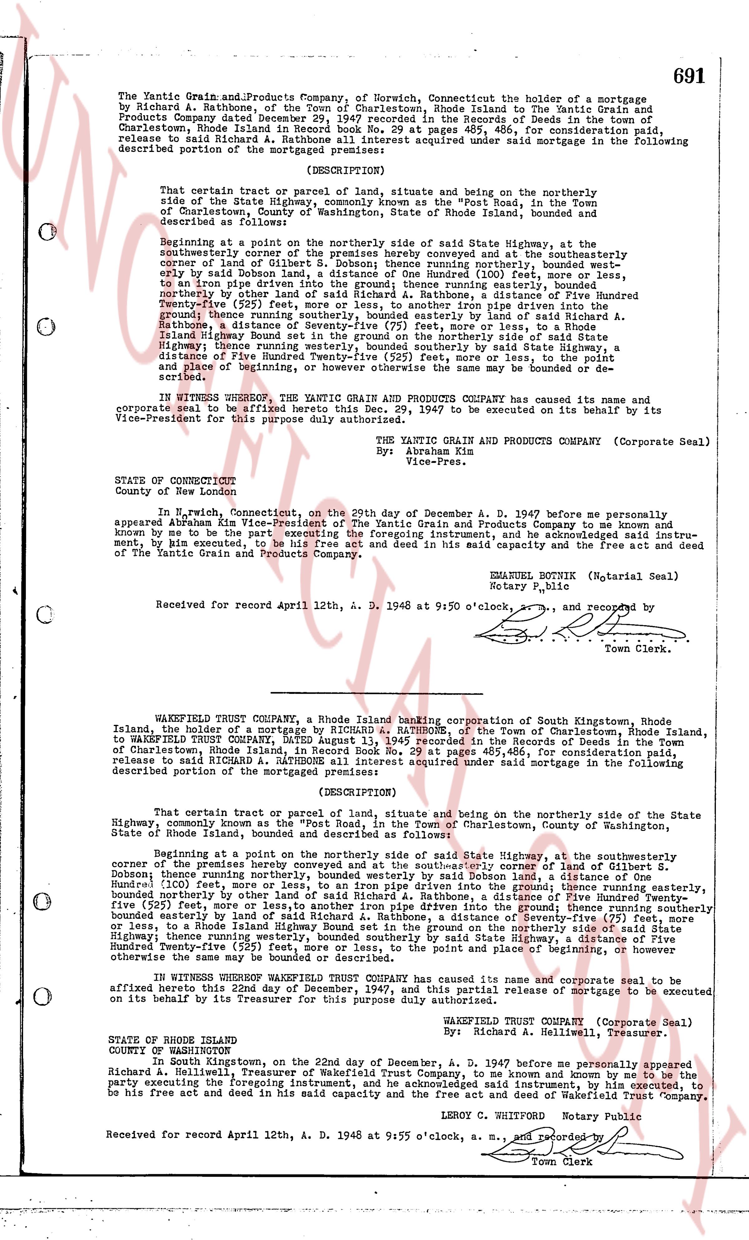
The Yantic Grain and Products Company, of Norwich, Connecticut the holder of a mortgage
by Richard A. Rathbone, of the Town of Charlestown, Rhode Island land-evidence book 29
Products Company dated December 18, 1947 contained in the records of Deeds in the records of
Charlestown, Rhode Island in Record book No. 29 at pages 485, 486, for consideration paid,
release to said Richard A. Rathbone all interest acquired under said mortgage in the following
described portion of the mortgaged premises:
(DESCRIPTION)
That certain tract or parcel of land, situate and being on the northerly side of the
State Highway, commonly known as the "Post Road", in the Town of Charlestown, County of
State of Rhode Island, Town of Charlestown, County of Washington, State of Rhode Island,
and described as follows:
Beginning at a point on the northerly side of said State Highway, at the
southwesterly corner of the premises hereby conveyed and goes at the southeasterly
corner of land of Gilbert S. Dobson; thence running northerly, bounded west by
early by said land of Gilbert S. Dobson, a distance of One Hundred (100) feet, running to
an iron pipe driven into the ground; thence running easterly, bounded south,
northerly by other land of said Richard A. Rathbone, a distance of One Hundred Fifty
Twenty-five (525) feet, more or less, to an other iron pipe driven into the ground;
thence running southerly, bounded easterly by land of said Richard A. Rathbone, a distance of
Rathbone, a distance of Seventy-five (75) feet, more or less, to a Rhode Island
Highway, bounded west by other land of said Richard A. Rathbone, northerly side of said State
Highway; thence running westerly, bounded south by said State Highway, a
distance of One Hundred Twenty-five (525) feet, more or less, to the point and place of beginning,
or however the same may be named or be described.
IN WITNESS WHEREOF, THE YANTIC GRAIN AND PRODUCTS COMPANY HAS caused its name and
corporate seal to be affixed here to this Decy. 29, 1947 and executed on its behalf by its
Vice-President for this purpose duly authorized.
THE YANTIC GRAIN AND PRODUCTS COMPANY (Corporate Seal)
By: Abraham Kim
Vice-Pres.
STATE OF CONNECTICUT
County of New London
In N. Norwich, Connecticut, on the 29th day of December A. D. 1947 before me personally
appeared Abraham Kim Vice-President of The Yantic Grain and Products Company and to me known
and by me to be the party executing the foregoing instrument, and he acknowledged said instru-
ment, by him executed, to be his free act and deed in his said capacity and their free act and deed
of The Yantic Grain and Products Company.
EMMANUEL BOUTIN (Notarial Seal)
Notary Public
Received for record April 12th, A. D. 1948 at 9:50 o'clock, [?] and recorded by
Town Clerk.
----
WAKEFIELD TRUST COMPANY, a Rhode Island banking corporation of South Kingstown, Rhode
Island, the holder of a mortgage by RICHARD A. RATHBONE, of the Town of Charlestown, Rhode Island,
to WAKEFIELD TRUST COMPANY, Dated AUGUST 13, 1945 recorded in the Records of Deeds in the Town
of Charlestown, Rhode Island, in Record Book No. 29 at pages 485, 486, for consideration paid,
release to said RICHARD A. RATHBONE all interest acquired under said mortgage in the following
described portion of the mortgaged premises:
(DESCRIPTION)
That certain tract or parcel of land, situate and being on the northerly side of the State
Highway, commonly known as the "Post Road" in the Town of Charlestown, County of Washington,
State of Rhode Island, bounded and described as follows:
Beginning at a point on the northerly side of said State Highway, at the southeasterly
corner of the premises hereby conveyed and goes at the southeasterly corner of land of S.
Dobson; thence running northerly, bounded westerly by said Dobson land, a distance of One
Hundred (100) feet; thence running easterly, bounded south by other land of said Richard A.
Dobson; thence running northerly, bounded westerly by said Dobson land, a distance of One Hundred
Fifty-five (155) feet, running to an iron pipe driven into the ground; thence running easterly,
bounded northerly by other land of said Richard A. Rathbone, a distance of One Hundred Fifty
Twenty-five (525) feet, more or less, to another iron pipe driven into the ground; thence running
southerly bounded easterly by land of said Richard A. Rathbone, a distance of Seventy-five (75) feet
or less, to a Rhode Island Highway, bounded west by other land of said Richard A. Rathbone, on the
Highway thence running westerly, bounded south by said State Highway, a
distance of One Hundred Twenty-five (525) feet, more or less, to the point and place of beginning, or
however the same may be.
IN WITNESS WHEREOF WAKEFIELD TRUST COMPANY has caused its name and corporate seal to be
affixed hereto this 22nd day of December, 1947, and this partial release of mortgage to be executed
on its behalf by its Treasurer for this purpose duly authorized and empowered.
WAKEFIELD TRUST COMPANY (Corporate Seal)
By: Richard A. Hellwell, Treasurer.
STATE OF RHODE ISLAND
COUNTY OF WASHINGTON
In South Kingstown, on the 22nd day of December, A. D. 1947 before me personally appeared
Richard A. Hellwell, Treasurer of Wakefield Trust Company, to me known and known by me to be the
party executing the foregoing instrument, and he acknowledged said instrument, to be his free act
to be his Free act and deed in his said capacity and their act and deed of Wakefield Trust Company.
LEROY C. WHOPPORT Notary Public
Received for record April 12th, A. D. 1948 at 9:55 o'clock, a. m., [?] and recorded by
Town Clerk
The page as recorded